Dome Hill
Date: 18th January 2023 - Summit: 1177m
Photo credits: Ben Wells, Tracey Orr, Simon Kendrick, Jess McDonald

Expectation: the long, gently sloping ridgeline north to Dome Hill - taken from Eldon Bluff the day before.
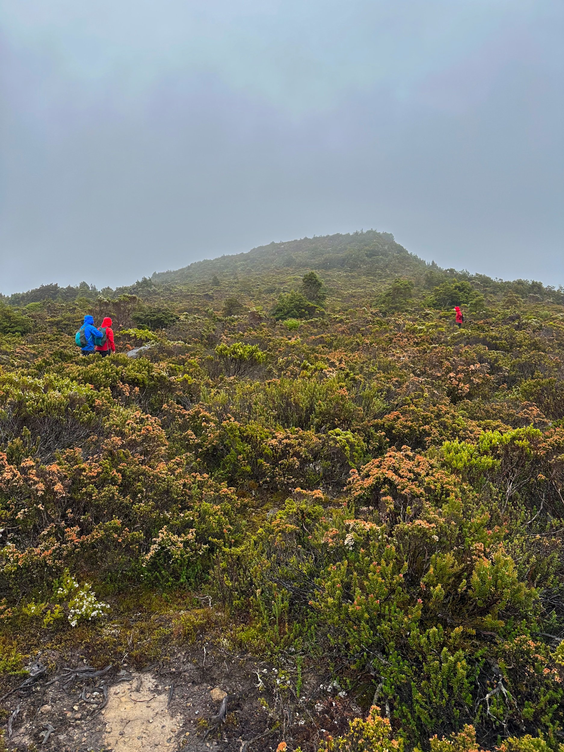
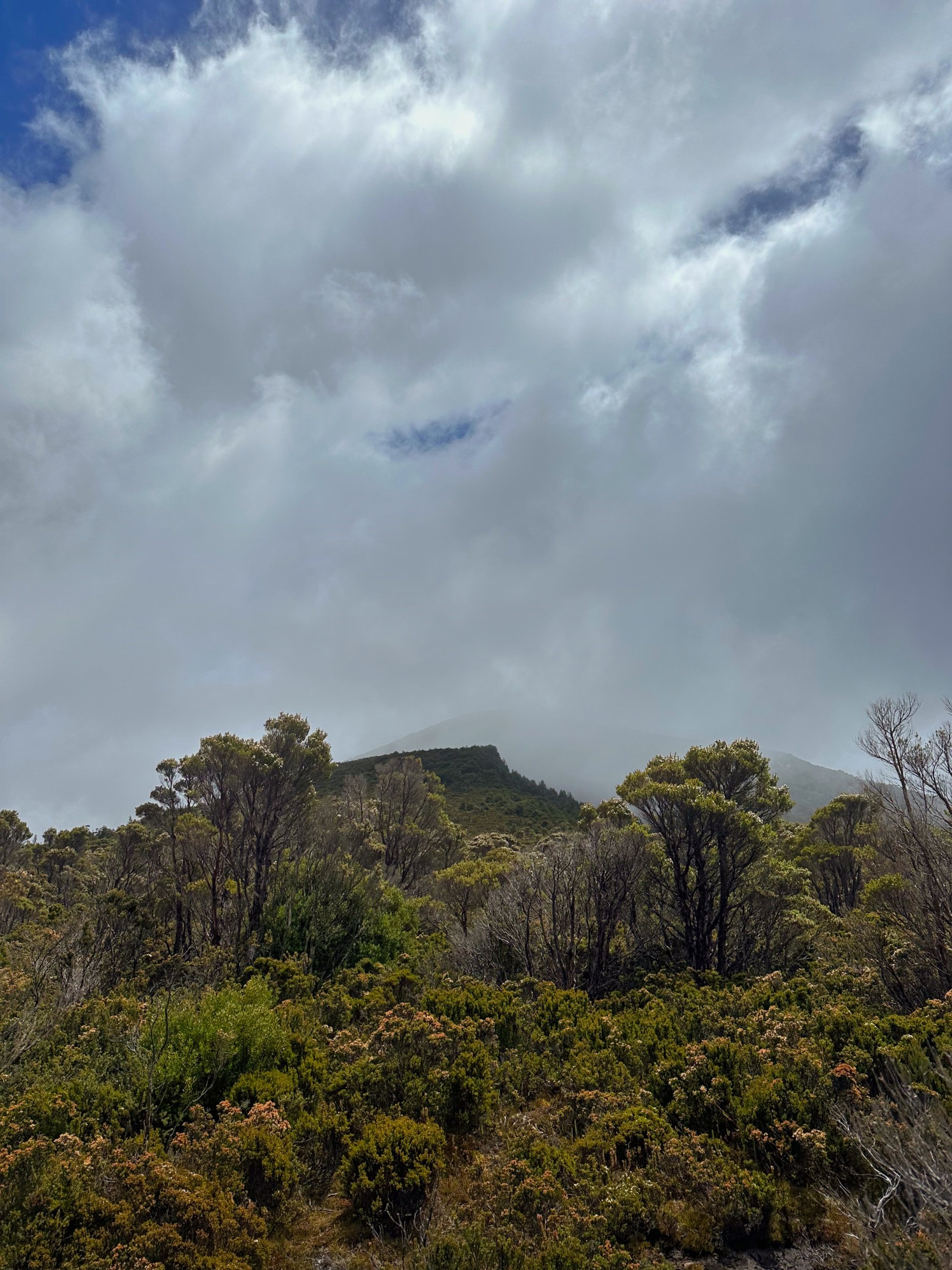
Reality: approaching the summit in drizzle and low cloud one day later.
Without time in our schedule for a rest day (if we wanted to get back to Five Duck Tarn in time to attempt Tramontane with Becca and Tim) we had all convinced ourselves that the ascent of Dome Hill would be our “rest day”! And while the shorter distance and easier terrain was certainly more restful than the full-on 15 hours we had spent summiting Eldon Crag and Eldon Bluff the day before, it was anything but “restful”. The burning heat of the previous day had been replaced by a cold wind, persistent drizzle and low cloud that refused to shift throughout the day. The one advantage of the cold weather meant we made a decision early on to stay low as long as possible to avoid the wind up high. This proved very handy indeed!

Weather conditions were of the “stay in the tent and nap" kind, given a choice.
It had rained overnight as I lay in the tent, sleep alluding me. It was going to be a “wet weathers on” kinda day. The Abels states that allowing 2-3 hours from Lake Ewart to the summit of Dome Hill is reasonable. I wondered if our legs, weary from four consecutive tough days, would be up top the task!
A sleep-in was a treat to ourselves. Every other day of the trip so far we’d been up before sunrise to set off between 6am and 7am, ensuring we’d have enough daylight hours to cover the distance required. With no need to break down camp and a more manageable day ahead, for once, we allowed ourselves a lazier start, setting off around 8am.
Wandering out through the buttongrass, which was now boggy and squelchy thanks to the rain, we discussed the way forward. Not one of us wanted to climb back onto the prominent ridge which runs northwestwards from Eldon Bluff again. That section had been one of the least enjoyable parts of the trip the day before, because of the dense scrub that guards the lower reaches of the ridge.

Setting out across the button grass marshland west of Lake Ewart.

The initial climb up towards the Dome Hill ridgeline hadn’t got any easier. Or drier.
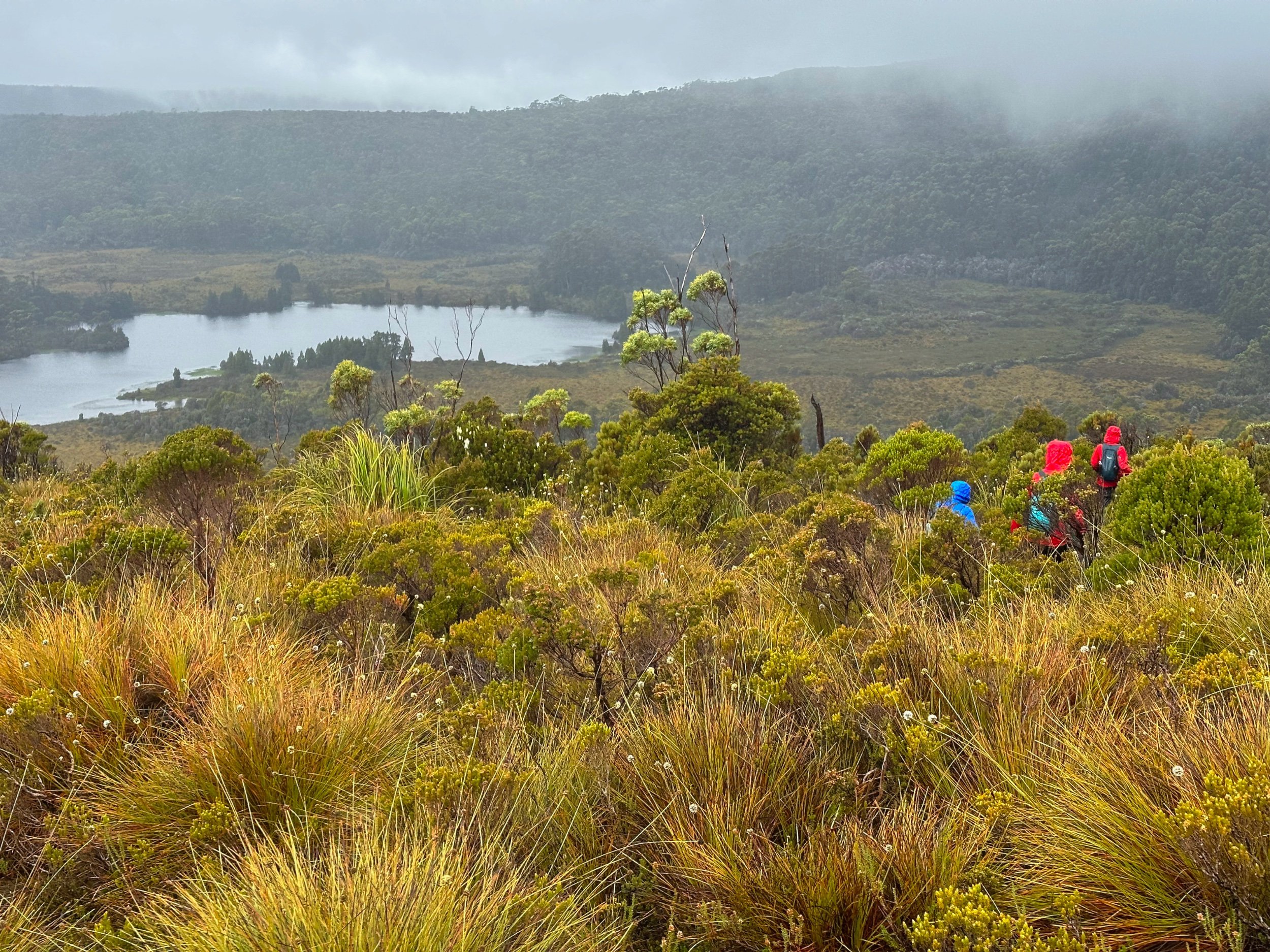
Topping out onto the first ridge plateau. Lake Ewart and a mostly hidden Castle Mountain in the background.
Instead, we made what turned out to be a simple, but crucial and hugely beneficial call. We would stick low for as long as possible, using our satellite imagery to bounce in a northerly direction from one button grass or low vegetated area to the next, until it ran out and we needed to start the climb up towards Dome Hill. Doing this gave us two benefits. One, it would keep us low, in the lea of the wind and out of deteriorating weather up high on the ridge. And two, it would limit the amount of scrub bashing early on.
And so the four of us wandered along, initially on the same bearings as the day before. Over the first button grass field, over the creek (at a slightly different location, as for the life of us we could not find the crossing the from the day before) and over the next small button grass plain.
When we reached the foot of the scrubby climb from the day before we diverted and stayed low instead of starting to climb. Taking our time to always pick the path of least resistance through the button grass and low scrub. We would weave this way and that, back and forth, a little left and then a little right, all with the aim of avoiding multiple small depressions through the button grass that held slightly denser scrub.

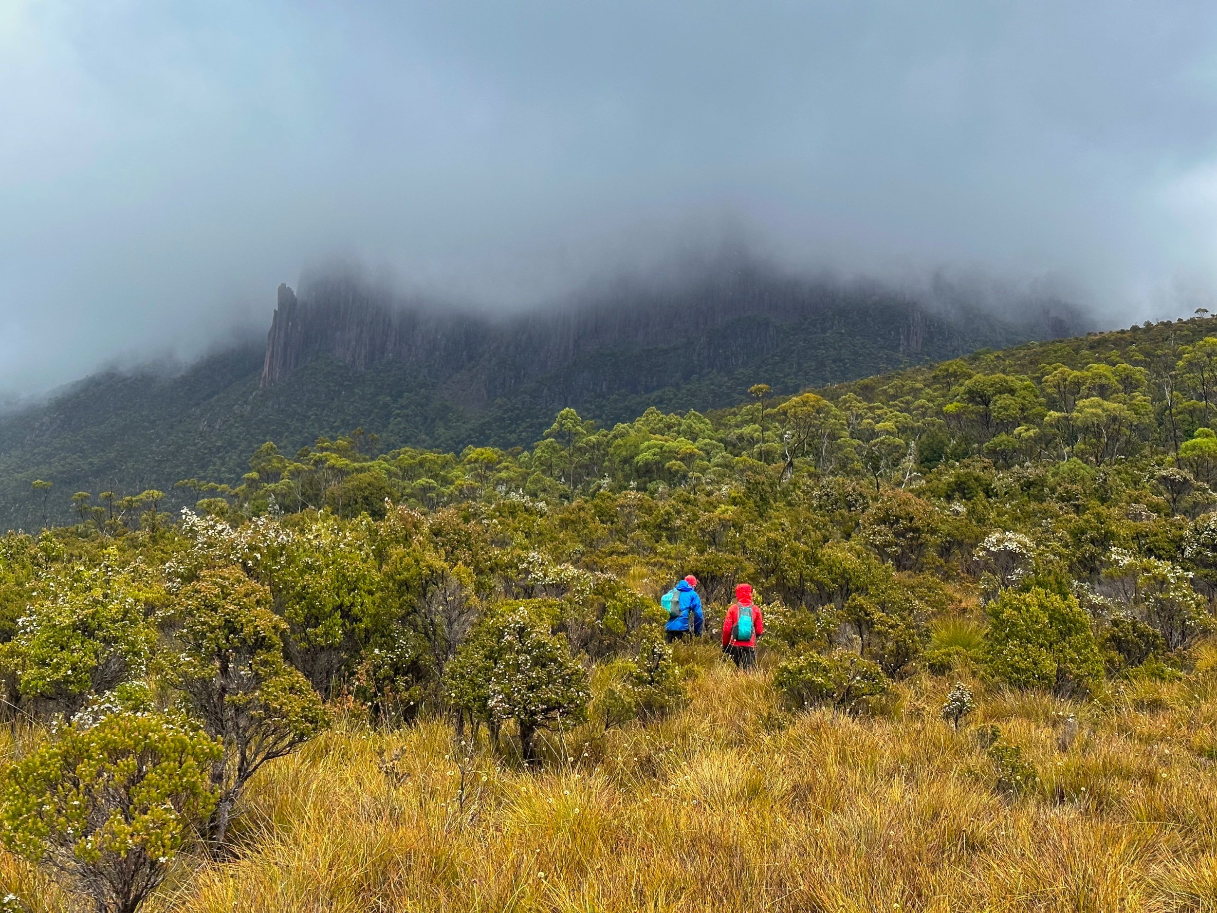
Contouring around towards the main (northward running) ridgeline towards Dome Hill.

Large areas of flat, solid rock were useful navigational markers for our route.
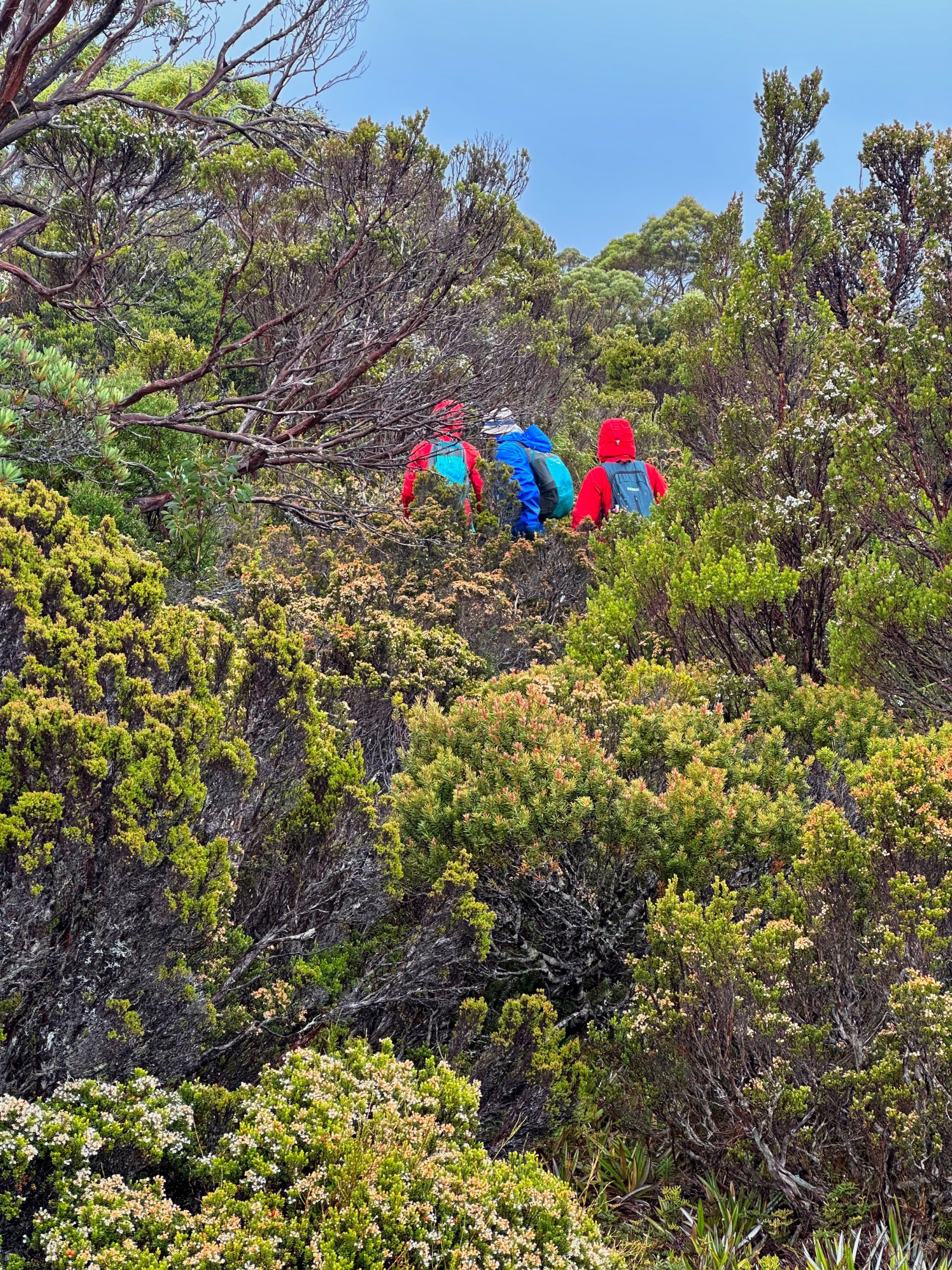
We rode this button grass wave all the way to the foot of the Dome Hill ridge where we found enough animal pads leading through the now higher and thicker vegetation to make the walking easier. Very minor bands of scoparia or dense tea tree occasionally gave us cause to use a little more effort, but we really could not complain about the vegetation thus far! The cold, yes! The vegetation, no.

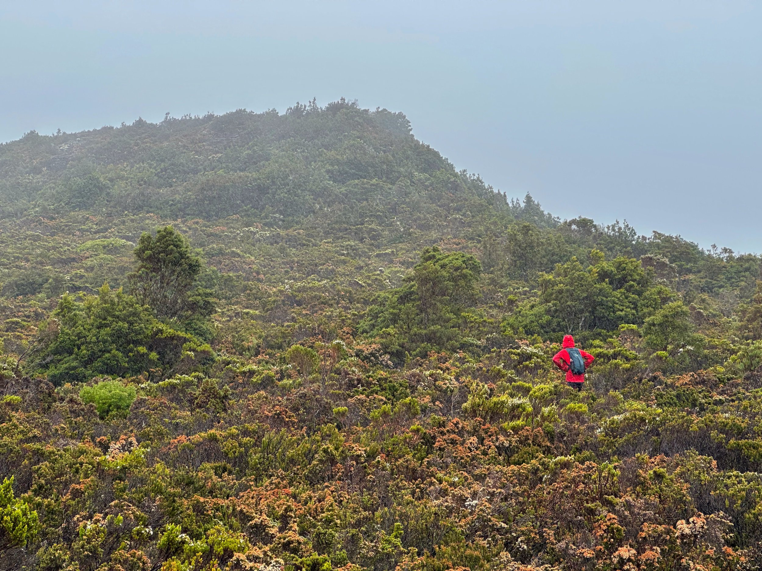
Making our way through waist-high scrub towards a mist-hidden Dome Hill.
Scrub getting thicker and taller.
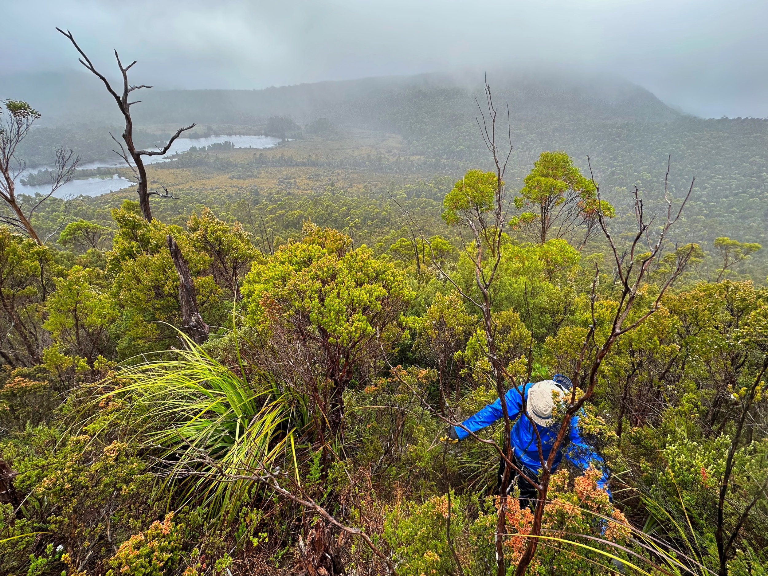
As we climbed higher, the vegetation changed again to delightful pockets of rainforest. We stopped under some moss covered myrtles to enjoy a quick snack - and do a few push ups and jog on the spot to warm up! From roasting ourselves the day before to trying to stay warm today. Typical Tasmanian weather, living up to all the analogies!
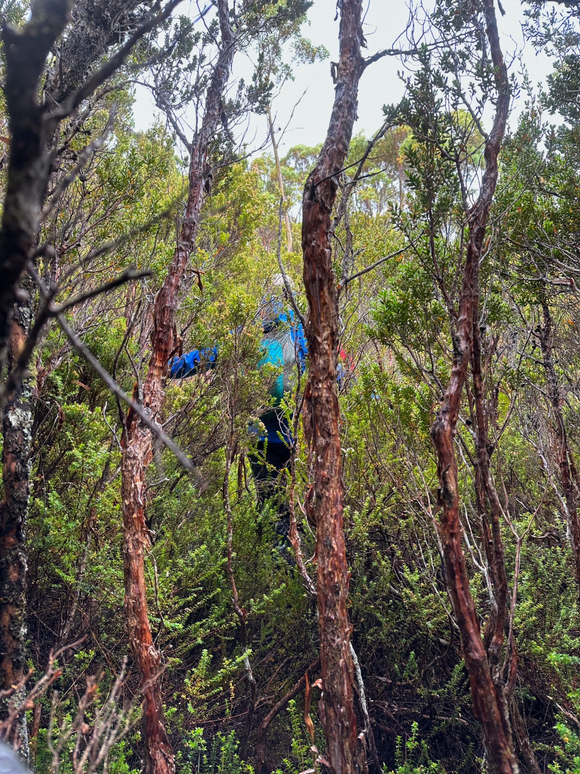
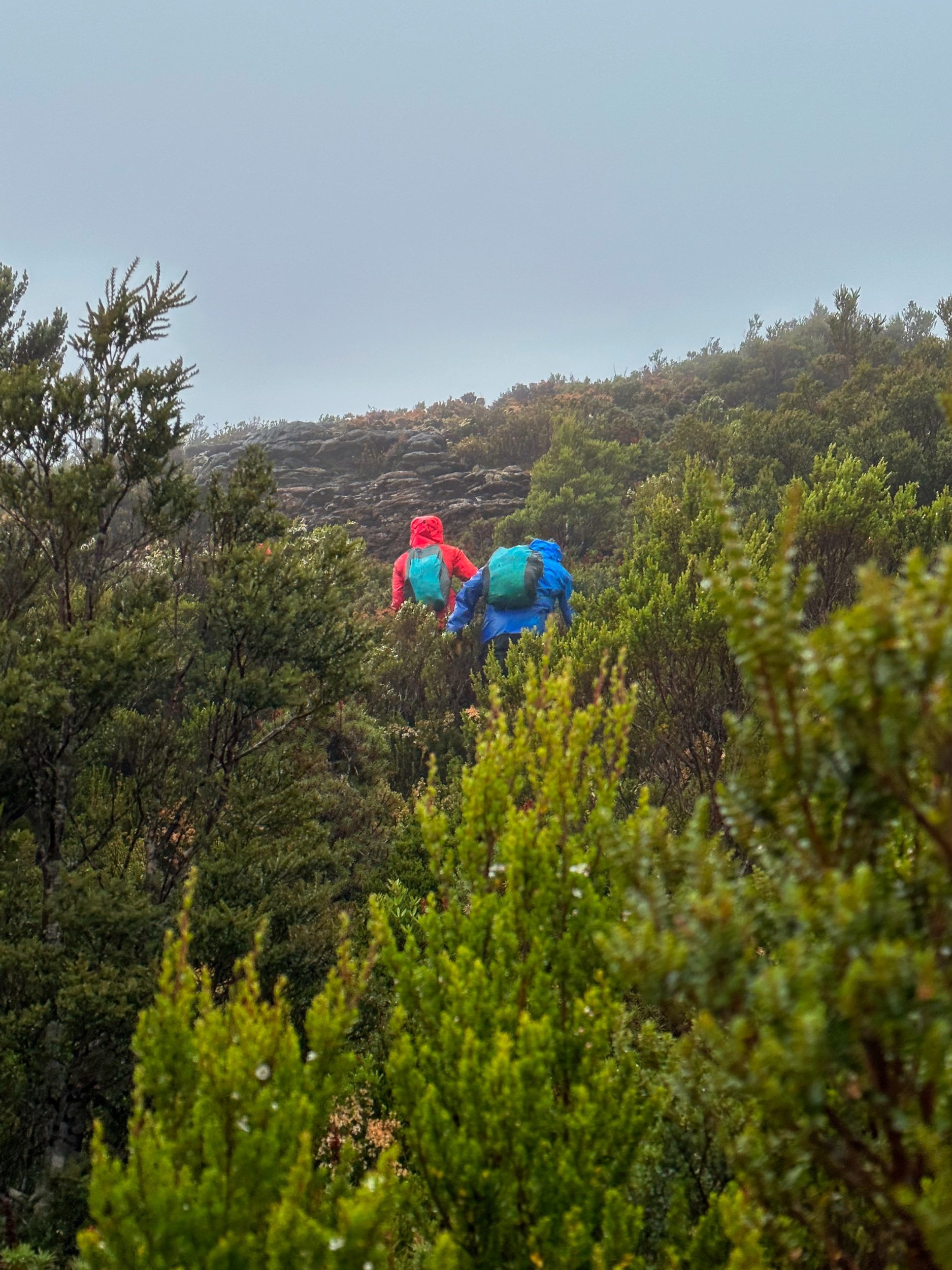
Pushing through dense tea tree and bauera.

An enormous myrtle, which provided enough clear space for a snack break.

The stark contrast between the open ground underneath the myrtle, and the thick tea tree than surrounds it.
The ridge leading north to Dome Hill was not particularly steep nor scrubby, but it seemed to go on forever. With no views around us due to the low cloud and mist - and cold winds blasting us in the face - we instead enjoyed the views at our feet.
Frequent bands of exposed sedimentary rock with hidden fossils broke up the low vegetation and lead the way ever upwards. Gorgeous flowers at our feet stopped us in our tracks for photos. Were it not for the cold and objectively miserable conditions, it really would have been a most lovely way to spend a few hours.

Using sections of the flat shale to our advantage.

Fossils amongst the shale.

Alpine flowers clinging onto the exposed shale.

Getting there… slowly…
More than two hours in, we still couldn’t see the summit ahead. Instead, all that was visible was a faint and somewhat foreboding silhouette high in the distance. Animal pads and areas of open walking made the going easier as the climb gradually started to steepen. Visibility dropped and we couldn’t see more than a few metres around us in the mist, but our numerous GPSs indicated we were closing in on the summit.
“We must be nearly there, right?”
“Surely this is the last pinch?”

“Are we there yet?!”
The short, sharp increase in elevation just before the top got our lungs working and warmed us up slightly, but in no way prepared me for the onslaught of freezing winds that would hit us as soon as we crested out onto the mostly bare summit area. We wasted no time in touching the cairn marking the high point and getting a few photos before quickly retreating behind one of the few bushes near by to try to get some shelter. All four of us spent the next few minutes digging into our packs for an extra layer or two!
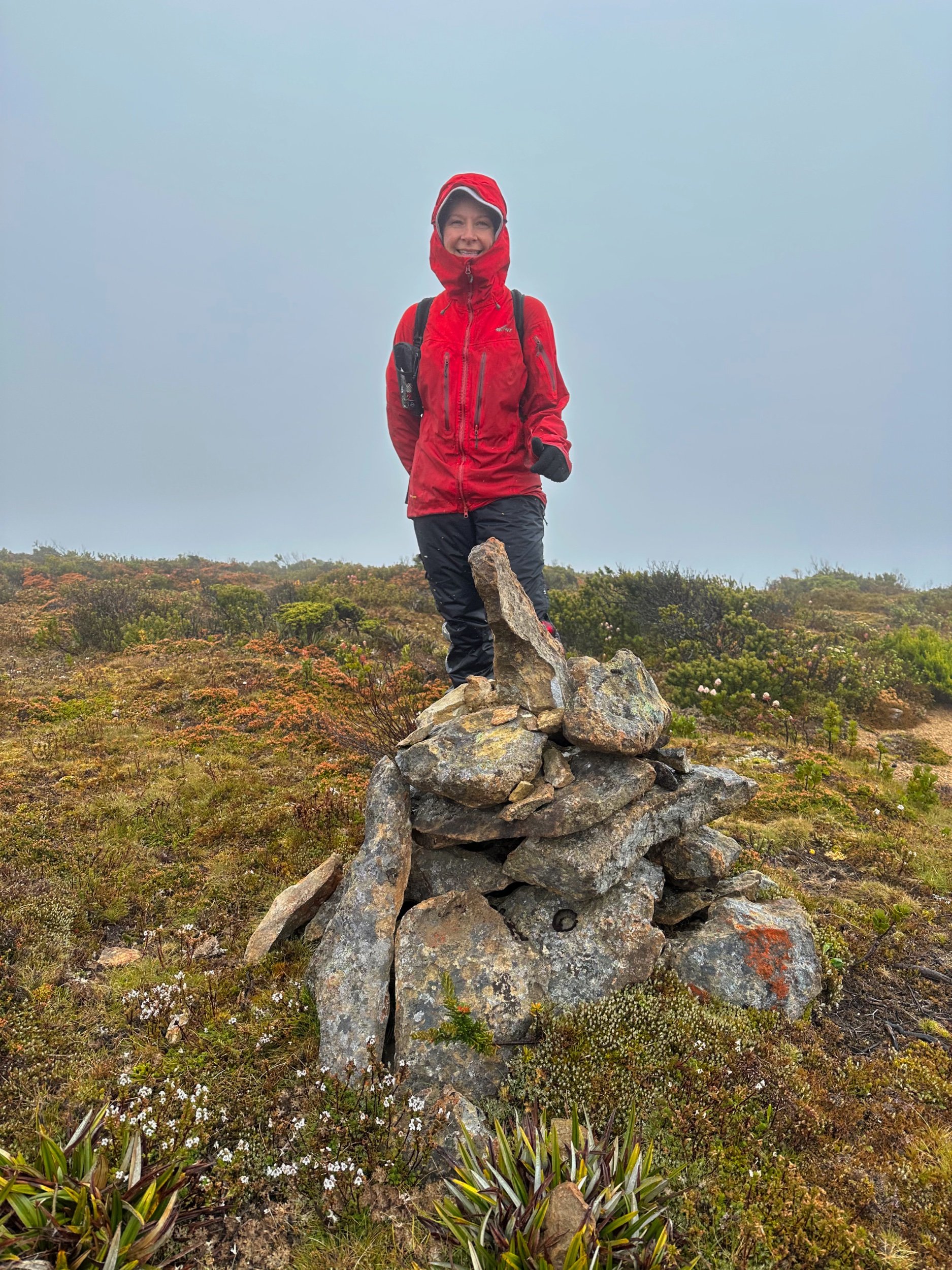
Finally! The cairn atop Dome Hill’s, ahem, rather dome-like summit.
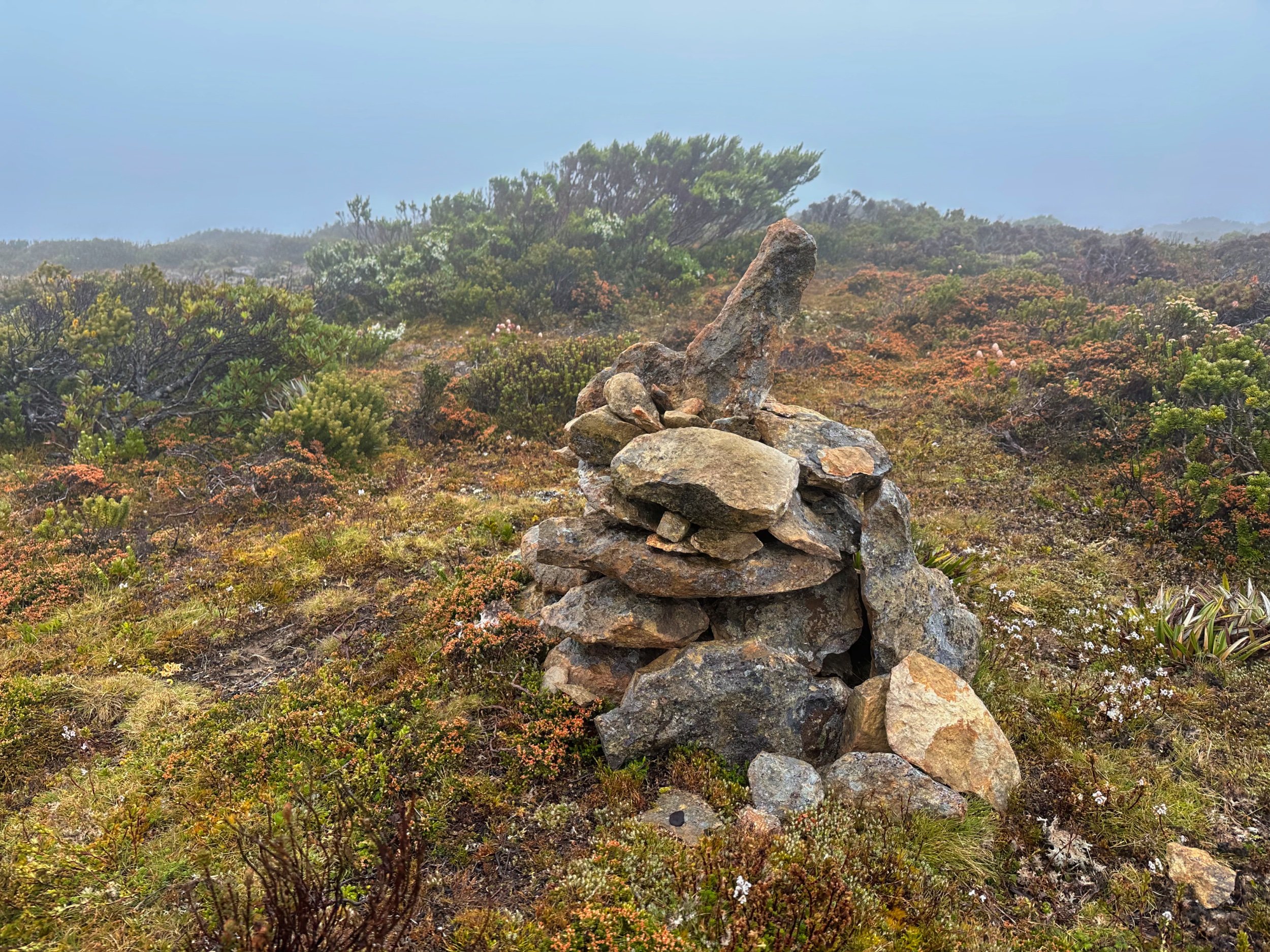
Summit cairn.

Jess and Simon pose for their “proof of summit” photo. Alas, there isn’t much else to see.
It had taken us just shy of three hours to reach the summit from Lake Ewart which, given the weather conditions and our physical condition after the day prior, seemed like a pretty good effort. Such a pity there were no views to be had, but that is Tasmanian bushwalking for you. You win some, you lose some.
It was far too unpleasant to stay up top for long so after donning extra layers and downing some calories, we hastily began our downwards retreat. Gravity - and knowing the best path home - meant we made much quicker time back down off the exposed ridge to the shelter of the rainforest than we had on the way up. Once again, we would stick to the easier button grass walking on the return, rather than going via the Eldon Bluff ridge. We were all saturated and feeling the cold. The quicker we made it back to our camp, the better.

Commencing the long walk back to Lake Ewart.

The weather is trying to clear, but failing. Here was a fleeting moment where we could see more than 100m in front of us.

The outflow of Lake Dorothy can be seen for a moment, but Eldon Bluff and Crag remain thoroughly tucked in cloud.
The cloud threatened to clear off the top of Dome Hill as we headed south back down the ridgeline, but never did.
Eldon Bluff still completely misted in as we returned towards camp at Lake Ewart. Needless to say, we were happy we’d chosen to climb it the day before in the better weather.
It was still raining heavily as we reached the tents a few hours later. It gave us all the perfect excuse to just strip our wet gear off and defrost/hibernate in the tents for the rest of the afternoon. Nothing goes down better than a hot cup of soup, a Nanna nap and knowing that we had been successful thus far in our trip into the Eldon Range.
Final descent down into Lake Ewart.

The kinda view you don’t mind when it’s cold and raining outside!
That said, we were all apprehensive of the next day’s climb out from Lake Ewart. Descending down to the lake had been genuinely horrible and frustrating, so climbing back out wasn’t likely to be any better. A few hours later, as we lay in our separate tents listening to the rain continue to fall, Bender and I were scouring the map, quietly discussing a potentially better option for the next days climb. It’s weird how great minds think alike -Jess and Simon suddenly called out with the same idea!
Airdropping images to each other that we had scribbled lines on - ain’t technology grand? - we discovered that we had each selected an almost identical route out of Lake Ewart! Assuming the aerial imagery was accurate, it would allow us a less traumatic experience than our descent. Of course, we would not really know until we set off in the morning. But we can let you in on a little secret dear reader - it far exceeded our expectations in the most pleasant of ways! Sometimes taking the path less travelled really does work out better! But that is a story for the Castle Hill essay…
Find the next day’s adventures here.
The Stats.
Distance: Approximately 13km
Time taken: 7 Hours return from Lake Ewart.
Difficulty: One of the easier walks in The Eldon Range. Not easy - but one of the less scrubby, less complicated and shorter walks.
Type of track: Untracked.
Access from: Lake Ewart.

The Map.
Route taken to Dome Hill from Lake Ewart.