
158 of 158….!
It takes a village to climb 158 Abels.
Indulge us as we acknowledge some special people who helped make it happen. Plus a Q&A and some insight into what's next.
It takes a village to climb 158 Abels.
Indulge us as we acknowledge some special people who helped make it happen. Plus a Q&A and some insight into what's next.

How not to a be an “opinionated tool” on social media after a bush rescue.

Image courtesy Westpac Rescue Helicopter Service Tasmania website.
WARNING: This blog is probably going to offend some people.
Before reading any further here is an excerpt from the Westpac Rescue Service Tasmania website.
“The Westpac Rescue Helicopter Service is an integral part of Tasmania’s emergency services, and is available to anyone who finds themselves in a dangerous situation.
Our highly skilled crew are called out daily for a variety of assignments - from bushwalker rescue missions in Tasmania’s rugged World Heritage Areas to motor vehicle accidents or extracting an injured fisherman from a trawler.
Tasmania Police also makes use of our helicopter service as a crime-fighting tool to maintain Tasmania’s reputation as the safest state in the nation.”
This morning I woke up to the news that a young bloke and his father had been rescued from the Walls of Jerusalem National Park here in Tasmania. See the post below on the Tasmanian Police (TasPol) Force’s Facebook page. Within minutes of being posted, predictably, the kind citizens of Tasmania (and further afield) began voicing their two cents.
Voicing your opinion on open and very public forums like Facebook, Twitter or whatnot is totally fine when it comes to such pressing and contentious topics - such as the eternal ‘putting pineapple on pizza’. (Spoiler alert - it’s perfectly fine.)
But what happens when we do it on a post about some poor person or group being rescued in our wild places? Do we even have the right to do it?

Plato once stated “Opinion is the medium between knowledge and ignorance”. Literally everyone has an opinion on literally everything these days. And unlike in Plato’s day, the power of social media means anyone can voice their opinion to the world far and wide with the mere tap of a few keys. Me writing this piece is putting my opinion out there. If someone comments on this blog, they are voicing theirs.
Limited specific details on the rescue were given on the TasPol post - as is standard policy - to protect the privacy of those concerned while still drumming home the importance of having a PLB, checking the weather and being prepared for the conditions. All the basic Bushwalker 101-type stuff that should be obvious, but still doesn’t hurt to have repeated regularly. Especially for visitors to the state not familiar with our uniquely variable weather patterns.
Remember what Plato said - “Opinion is the medium between knowledge and ignorance”.

Just a snippet of some of the comments from the Tas Pol page.
Anyone reading this or any other similar post can, therefore, only make assumptions on what actually happened. They do not have first hand knowledge of exactly what transpired and how. Many, in their ignorance, instead chose to make unfounded claims that the poor fellas rescued were either unprepared, didn’t have the right gear, shouldn’t have been out there in the first place, should have just walked out as they were “just a bit wet”, some combination of the above and/or all manner of other unfounded and ignorant claims.

Yet more kind words from strangers.
As the debate raged, the snide quips of “charge them”, “bush taxis”, “it’s their own fault”, “too lazy to walk out”, or the wonderfully judgemental “too soft” started. The self-described law-abiding taxpayers shouted from the roof tops at the monetary cost of rescuing these selfish, ill-equipped, ill-prepared parasites of society. How dare they put themselves into a situation that requires rescue? And then how double-dare they call for rescue?! Heathens!!
With metaphorical pitchforks raised, these vigilantes of the taxpayer funds went so far as to loudly claim that if these two blokes ever read about themselves, it will be to learn that they aren’t worth rescue. It is, after all, their fault they got cold and wet!! (Ah, the charms of social media…)

Lovely reflections of the kindness of strangers…
As a society, is it OK to take rescue or medical assistance away from those that “self-inflict” the situation? It is OK to say that if someone places themselves in risk - deliberate or otherwise - that they should pay for the rescue? And if we charge people to use rescue services - who do we charge?
Do we send a big (likely financially crippling) bill to the family driving on a wet road that unfortunately ends in a serious accident requiring the Westpac Rescue Helicopter to airlift someone to hospital? Or we just don’t send the chopper - saving thousands of dollars an hour - as the road was wet when they left home, so they should just suck it up instead?
What about the trail runner who sprains or breaks an ankle at a race and needs the chopper to get them safely off kunyani? They should be at home on the couch with a cigarette and beer in each hand, not out costing us money with another “unnecessary” rescue?
A kid out building a cubby in the bush that falls from a height. Tough luck kiddo. No emergency services for you mate cause Mum told you not to climb trees. It. Is. Your. Own. Fault.
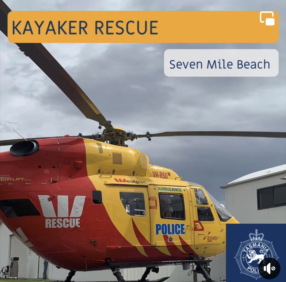
What about the father and son out fishing who get hit with a freak wave and have their dingy sink, resulting in police and rescue service resources being required?
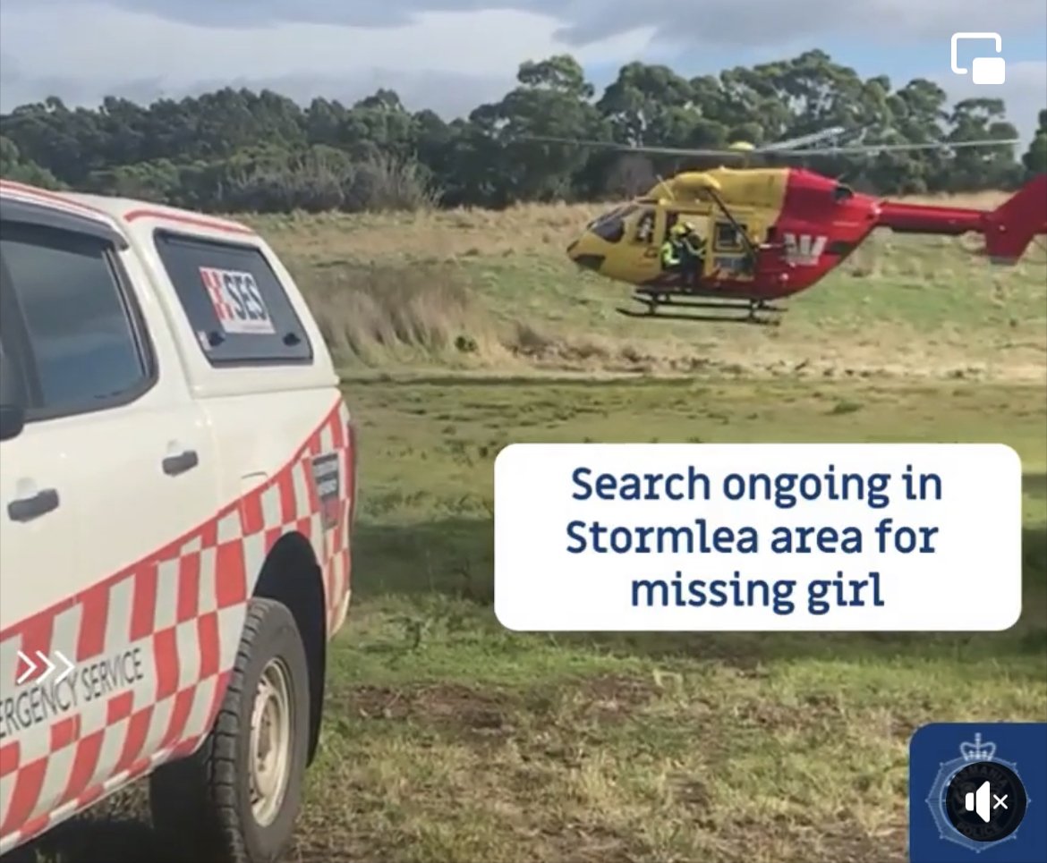
Why should our search and rescue services be sent to help look for a toddler that has wandered off? Surely the parents should have kept a better watch out in the first place, right?!
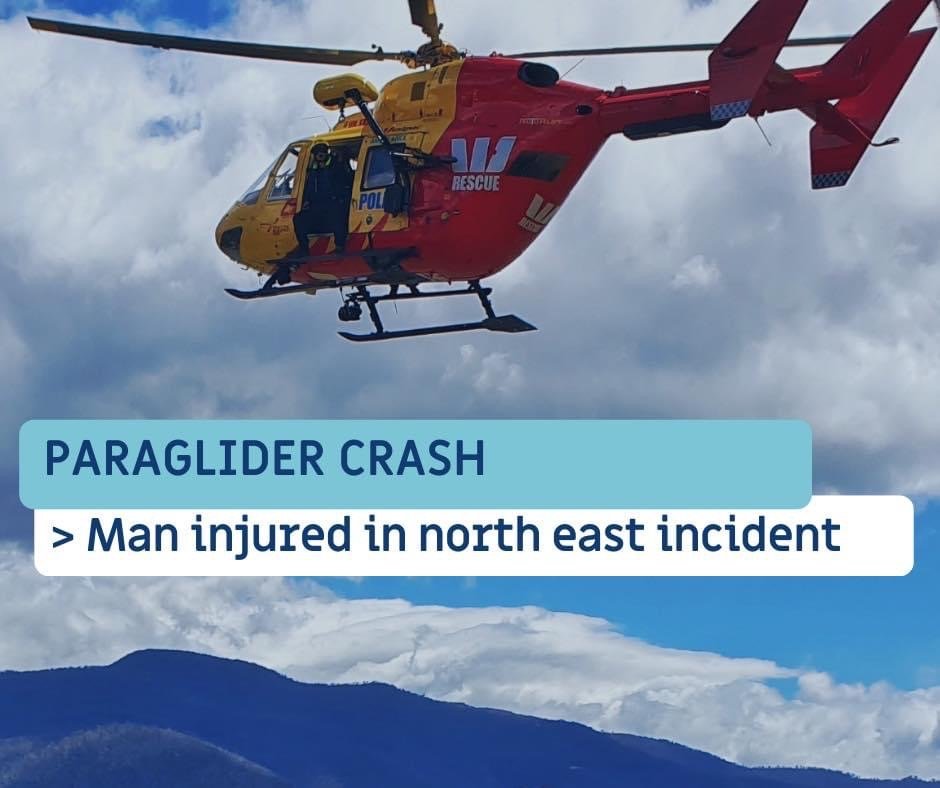
All of these “what-ifs”. See the images below for just a few of the other situations our amazingly talented rescue personal help Tasmanians with.
Guaranteed, if TasPol posted about any of the above rescues, there would be an outpouring of sympathy. Poor toddler, poor family, poor father and son almost drowning. “Thank god for our emergency services” would be the catch cry. “So glad the toddler is back with mum and dad”. “Thank goodness the helicopter could reach the family in the car accident in time”. Not one person would post “charge that kid their pocket money for being rescued”. Not one person. Because frankly, it would be poor form, very poor form.
Yet, as soon as news of some unfortunate bushwalker being rescued hits the waves, the couch-dwelling “taxpayers of Tassie” start. (Yes, that’s me making ignorant assumptions that all the haters dwell on their couches).
They read the words “cold and wet” and equate it with being caught walking around town or commuting home without an umbrella or decent jacket.
What they don’t realise is that being cold and wet over a multi-day bushwalk can lead to hypothermia. Particularly in windy, exposed conditions. Being able to get yourself dry and warm is of critical importance when out bush and not being able to do so is very dangerous. Hypothermia doesn’t care if you put yourself in that situation or not. She is a cruel mistress that will make things go from uncomfortable to deadly rapidly. I guess that’s why the folks who run the Westpac Rescue Helicopter Service regularly stress “don’t wait to hit the button until it’s too late!”.
No bushwalker ever wants to be rescued. I certainly don’t. In fact, I’ll often assess risk and alter my plans based on “yeah… that’s not worth getting rescued over”. It’s a good perspective to keep in mind, especially when you’re undertaking tough routes and being more ambitious than usual.
Still, the reality is that you can be the most experienced, best prepared bushwalker in the world and still require rescue. Not all risk can be mitigated against and sometimes, yes, sh*t just happens. Slips and falls, snakes, a twig in the eye, weather ignoring the forecast (!), equipment failure - not everything is within your control.
The last thing we ever want to do is send out the message to walkers be it via social media, forums etc. that they should ever hesitate when they feel their situation is out of their control and lives are at risk. Had that father and son died of hypothermia, then a wife and mother would be planning a double funeral right now. As she cried, she would be rightfully angry that they didn’t call for rescue before it was too late.
Also, skilled paramedics and rescue staff would be feeling the pain and distress of retrieving bodies, instead of rescuing people from a salvagable situation.
Of course, we want everyone to be prepared and safe when they visit our natural places. Everything in our lives has risk involved, and bushwalking is far from risk-free. People need to be realistic about their experience and abilities not just if things go perfectly as planned, but when things go wrong too.
As such, we also all want a society that accepts that sometimes things will go wrong - be they avoidable or otherwise - and that when we do need help and have to hit that button, we don’t wake the next day to endless commentary from total strangers about how useless we are. Based on a few limited factoids sourced on social media and the, ahem, wealth of the commenter’s personal experience.
A bit of food for thought for all of us.
Five ways to not be a tool on social media after a rescue.
Remember what Grandma said - if you haven’t got anything nice to say, just shut up. The great thing about being ignorant to something is that if you keep your mouth closed, no one will ever know. Remember, the Internet isn’t quite the anonymous hole these days we sometimes like to believe. What you write will probably be seen by not only those concerned, and very likely seen by your family, friends, workmates, boss, clients and so on. Would you repeat what you post online from a megaphone in the middle of town? How willing are you stand by that opinion? If that father and son were sitting next to you, would you say the exact same thing?
Don’t say or repeat information as ‘fact’ if it isn’t 100% verified as being true. Statements like “they just wanted a ride home”, “should have been better prepared” etc. aren’t facts - just mindless opinion. Unless you were in the tent alongside them or part of the rescue team, you really don’t know how events occured.
Don’t publicly give your opinion on what they could have or should have done differently, even if you are a bushwalker. Once again, unless you were witness to the events, you do not know the circumstances nor why choices or actions were made.
Put yourself in their boots. Yep… you probably wouldn’t appreciate a chorus of clueless naysayers giving their thoughts on something they have no knowledge or understanding of either.
Sprinkle a little kindness their way instead, and change the narrative. Write “Glad they got home safe to their loved ones.” instead of “They should have just been left to die” (Honestly who even says stuff like that?!). Remember, they are human beings with families and have just gone through what was likely quite a traumatic ordeal.
And one more thing… Our Westpac Rescue service is world class but to maintain the service it also relies on donations. Why not flick them a few bucks because even if you don’t bushwalk you might find yourself in need of their services one day!

Like pulling a rabbit out of a hat…
I love and I mean LOVE looking at peoples packing lists. Or watching “what is in my pack videos”. Or stalking friends gear. Why? Because no matter how long you have been bushwalking you never stop learning and there is always someone that has useful tips that you can use to make your own life easier.
I love - and I mean LOVE - looking at people’s packing lists. Or watching “What is in my pack” videos. Or stalking friends’ gear.
Why? Because no matter how long you have been bushwalking, you never stop learning. There is always someone that has useful tips that you can use to make your own life easier.
For instance, on our Western Arthurs trip, Grahame had a soft collapsible cup which he used to catch tiny drops of much needed water falling off some rocks. I already had heaps of these cups from trail running races, but never thought to take them bushwalking. On our Pokana Peak trip with some of our regular walking buddies Simon and Jess, I noticed they had these really cool 1L and 2L collapsible bladders.
Sometimes it’s different ideas and tips for food. On our Federation Peak trip I noticed Becca (aka Rockmonkey Adventures) eating boiled eggs multiple days into the trip. I had never thought that boiled eggs, kept in-shell, could last more than a day out the fridge.
Of course, you also see people pulling out the most weird and wonderful stuff from their packs. I once saw a young fellow pull multiple giant cans of baked beans with a equally giant (and heavy!) kitchen saucepan at Tahune Hut along the Frenchmans Cap Track that made me chuckle. Like a magician pulling a rabbit from a hat, you never quite know what someone is going to dig out.

Small Collapsible Cup
Keep one in your pocket for catching drips of water or collecting from tiny pools.

Individual bladders.
Love that these come in various sizes and collapse to almost nothing when not in use.
A lot of time, effort and expense goes into selecting appropriate gear for a trip and each trip differs. The weather can completely alter what goes into my pack, as can terrain, the length of the trip, what number of walkers are coming along (ie. potential to share gear) and so many other variables. Bender and I both have pretty standard pack lists to start with, then we swap gear in or out that is specific to the trip we are planning. It might be as simple as extra gloves in winter, or extra sunscreen and water carrying capacity in summer. It could be taking a stronger tent for snowy conditions or warmer sleeping bag. And always, there is that fine line to balance between having everything you need but not overloading your pack.

A little luxury!
I will admit, I like a few luxuries. I take a small battery powered mattress pump, as I figure for 70g it saves me time and effort (and sore lungs and dizziness!) at camp. It also helps to keep condensation out of the innards of my sleeping mat, helping to avoid mould and extend its life.
I also like a protein shake at camp after a big day’s walking. The powder mix isn’t particularly light, but it helps my muscles recover quickly and keeps me going on multiday trips. We are lucky enough to own some pretty good gear - it’s light, durable and fit for purpose. Yes, I could still lighten my pack by taking out my few luxuries but then I would probably be miserable and “ain’t nobody got time for that!”

Don’t judge the junk! I tend to lose weight on trips so try to max out the calories with scroggin, olive oil and cliff bars.
I have just finished packing for an 8-day trip to the Denison Ranges and The Spires. Mind you, as I write this, the area we wanted to visit is experiencing snow and torrential rain. It is the sort of area we might only visit once in our lifetime, so we want views from our summits and a safe, mostly comfortable experience. This trip might turn into a couple of shorter missions instead over the 8 days we have off work. Given pretty much the whole state is having an early autumn cold shock, I have adjusted my pack accordingly.
Given the rain and cold, I am taking 4 pairs of gloves (I hate cold hands), an extra warm layer plus thermal bottoms and a thermal top for walking and an extra set for camp/sleeping. I am also taking a light weight day pack instead of my usual Solomon vest. As it is a multiday trip and I am trying to reduce weight, the lighter Denali stuffable summit pack will suffice. I could use my actual big pack as a day pack, but I prefer a smaller one. Extra gloves and warm layers will increase the weight of my pack, but I am pretty sure I will actually use all of the extra gear.
When I first started walking, I would unpack my gear when I got home and take an inventory of what I didn’t use. I would find I hadn’t used sooooo much stuff! Over time, I stopped putting the stuff I never used into my pack. I stopped packing my fears and “what ifs”. Now, years later, when I unpack after a trip, there is rarely anything that hasn’t been used - other than my first aid kit . Oh and I would never take that out!

You will notice on the pack list that along with the first aid kit, I have my own cook system, toiletries, PLB, navigational tools and gas. Bender takes these same items too. Why do we double up on these things, when we could share them and lighten our loads? We figure if we ever get separated out in the bush - unlikely, but things can happen out bush - we will both need these items individually to survive. Plus, if our stove dies, we have a back up. Gas canister failure or just plain run out - back up. Dead battery or damaged device - back up.
The only thing we share is the tent. Bender carries the tent itself along with the pegs, groundsheet and additional guylines, and I carry the poles. Our primary (three-season) tent weighs just under 1kg all up, so the impact it has on our overall pack weights isn’t massive . We do each carry an emergency bivvy bag (a more durable space bag, essentially) in case we are separated and need shelter.

Websites like LighterPack are a great way to compare gear and keep checklists.
I have attached a link to my Lighter Pack List here.
You can check out the exact items for this trip. The only thing missing from the list is our TarpTent Double Rainbow Lithium. The tent poles I carry come in at 169g and rest comes in at around 850g (give or take additional pegs or lines we might include). We haven’t decided on whether to take the Tarptent at this stage or give our much stronger and warmer (but much heavier, at approx. 3.7kg all up) Hilleberg Nammatj 2 GT a whirl for the first time this year. We’ll likely be camping up above 1300m on exposed plateaus for a few days, which isn’t the best the place to be stuck in strong winds in an ultralight DCF tent We will watch the weather for two more days before deciding.
Taking out the weight of the clothing I will be wearing it, comes in at 11.4kgs for an 8-day trip, which is pretty good. Adding 1L of water will bring it to just over 12.5kg. By the time I eat the food and use most of the gas, I should be walking out with a pack that is around 7.2kgs. Not a bad base weight. With a long standing back injury, keeping my pack weight down is essential if I want to keep heading bush.
Injuries aside, I really do believe lightening your pack load can make the difference between thoroughly enjoying a trip - or suffering through it. It has taken us a few years to research, purchase and test lighter gear that still stands up to Tasmania’s weather and terrain. Gear for us will always be an evolving thing. We figure we don’t drink, smoke or go on fancy holidays, so buying good gear is our ‘vice’. Or more accurately, our investment in safety and good times spent enjoying the simple pleasure of our local wilderness.
Now we just need the snow and rain to stop! Oh, and if you have any gear tips or tricks leave them in the comments below for me to pilfer!

Nine Things I wish I had known before doing The Eldons
The thing about bushwalking in Tasmania is that no two walks are ever the same. Indeed, two people can be on the exact same trip and have totally different experiences. All the research in the world won’t replace lived experience out on the trail. These are the nine things I wish I knew before embarking on one of Tasmania’s toughest off-track walks, The Eldons.
The thing about bushwalking in Tasmania is that no two walks are ever the same. Indeed, two people can be on the exact same trip and have totally different experiences. All the research in the world won’t replace lived experience out on the trail. These are the nine things I wish I knew before embarking on one of Tasmania’s toughest off-track walks, The Eldons.

On the edge of The Eldon Range looking in. Photo: Ben Wells
Before I get into the nitty gritty of what I would and would not have changed on our trip, a bit of background information. The Eldon Range lies within the western central region of the Cradle Mountain-Lake St Clair National Park and runs east-west for about 9 km. The entire area is described in The Abels as
A very remote wilderness region with no tracks”.
It goes on to say
“Only very fit, experienced parties should consider walking here due to the rugged terrain and thick scrub, in a location where unpredictable and extreme weather events occur.”
And, crucially,
“three days should be allowed to simply reach the eastern end of the range”.
After recently returning from the range I can emphatically say that there is NO exaggeration in this description! I would add that the further into The Eldons you wander, the harder and more physically and mentally demanding the challenges become.
A year ago or so we had experienced a small taste of what The Eldons has to offer when we visited the minor (or "Little”) Eldons - namely Camp Hill, Pyramid Mountain and Rocky Hill - which is a parallel range to the south. With the benefit of hindsight, I now know it wasn’t so much of a taste as a warning! The Eldon Range is spectacularly beautiful but she is also a tough mistress. She will give you a breath-taking sunrise one morning and make you cry with frustration at sometimes almost impenetrable scrub by the afternoon. What she gives you is earnt.
I cannot say I enjoyed every minute of our 10-day trip, but I can say there was a near-constant mixture of frustration, beauty, tears, laughter, wins and losses. As our good friend Simon says - it’s ‘character building stuff’.
Who knows what your foray into The Eldons will bring (or has brought). Perhaps you will have things to add to or subtract from my list.

A typical day walk in The Eldons, scrub your constant companion. Photo: Ben Wells

A typical day walk in The Eldons, scrub your constant companion. Photo: Tracey Orr
Number 1 - It will be harder than you think. Much harder. Don’t cram - it’s not an exam.
Everyone in our group agreed that we had underestimated The Eldons. Of course, we all knew it was going to be hard. The Eldons sees relatively few walking parties each year for good reason. Actually we all knew it was going to be really hard! Difficult, challenging and character building were words regularly mentioned in our chats and planning. We had revised our itinerary numerous times - each time making each day’s itinerary a tad bit easier.
Our final itinerary (below) was based on how many days we had off work, and what mountains we wanted to attempt to climb whilst out there. Bender did so much work with the itinerary, looking to be as efficient as possible with the time we had available, and he planned it perfectly. But in reality, it was still harder than any of us would have preferred, and it didn’t take long before the fatigue started to set in. Lesson 1 - allow at least one rest day mid-trip to recover. Had we allowed for it, we would have all been better for it!

Averaging a kilometre an hour is not unusual due to the steep terrain, dense scrub and lack of tracks or even track markers. Photo: Ben Wells
Day 1 - Car to Pine Camp. Approximately 11km, 900m elevation gain, 8 hours. (Hot day!)
Day 2 - Pine Camp to Five Duck Tarn. 10km, 500m elevation gain, 9 hours. (Started out drizzly and cool, eventually fined into a warm, clear day).
Day 3 - Five Duck Tarn to Lake Ewart. 10km, 370m elevation gain, 11 hours. (Another warm day, hard work in the scrub!)
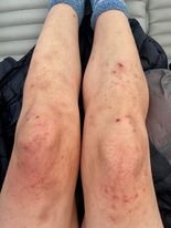
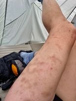
The pictures above show my legs bruised, scratched and bitten and its only day 3! That is despite wearing long trousers, outer pants and gaiters!
Day 4 - Day walk from Lake Ewart to Eldon Bluff and Eldon Crag return. 14km, 1050m elevation gain, 15 hours. (A very, very warm day, overcast conditions by the evening.)
Day 5 - Day walk to Dome Hill. 13km, 470m elevation gain, 7.5 hours. (Cold, wet and windy!).
Day 6 - Lake Ewart to Tarn Camp and Castle Mountain day walk. 7km, 400m elevation gain, 7 hours. (Morning was cold and drizzly but eventually fined up, though cloud misted up the peaks as we summited Castle Mountain, which was unfortunate.)
Day 7 - Tarn Camp to Five Duck Tarn, via High Dome. 11.5km, 660m elevation gain, 11 hours. (Clear and warm in the morning, became overcast by the afternoon which actually made for very comfortable walking conditions.)
Day 8 - Tramontane day walk from Five Duck Tarn, return. 12.5km, 740m elevation gain, 11 hours. (Clear then quite foggy in the morning, eventually lifted with decent cloud cover for comfortable walking.)
Day 9 - Five Duck Tarn to Pine Camp. 8.6km, 530m elevation gain, 7 hours. (Partly cloudy though definitely warm until the evening, when we got a thunderstorm and overnight rain.)
Day 10 - Pine camp to hot chips! 11km, 320m elevation gain, 6.5 hours. (Clear, generally cool conditions and lots of low mist in the valley for magical walking back down the ridge. The forecast rain didn’t come until three hours after we got back to the cars - winning!)
The toughest day (by far) was Day 4. This was as we expected and was mostly dictated by weather: the rain forecasted on Day 5 would be OK for summiting Dome Hill but less desirable for the higher elevation and boulder climbing on Eldon Crag and Eldon Bluff.
We got very fine weather for Day 4, almost too warm, which combined with the limited water available, the long difficult walking from and to Lake Ewart and the fatigue of three big days of walking with heavy packs prior, meant we were all pretty well toast by the time we made it back to camp after climbing both Eldon Bluff and Eldon Crag in the one day.
Resting up on Day 5 - and riding out the worst of the weather - would have given us a chance to recover and recharge, as well as ride out the worst of the rain. Instead we did Dome Hill, which was an ‘easier’ walk, but hardly ‘easy’.

Many small tarns and creeks were completely dried out. Water (finding it and carrying it) was a constant pressure. Photo: Simon Kendrick.

Searching yabby holes for any sign of water on Eldon Crag. Photo: Simon Kendrick

Painstakingly collecting water from a yabby hole to fill our dwindling supplies on Eldon Crag. Photo: Simon Kendrick.
Number 2 - Be prepared to carry a lot of water.
Whilst the maps may show various tarns and creeks, they simply cannot be relied upon during the warmer months. Almost each and every day of our trip, water was foremost in our thoughts. Where could we find it? How much would we need to carry? Would the creeks be flowing? We knew that after a long and hot summer - and below average rainfall on the west coast - that water would not be easy to find in between camps. With this in mind, we had all packed extra bladders/water carrying containers (not just our usual drink bottles) and boy, was I glad we did! In addition to extra carrying capacity, a small collapsible cup, LifeStraw, water filter and/or buff are very important additions to ones pack in case, like us, you have to resort to sucking water out of yabby holes! Near constant “worry” about water added to an already tough trip. Lesson number two - take the capacity to carry extra water!
Number 3 - Batteries, power, navigation.
The Abels is not wrong when it states the area is “untracked”. Occasionally, VERY short lived sections of overgrown “cut” track may reveal itself, but it cannot and should not be relied upon. No sooner do you notice an ancient cut on a piece of scrub then it disappears! A pad may appear well trodden but lead in the wrong direction or just end abruptly! Most of the time you’re just relying on brute force to get though dense scrub or picking and weaving your body through whatever small gaps you can find. Forced by scrub to have no rhyme or reason, just heading in the direction you need to go.
We were all well prepared with maps, compasses and various electronic GPS devices and a collection of GPX routes and waypoints. That said, as we were in scrub a lot of the time, with no line of sight around us, we relied more heavily on our electronic aids than our maps. This meant that we were chewing through the batteries on our devices quicker than anticipated. Lesson number three - take more battery banks than you think you will need! (Adding insult to injury, a faulty charge cable actually caused Ben’s phone to chew through three day’s worth of battery in one hit! Ben was ever so grateful to Becca and Tim - who joined us later in the trip - and bought in extra battery power for him.)

Our food drops hanging in the scrub at Five Duck Tarn. Jess’ on the ground. Photo: Simon Kendrick
Number 4 - Food drop if you can.
This was a game changer for me. With an ‘in-and-out’ trip confirmed, our group decided to leave a food drop at Five Duck Tarn to lessen some weight and bulk from our packs for most of trip. We each purchased a lightweight, screw-top container that we could squeeze three days of food into. The screw top was to prevent animals getting into it and feasting, which we further secured with gaffa tape. We reached Five Duck Tarn on Day 2 and happily strung up our food drops in dry bags in the shade of a small tree - Jess the brave soul just wedged hers in its trunk! We would return here on Day 7. It may not sound like much taking ~1.5kgs out of your pack but given the length and difficulty of the trip, any saving was worth it!

Most nights being social around camp was hard due to the persistent march flies and mosquitos! Photo: Simon Kendrick
Number 5 - The insects are insane!
One thing I did not expect was how bad the march flies, ants and mosquitos were. They’re usually a bit of a nuisance over the warmer months, but for whatever reason The Eldons bugs were just insane! No sooner would we stop and make camp, or even just stop for lunch and we would be inundated! I am talking zillions of them! Ben was the only one who wisely packed bug spray and we all pilfered it off him! That said it barely seemed to have any effect.
Being social at dinner time was tricky, after a while we’d all be hankering to get into our tents, followed by a solid half-hour of hand claps and smacks as any intruders were dealt with. At night there were so many mosquitos that you would hear the drone of their high pitched buzzing outside the tent. I would definitely take the strongest bug spray I can get my hands on next time. A lightweight head net or even a ‘net-tent’ would be worth the added weight too.

Camping at Five Duck Tarn - about as close as you could get to the tarn without getting muddy! Photo: Jess McDonald
Number 6 - Be prepared to be grotty… Take spare knickers!
Don’t rely on being able to wash yourself or your clothing! We love camping at alpine tarns. After collecting water for dinner and drinking, if they’re big enough, we will often stand on the rocks surrounding alpine tarns or lakes, gather water and wash the day away. If it is a multiday trip we would also carry some water away from the source and wash out some clothes, hanging them on a shrub to dry. We thought this would be the case on The Eldons. Alas, it really wasn’t - well not at any of the campsites we used anyway.
For one, most days you arrive into camp so late that there is barely time to collect water and cook before retiring. Travelling a mere one kilometre an hour was standard for most days within The Eldons. And secondly, we were a little disappointed by the camping at Five Duck Tarn and Lake Ewart. Due to surrounding soft muddy edges, scrub and submerged weeds etc. you really aren’t camping with idyllic views, and reaching the tarns to swim or wash is quite difficult.
Thirdly, the mozzies, march flies and ants would eat you alive if you stood undressed for too long anyway! Most of the time we’d instead have a baby wipe wash each evening and carry the wipes out with us. Without getting too up close and personal, I was so glad I took five pairs of underwear! Ben managed to wash and dry one of his two pairs of socks whilst we were at Lake Ewart, but that was the only opportunity.

Benders gaiters in a sorry state! Photo: Jess McDonald
Number 7 - Get your sew on!
The Eldons are tough on your gear. By the end of our trip, each one of us had experienced some kind of gear mishap, fail or minor issue. The constant scrub bashing plays havoc on tops, trousers, gaiters and outer layers. Make sure you take a small sewing kit and some gaffa or Tenacious tape for on-the-go repairs. Simon and Bender did multiple repairs, with Simon using sewing thread and Bender getting creative with dental floss! I used all the tenacious tape I took in for multiple gaiter repairs - and eventually all of Bender’s gaffa too - and was lucky enough that Becca bought in some extra tape for the final few days.
We had all checked our gear was in good working order before leaving for the trip. The Eldons scrub is just more abrasive and constant then any other we have ever experienced. I went through two pairs of scrub gloves on the trip. Bender’s gaiters were shredded by Day 8, and his new-for-the-trip pants look about three years old and needed several holes and ripped seams repaired.
Number 8 - Give yourself a treat or two. Bump those calories.
As with any multiday trip we were conscious of our pack weights. There is a fine line between being ruthless with not taking luxuries to keep your pack weight down, and being miserable on track because you’re uncomfortable or craving that yummy treat after a hard day’s walking!
I was pretty happy overall with my pack. My 10-day pack weighed in at 15.2kgs which included 2 litres of water and 6kg food. I had included a nice little treat (a few Oreos, some chocolate or a few lollies) for each evening. At the end of a long and hard day sometimes these little luxuries become a necessity to maintain a good mood and brace yourself for tomorrow’s challenges. Bender commented towards the end that he wished he had taken a few more treats (yes I was sharing mine with him) instead of focussing on healthier main meals.
One thing that worked for me was that I decreased the size of my main meal for each night but added in a small soup or some two minute noodles as entrée. This worked really well for me as it was quick to prepare, gave me variety and I felt like I was having a 2-3 course dinner each night. Other than boiling water once none of my food required “cooking” which meant I could take less gas.
I also added a small amount of Extra Virgin Olive Oil (EVOO) to my dinners and lunch time dips to keep a higher calorie count up for energy. Even with this, I lost a few kilos after 10 days out bush - as did every member of our group. Don’t skimp on electrolyte either. When it’s hot out there and you are working hard you will need it. Also consider taking a protein shake to have as soon as you reach camp. It’s a super quick way to repair muscle and hydrate your body whilst setting up the tent or preparing your main meal for the night.
Sample Days Menu for Xing (vegan)
Breakfast - Oats with brown sugar, cinnamon, almond meal and salt.
Morning Tea - Scroggin made with various nuts, seeds, jelly beans, dried fruit and a Carmens muesli bar.
Lunch - First two days were peanut butter sandwiches. Remaining eight days were Vitawheat crackers with hummus or other dip (EVOO added) and dried fruit. Half a Cliff Bar.
Afternoon Tea - Ginger Nuts biscuits, mini Oreos, scroggin, other half of cliff bar.
Dinner - Soup or two minute noodles, small main meal with EVOO added (Macaroni cheese, Shepherds Pie, Spaghetti, Split Pea and Cauliflower Dahl or Butter ChickPea Curry with Cumin Rice) and a chocolate protein shake. Small amount of chocolate for desert.
Drinks - Water, Hydralyte, Fruit tea bags in cold water, coffee, protein shakes.
Sample Days Menu for Bender (definitely not vegan)
Breakfast - Instant Oats (honey flavour) with a small handful of dried fruit and nuts/seed mix.
Morning Tea - Dried fruit/nuts/seeds mix, museli or oat bar.
Lunch - VitaWeets with either salami and cheese (earlier in trip) or hummus/corn dip (later in trip).
Afternoon Tea - Museli/oat bar, jelly beans if needing an extra sugar kick. And usually the uneaten half of Xing’s Cliff Bar ;-)
Dinner - Protein shake (most nights), soup (most nights) and a half-portion of Alps and Amici Freeze Dried Meal (mostly their excellent Butter Chicken, but there were a couple of Chicken Spinach Curry meals in for good measure too) combined with either flavoured cous-cous (mostly Ainsley Harriot Moroccan Medley) or a serve of Deb instant potato mash with some bacon bits mixed in.
Drinks - Water, Coda tablets, instant Strong Latte powder, protein shakes.

The dream team - minus Bender who is taking the photo! Photo: Ben Wells

One tough day - sitting on Eldon Bluff. The company will make or break a trip like this! Photo: Tracey Orr
Number 9 - Company and trust will make or break your trip.
Simon, Jess, Becca and Tim have bushwalked with Bender and I several times before. We have enjoyed each others company on challenging walks like Federation Peak, the Western Arthurs and Pokana Peak. We all walk at roughly similar paces, can navigate safely, aren’t afraid to get neck-deep in scoparia and know how to dig deep when the going gets tough. Importantly, we’re all motivated by the same things when out bush - namely having a good time and climbing peaks! As such, we know we work together well.
Knowing and trusting your walk buddies is crucial for tough trips like The Eldons. To be blunt, this is not the place you want to be dealing with people and personalities you have not walked with before. Our Eldons trip worked because we all had faith in what each and every one of us was bringing to the party. We are all very capable individuals that become even stronger as a group.
Such is the exhausting nature of the days that rotating the person out front is essential. As someone tired and needed a break, another would step forward, find the line - or plow the road - and keep the group moving. Even when we were all tired and enthusiasm to be the trail blazer through yet another patch of dense scrub was low, someone stepped up. Constantly navigating out front is exhausting work. Throw in scrub, heat, cold and million other constant challenges and you have a recipe for disaster if you are not confident in your fellow walkers. Our success on this trip was directly attributable to our team work. I feel pretty damn lucky to have been part of this fabulous six!

Jess and I exhausted and desperately trying to cool ourselves using the cold timber of the trees. That is desperation right there. And this was only day 3 of the 10 day trip! Photo: Ben Wells.
In finishing - I hope these things help you when planning your next adventure. Over the coming weeks I will post up full trip reports for Eldon Crag, Eldon Bluff, Castle Mountain, Dome Hill, High Dome and Tramontane. In the meantime I would also love to hear any of your do’s and don’ts for The Eldons!

Which side of the line does this fall dear reader?
As I sit to write the Namaste Needles trip report, I am at a loss as to where to begin, for this (mis)adventure was a fairly miserable affair. Sure, the company was great, the wildflowers beautiful and a rainbow chased us out on our final day. But the three days prior walked a very, very fine line between adventure and stupidity. I will let you decide which side of the line the trip landed, but in no way would I encourage anyone to replicate it. The Namaste Needles is strictly a fine weather-only mountain.
As I sit to write the Namaste Needles trip report, I am at a loss as to where to begin, for this (mis)adventure was a fairly miserable affair. Sure, the company was great, the wildflowers beautiful and a rainbow chased us out on our final day. But the three days prior walked a very, very fine line between adventure and stupidity. I will let you decide which side of the line the trip landed, but in no way would I encourage anyone to replicate it. The Namaste Needles is strictly a fine weather-only mountain.
We hope you enjoy the trip report more than we enjoyed the trip. We would love it if you could read the trip report and then pop back here and let us know which side of the line you think we walked…! Bender, Xing and Lucas.

The Namaste Needles.

Blind trust has no place in bushwalking…
Like many others, we bushwalk so often that packing for a trip becomes second nature. We have designated storage spaces in our homes for our gear, printed packing lists, specific gear setups for different types of trips (day trip, multi day, winter, summer etc.) and we can (usually) turn around gear between trips super fast - a well oiled machine indeed! But even with all this in place we made a HUGE error on our recent Mount Sorell Trip.
Our recent trip to Mount Sorell was a reminder in all things ‘preparation’ for Bender and I.
Like many others, we bushwalk so often that packing for a trip becomes second nature. We have designated storage spaces in our homes for our gear, printed packing lists, specific gear setups for different types of trips (day trip, multi day, winter, summer etc.) and we can (usually) turn around gear between trips super fast - a well oiled machine indeed! But even with all this in place we made a HUGE error on our recent Mount Sorell Trip.
First, a little background. Amongst a bevy of tents (probably too many!) between us, both Bender and I own TarpTents. I have the TarpTent Double Rainbow Lithium, a lightweight (sub-1KG) two-person, single-skin DCF tent we generally use for all of our shared adventures, outside of the winter months where we revert to our vastly-warmer Hilleberg Nammatj. Additionally, Bender has a TarpTent ProTrail Lithium, an ultralight (sub-500gr), hiking pole-supported, one-person single-skin DCF tent that he uses for fastpacking trips and other solo adventures.
After our trips, our tents are usually set up at Bender’s place for a day or two to dry out before being carefully cleaned and packed up, ready for the next adventure. Bender has a large open space to pitch the tents indoors, which is mighty convenient! Looking after our gear is obviously important (good tents are really expensive!) but it is also critical we don’t spread dirt/mud and potential diseases from one National Park or area into another. Phytophthora aka. ‘root rot’ and the frog disease Batrachochytrium dendrobatidis aka. chytrid fungus.
A week before our Mount Sorell trip, Bender had used his tent for a return visit to Federation Peak to guide some friends to the summit, whilst I had solo climbed Mount Bobs nearby. So it just so happened that he had both tents drying out at the same time, ready for the upcoming weekend out west.
Despite being quite different tents, both tents are made from the same materials and look almost identical when rolled up. You can probably see where this is going… ;-)
All the gory details are in the Mount Sorell blog, but I was walking in early to pitch our tent and spend a leisurely day relaxing whilst Lucas, Bender and Ben Y would walk in later that evening after work. Rain was forecast, but I looked forward to being warm and cosy in the tent, chilling out and enjoying some quiet solitude with my book.
Returning from the summit of Mount Sorell.
The night before we were due to set off, Bender dropped ‘my’ tent off to me all neatly packed up and ready (thanks babe) so I popped it straight into its pod, and slipped its poles into my pack along side it. I also had a small, cheap tarp (the blue ones used with trailers) as I knew from previous reconnaissance that our camping spot would be on sharp rocks and gravel. Driving pegs in is almost impossible, but there are lots of rocks to tie tents to and secure them.
The nightmare begins…
As forecast, the rain was belting down as I arrived to our camping spot and I couldn’t wait to get out of the cold and wind and dive into the tent. After laying down the tarp, I dragged the tent pod out of my pack and shook out the tent to pitch it. As it floated to the ground, my heart sank. FML. Shit. FML. OMG - I had the wrong tent! Bender had inadvertently given me his ProTrail! Which not only lacked the required space we’d both need later tonight, but I had never pitched it or used it before either! It pitches with hiking poles to save weight and like most non-freestanding, hiking pole supported shelters really prefers to be pegged out than held in place with rocks.
It was raining, it was windy, I was now quite cold and had NO shelter. The ground sheet tarp was too small to fashion into a lean-to for shelter - it was simply to be a durable footprint. After simultaneously using the most unladylike like language and firing a message off to Bender on the InReach that we had a serious issue he needed to solve before leaving Hobart with the guys, I shoved some chocolate into my mouth to warm me up and realised I had two options:
One - walk all the way back to the car (a good few hours) and sit in the car for the next eight hours until the boys arrived. Or, two - somehow pitch the tent without long enough poles or trees to tie it to! I chose to at least try the second option before bailing out.

Worlds dodgiest pitch!
My Double Rainbow Li is a wonderfully easy and straightforward tent to setup, with a dedicated “arc” pole, cross-brace and a semi-freestanding mode to help it hold its shape on solid rocky surfaces where you can’t use pegs. The ProTrail however needs very specific pitching, and I quickly learned that it can be a very unforgiving tent! My walking poles weren’t long enough to tension the front, and the plastic tips on the end of them meant it couldn’t get them through the small holes that the Bender’s poles would normally use. The ProTrail can be used with dedicated lightweight poles, but of course these are completely different lengths to the ones I had with me for my tent, so were of no help to me.
We’d learned nearly a year ago camping at Shelf Camp (Mt Anne Circuit) and later at Haven Lake (Western Arthurs) that a bit of creativity and a lot of guy line is often required to securely fix a tent without pegs. As such, I had packed in several extra lengths of 3mm cord, as I knew we’d be pitching essentially on solid ground.
So after over an hour of McGyver-ing I had the tent “pitched”. And by pitched, I had just enough tension across it using cord strung up to rocks that it sat upright - sort of! It would however not stand up to any real gusts of wind, so I was praying the weather wouldn’t get worse.
I climbed in, changed into dry clothes and then proceeded to sit in the middle of the already low-slung tent, holding it up with my hands above my head. FOR. NEARLY. EIGHT. HOURS!!
The combination of doing abdominal crunches and holding my hands above my head kept me warm enough. But I couldn’t get my warm sleep gear out, as the inner tent had pooled with water due to rain getting in as I figured out how to somehow pitch it.
Mercifully, Bender had been able to organise another tent for us (thanks Lucas!) before leaving Hobart. He and the guys arrived at camp about half an hour after nightfall, and after profuse apologies we quickly got the new tent up so I could finally shed my now damp-again clothes and get warm!
Whilst I was pretty proud that I managed to deal with the situation and create a good-enough shelter for myself, there was one HUGE lesson in this debacle:
Never trust anyone else to pack your gear - always, always check your own gear.
(I’m sure Schapelle Corby can relate, LOL!)
I was understandably a bit annoyed at Bender when I realised he had given me the wrong tent, but I should have checked my own gear. I placed my safety in the hands of someone else and so it was entirely my burden to bear! Needless to say I wont make that mistake again - and I am sure neither will Bender ;)
If you want to read the whole gory tent story check it our here.

The tent loaned to us by Lucas.

Hand me the sunscreen babe - I mean thermals…
Coming soon will be our trip report for a recent trip into Lake Rhona to climb Reeds Peak and Bonds Craig. A huge take out from that trip is why we are always prepared for any type of weather on trips in Tasmania.
Check out the pictures below. Taken 24 hours apart. Sunny one day, snowing the next! Bender and I literally NEVER head out even for a day walk without wet weathers, thermals, gloves and an emergency bivvy. Keep an eye out for the full trip report but in the meantime enjoy a little snow on the beach at Lake Rhona!

Lake Rhona with the sun shinning.

Snowing at lake Rhona 24 hours later.
Snow at Lake Rhona, South West Tasmania.

Finally our visit to Camp Hill…
One girl, unlimited adventures.
We begin our adventure to Camp Hill from the summit of Rocky Hill. The wind was whipping around us as we stood looking to our west, discussing where we might breach Camp Hill’s notorious scrubby guard. We thought, in the words of Mark Twain, that we had eaten the biggest frog a few days earlier on our visit to Pyramid Mountain and in terms of distance to travel, perhaps that was true. Although there was only 2km between us and Camp Hill’s summit, it would be a well earned summit and we would be in constant contact with our good friend scoparia almost the entire way…

We begin our adventure to Camp Hill from the summit of Rocky Hill. The wind was whipping around us as we stood looking to our west, discussing where we might breach Camp Hill’s notorious scrubby guard. We thought, in the words of Mark Twain, that we had eaten the biggest frog a few days earlier on our visit to Pyramid Mountain and in terms of distance to travel, perhaps that was true. Although there was only 2km between us and Camp Hill’s summit, it would be a well earned summit and we would be in constant contact with our good friend scoparia almost the entire way…

Looking north over the high point cairn on Camp Hill’s very broad, remarkably flat summit. Eldon Bluff and Castle Mountain can be seen in the distance.
The trip to Rocky Hill’s summit from our heavenly campsite had been a relatively quick, easy and straightforward affair. As we eyed off Camp Hill to our west, we knew that the adventure to its highest point was going to be anything but those things!
The wind was fierce but the sun was shinning, and rain wasn’t forecast till later that afternoon. After some time enjoying Rocky Hill’s stunning views we headed north west, gravel crunching under our feet as we descended towards the saddle that joins Rocky Hill with a small unnamed high point. Our route was almost identical to the border between the Cradle Mountain - Lake St Clair and Franklin-Gordon Wild Rivers National Parks marked on Tasmanian Topographic Map.

Looking north-west from Rocky Hill to the unnamed hill (right) and Camp Hill (left).

Looking north towards the Eldon Range from the unnamed hill between Rocky Hill and Camp Hill.
The walking at this stage was easy - ankle high scrub meant we covered the distance quickly. Contouring a little rocky outcrop along the way (on the return we went straight up and over it) we could see as far as the high point on the unnamed hill. Short-lived sections of gravel interrupted the low level vegetation and it was absolutely delightful to find fossils amongst the rock below our feet. Here we were standing on mountains and this area would have been covered by the oceans a thousand years ago. Scalloped imprints forever entombed in rock.

Fossils abound on the barren gravel sections.
Our pace slowed so we could enjoy this window into history. Searching the rocky deposits and turning over stone after stone. Like the fungi of the previous day’s trip, the Little Eldons were constantly putting on a show at our feet as well as a feast for our eyes with expansive views.

Looking west across the narrow saddle to Camp Hill.
The unnamed hill was broad, flat and covered in stunted vegetation. We spent a little time wandering its top before scouting its western edge for a suitable drop off point. The Type-2 fun was about to begin. Our path ahead involved a steep descent into a narrow saddle, then a climb to the next high point, where we would briefly level out before climbing steeply again to Camp Hill’s summit. What we could also see below was scrub, scrub and - you guessed it - more scrub. Time to eat that second frog!

Leaving the unnamed hill and entering the scrub. Camp Hills summit far in the distance (center of pic) Photo Credit: Simon Kendrick
A small section of rock led us straight into waist-high vegetation. That soon gave way to a prolonged section of head-high scoparia. We were using brute force to try and push our way through the almost impenetrable flora and were only making progress because our downwards momentum was assisting us. There would be no way we could push uphill through what was using all our energy to basically fall through on the way down - an alternate route would need to be taken on our return journey.

Occasional “pad like” sections would appear within the thicker scrub.
Finally, the thick scoparia gave way to open forest, a mix of tea tree, myrtle, sassafras and the occasional pandani. The forest canopy gave us precious respite from the rising heat and we ducked and weaved through it, always conscious of staying close to the centre of the ridge we were descending. Dropping off either side of it would only necessitate regaining precious elevation.

Moving through the open understorey was much more pleasant. Photo: Simon Kendrick

Ancient flora fighting for its place in the forest canopy. The pandani in particular were some of the tallest specimens we’ve seen.

Tiny Mycena interrupta growing out of decaying timber on the forest floor.
Our shade and easy walking would come to an end, as we positioned ourselves onto the spur east of Camp Hill. The plan was to follow this spur until its conclusion, dart briefly north-west and then follow the mountain’s north-eastern spur to the summit.

Moving through the open understorey was much more pleasant.

Making the most of the shade before the climb up the other side of the saddle.
Knowing we still had the most difficult part of the day to come, we rested in the shade of the forest and enjoyed a snack - none of us were overly eager to revisit what we feared would be more thick scrub.

Leaving the more open forest behind. Photo: Simon Kendrick
A pinchy climb up and out the forest and a few minutes weaving tall mounds of cutting grass, deposited us into a semi open area and surprisingly easy walking! Low baurea and lots of animal pads were a very, very welcome and completely unexpected change.

Looking east back at the unnamed hill we just traversed from.

Picking our way through moderate scrub thanks to several good animal pads through the bauera.
Taking turns to lead with glimpses of the “false” summit of Camp Hill spurring us along, we dropped down to the small gully below the next scrubby climb. Here we delighted in a large Fagus displaying the beginnings of its renowned orange glow.

A fine example of Nothofagus cunnii beginning to show its autumn colouration.

Closeup of the rich autumnal colouration of Nothofagus cunnii aka. Deciduous Beech.
The lone deciduous beech marked the point to start weaving our way upwards through the forest it stood guard in front of. Picking what seemed like the least dense section, we headed inwards and upwards. Our pace slowed, deliberately picking our path as carefully as possible through the patches of more open myrtle and tea tree. Save a few tight spots, it was relatively easy compared to the past couple of hours of walking.

Picking a clear way up the steep climb to the final ridgeline.
But, no sooner would we comment on “how good is this?”, Camp Hill would throw us a curve ball. Out of the forest and straight into head high scrub that required determined effort to push through.

Almost there… almost! Finding a way through on the final ridge towards the summit.

Getting close and personal with everyone’s prickly favourite Richea scoparia.
Camp Hill is one of those mountains that enjoys teasing (or should I say torturing?) its visitors. As we crested one high point, another would appear. The mountain appeared to be taunting us. How bad do you really want it?
Badly! There was no way we were turning back now - no matter what the mountain threw our way. We had worked too hard to get this far. Dense scrub - no problem. Steep climbs - no problem. “Wait!” thought Camp Hill, “Let’s throw in some scoparia so tall, that one must crawl under it instead of walking! A few minutes later another scoparia surprise was in store.
In all my years of walking I have seen - and had to push through - some very tall and very thick scoparia, but this took the cake. It rose a full metre or more higher than Bender or Simon. Perhaps because of its vertical height, the plant’s bases were spindly. Narrow corridors between each giant plant allowed us to walk “under” it with ease.

Finally clear of the scrubby stuff as the last few hundred metres to the summit are reeled in. Note the scrubby rise behind us that we would have to climb up on the return.
Eventually the patch of giant scoparia relented, to be replaced yet again with less intense scrub, which in turn gave way to a rocky pad leading up to what finally appeared to be the high point.
A short scramble up the last hundred or so metres and we had made it! The the broad and surprisingly flat summit area welcomed us with open arms. Cool refreshing water from its tarn filled our overheated and exhausted bodies. The real replenishment came from the endless views in the glorious sunshine. Wow, just wow!

Looking north-east, the final ridgeline we climbed. High Dome and the many peaks of the Du Cane Range lie beyond.

Jess and Simon enjoy a well-earned lunch looking south over the ever-present Frenchmans Group.
To the north the usually shy and distant Eldons Range was now visible in its entirety, front and centre. To our west Mounts Lyell and Owen dominated the view, with the Mounts Zeehan, Dundas and the Tyndalls Range further north. To the south Frenchmans Cap dominated - as its distinctive shape usually does - around the nearby summits of Philps and Sharlands Peaks. And to our east, we could see our full route back to Rocky Hill, with Pyramid Mountain further back and the lower Du Cane Range on the horizon.

Looking east back over the unnamed peak (left) and Rocky Hill (right). The twin-horned Mount Manfred can be seen behind ‘Junction Hill’ with Mounts Cuvier, Byron, Olympus, Hugel and Rufus further south.

Mounts Owen, Lyell and Sedgwick dominate the view west, with Lake Burbury in the fore.

Looking north across the valley of the South Eldon River, the Eldons Range has never felt so close! Left to right - Eldon Peak, Eldon Crag, Eldon Bluff, Dome Hill and Castle Mountain. Beyond the eastern ridgeline of Castle Mountain the faint silhouettes of Barn Bluff and Cradle Mountain can be made out.
It well and truly felt like we were alone in the universe, save the mountains that circled us in every direction. No better place to lunch like kings.
Lunchtime over, it was time to retrace our steps back to Rocky Hill. The return walk would be equally as challenging, with as much “up” as “down” as the trip out. Determined though to avoid the worst of the scoparia and thick scrub - as much to beat the forecast afternoon rain as to just avoid the discomfort - we discussed a few route changes as we descended back to the marshy area below the eastern ridgeline.
The determination paid off, particularly as we picked our way up the steep, scoparia covered final climb towards Rocky Hill. Like four hobbits, we dodged and weaved our way up, selecting forest and pineapple grass pockets always seeking the next pocket of pineapple grass. Slightly south to our outbound route, I found a gravelly drain that soon turned into enough of a pad to make the final climb much less frustrating.
Our tired feet were soon standing on Rocky Hill’s summit once more with just a hop, skip and a jump back to camp. And in good time too, as the building drizzle finally turned to rain not long after we reached our home away from home in the Pencil Pines.
We had been lucky enough to visit Rocky Hill, Pyramid Mountain and Camp Hill. Our bodies would be tired on the walk out tomorrow but for now we were warm and content. What a wonderful adventure with special friends.

Camp Hills open summit.
The Stats.
Distance: Approximately 8km return from our campsite.
Time taken: 7 Hours, 45 minutes return to camp including time spent at the summit of Rocky Hill and Camp Hill. From our campsite to the summit of Camp Hill (Via Rocky Hill) was 4.5 Hours.
Difficulty: Difficult. Completely off track with scrub varying from dense to super dense. Good navigational skills required.
Type of track: Completely off-track.
Access from: Rocky Hill.
The Map.
Route taken to Camp Hill from our camp just south of Rocky Hill.
