Marriotts Lookout
Date: 12th October 2019 - Summit 1100m+
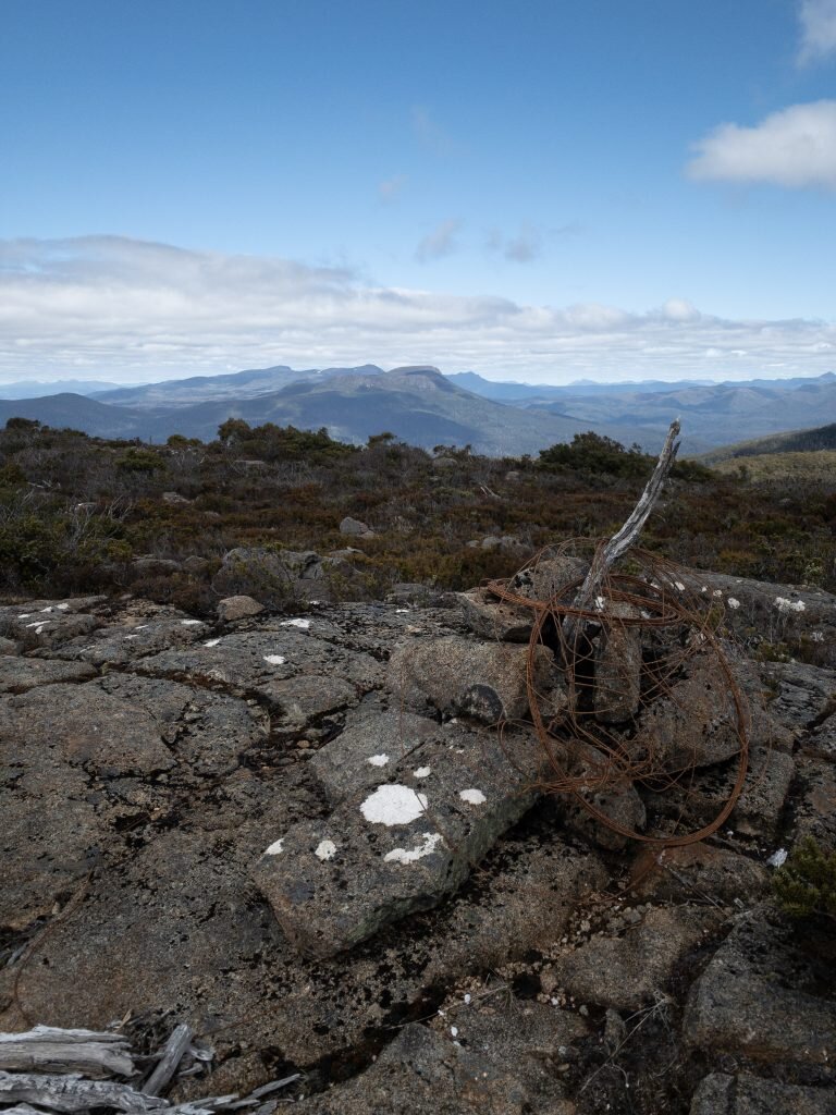
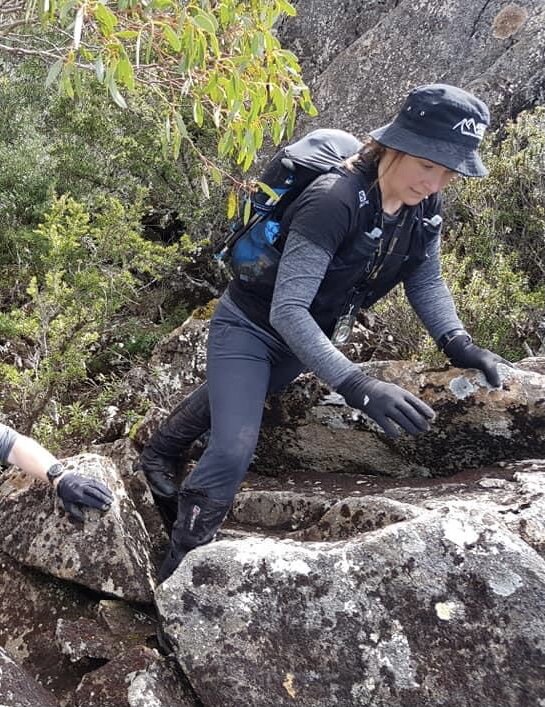
Marriotts Lookout Summit. Photo Credit: With thanks Lynnda Coffey
A fantastic day's hiking spent in the company of the Launceston Walking Club and led by the amazingly competent Carolyn Farrar. Marriotts Lookout, unlike its nearby cousin Abbotts Lookout, is graded as hard by the Abels book and is not to be underestimated due to its dense scrub and lack of track markings. Differing from most Abels we have climbed there is minimal increases in elevation along the way to the summit, but rather the elevation is saved as a sting in the tail on the return journey to squeeze the very last out of tired bush-bashing legs!!

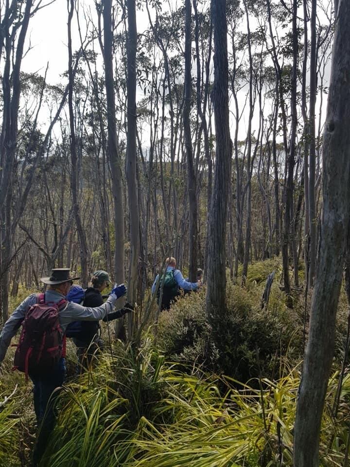
The small shed that indicates its time to go off track. Photo Credit: With thanks to Lynnda Coffey.
We began our journey to Marriotts Lookout on the completion of our hike to Abbotts Lookout. Using the word "hike" to describe Abbotts Lookout is more than a little tongue in cheek. In order for one to climb Abbotts Lookout, one need only climb onto a bus - literally! Access to these two Abels is now controlled by the Maydena Bike Park.
As the shuttle buses use the gravel road to commute MTB riders to the top of the park, walkers are not permitted to access it on foot. However, a very well spent $20 will buy you a ride straight to the top of Abbotts Lookout and save the monotony of a few hours walking up a boring gravel road.
After strolling the 50 or so metres to the summit of Abbotts Lookout from the bus drop off point, it was time to start our scramble to Marriotts Lookout. The easiest way to start the hike is to walk down the initial section of gravel road (as if returning to Maydena) until you meet the right hand junction that leads you along to a collection of communication towers. Continue past this first gathering of towers towards the left until you reach a small green shed with a trig point behind it. Just prior to reaching this smaller hut you will notice a cairn on your right. This marks the start of the track proper. Note: there is also a minimal pad behind the hut which we followed on our inwards journey, but on our return journey we stepped out at the cairned track and so would recommend walkers take the cairned route.

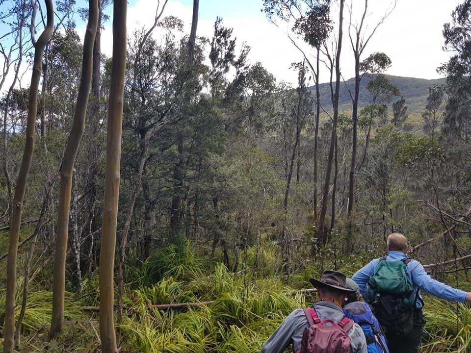
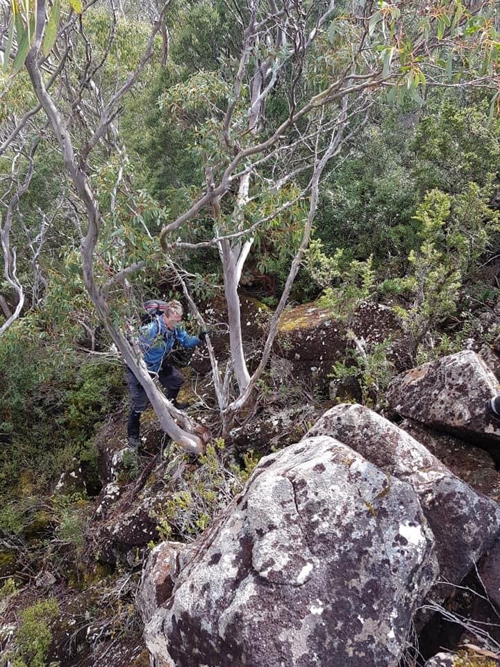
Descending into the light scrub below the shed. Photo Credit: With thanks to Lynnda Coffey.
Immediately upon stepping off the gravel road and into the dense mixed forest, we began a steep descent down the rocky face. Steep and dense best describes this section of the hike. Underfoot it was slippery due to moss covered ground, interspersed with sections of soft mud. Fallen trees both helped and hindered. It was a matter of using whatever hand holds we had to keep us upright as we negotiated the sharp journey down towards the scrubby cutting grass moor. A few cairns marked this section of the trail and the pad at this stage was reasonably visible.
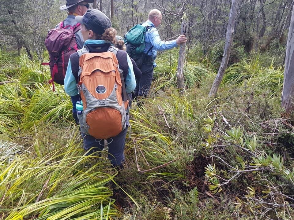
After concluding the steep decent down the mossy covered rock face, the ground began to level out ever so slightly. We were now guided by an occasional, faint pad along with intermittent yellow or pink ribbon. Navigation took some concentration as the ribbon was not terribly close together and blended into the surrounding bush. The push through waist-high cutting grass, bauera and tea tree wasn't without effort but for Chris, Lynnda and I who had climbed Mt Tor just a few days prior it seemed easy in comparison! The further we headed towards the low alpine heath plateau at the base of Marriotts Lookout the less distinct the pad became and eventually the ribbons stopped. It was now a 'choose your own adventure', avoiding the densest areas whilst still skirting towards the east.

Carolyn surprising us with cake! Photo Credit: Lynnda Coffey

Looking towards the rocky tors and the summit area. Photo Credit: Lynnda Coffey
After sometime of making our way as best we could through the cutting grass, the elevation began to climb gently upwards again. Here, the scrub changed once more to waist-to-head-high alpine heath. That said, this section was not terribly difficult to push through or negotiate around. Now, in the open area at the foot of the climb to Marriotts it was time for a water break and snack stop. Carolyn surprised us all by pulling out of her pack the most scrumptious homemade apple and rhubarb cake. Heaven! A slice of that and a sip of hot coffee from the thermos and life was good!
It turned out our refueling cake stop was perfect timing, as the real work started from this point onwards! With Marriotts Lookout clearly visible in front of us it was time to tackle the scrub-bashing up towards the summit plateau. From here, the Abels book recommends to walk between the two low tors which “straddle“ the ridgeline. From our vantage point we could see three rocky tors rising from the scrub on the eastern side of the ridge line. It was decided that we would head to the area between the two of the furthest east rocky tors and contour up the mountain.
NOTE: In hindsight, traversing through the first two (and more central) rocky tors, which we did on our return journey, would prove easier and more direct. The two rocky tors we negotiated between on the ascent do not actually straddle the ridgeline but rather sit on the eastern side of it. Later from the vantage point of the summit we chose instead to go between the two tors that “straddle“ the ridge as the scrub was less dense and it was a more direct route, saving time and energy from contouring the eastern side unnecessarily.
From the low alpine heath on the plateau below the summit line, we started climbing towards the rocky tors. The vegetation here was very dense. It required pushing, shoving, leaning and more than a little colourful language. Carolyn, Wayne and John were doing a marvelous job pushing a path through for the rest of us. It was head high, dense and strong. As we continued contouring around the mountain in almost a direct easterly bearing, it began to be interspersed with covered rock under foot. This made concentration all the more necessary. Climbing higher gradually due to contouring took the a little of the sting out of our ascent. We finally reached the rocky tors we had spied from below and began a small amount of rock scrambling.
It is important to mention if you choose to climb Marriotts Lookout via these eastern-most rocky tors (and we would recommend going between the more central rocky tors instead to avoid any rock climbing at all) that the rocks are loose. We found this out the hard way when a very large boulder came loose and tumbled down the rock face as we were climbing it. Great care should be taken to ensure that the rock you are using to lever yourself up on is stable. We were all surprised at how many very large boulders were easily coaxed from their position, becoming a serious safety hazard!
Once above the rocky tors the summit was visible ahead as we were in another pocket of low lying alpine heath. We changed bearing and headed straight for the summit. The summit cairn was not visible from this vantage point and we had a few more very minor sections of denser scrub and rock to negotiate, but after less than 15 minutes we were standing next to the summit cairn! Yay!
The summit of Marriotts Lookout itself is quite underwhelming, but as a platform to gaze in wonder at the mountains to all sides of it does not disappoint. The weather gods had blessed us and we had 360-degree views of nature’s mountainous playground including Mt Field West and Florentine Peak to the north, and Mt Anne to the south west. As we were all first timers to this mountain, it was even sweeter to get it in the bag on this trip. After an enjoyable lunch it was time to plan our descent.
From our high point we could now see that a more direct route homewards would cut out some of the very dense scrub surrounding the eastern tors. In fact, we could see a very open area of alpine heath and an obvious entry point back into the scrub on the other side of the plateau. From here we could survey four areas of less dense vegetation then the route we had climbed to the summit.
Taking a compass bearing directly off the distant opening in the scrub, it was a bee-line down the mountain. Taking this route allowed us to completely avoid unnecessary energy expenditure contouring and no exposure on the loose boulders of the eastern rocky tors. In rapid time we were at the base of the summit and enjoyed a larger area of low alpine heath than on the route up, making for more enjoyable walking.
Entering the dense bush again (albeit for a shorter period of time) it was Chris and I leading the charge of scrub bashing this time around. I love a bit of scrub bashing and was in my element. Carolyn was using her compass to keep us on track, Chris his fancy GPS and I was practicing using the tech features on my watch. Even though we were taking a more direct route back off the summit, and across the plateau below it to utilise the low alpine scrub sections, we knew our return route would join back onto our initial route at the cutting grass moor.
Back on the taped trail through the cutting grass the elevation began climbing as we closed in on the rocky face we had descended earlier in the day. It was a scramble up but not technically difficult, with only one reverse turn when the pad disappeared. After relocating the track a few metres away we were popping out onto the gravel road near the cairn at the small shed. Job done!
Spot on for timing we were able to enjoy a few minutes chatting before catching the next shuttle bus back down to the Maydena Bike Park. Time for a shower, a change of clothes and a delicious meal at the nearby National Park Hotel. A successful summit, a fabulous day's hiking over varying terrain with great company and led expertly by Carolyn. Can't ask for more than that!
The stats.
Distance: 9km return from Abbotts Lookout.
Time taken: 6 hours.
Difficulty: Hard due to dense scrub and an almost entirely untracked route.
Type of track: Cairns at the start of the trail and intermittent ribbon for the first kilometre, then completely untracked.
Access from: Maydena Bike Park.

The route taken to Marriotts Lookout.