Mount Bobs
Date: 6th November 2022 - Summit: 1111m
Photo credits: Tracey Orr

Sunset over Mount Bobs and the infamous Lake Sydney sink hole.
With Bender having already climbed Mount Bobs with a mate the previous year, it was time for me to visit this scrubby little mountain. It is said that it takes longer to reach Lake Sydney then it does to climb the mountain itself. I can 100% confirm this is true! What I can’t do is share the usual high level of photography. Most of the time I was either wading deep water, hanging precariously off or forcing myself through scrub and so photos took a back seat. I hope though that you are inspired to visit this very beautiful spot, even in the absence of lovely images to entice you.

The small temporary car parking area.
Before one can even consider climbing Mount Bobs, you must first tackle the overgrown, undulating, muddy maze that passes itself off as the Lake Sydney track! Bender had mentioned the difficulties he and a friend had endured last winter whilst trying to stay on the old, unmaintained track, and others had expressed a similar sentiment. I wasn’t looking forward to it. By all accounts the Lake Sydney track would be longer and harder than climbing Mount Bobs itself!
As well as the challenging Lake Sydney track, any Mount Bobs adventure also needs to take into account recent rains and water levels of Lake Sydney itself. There is really quite spectacular camping at Lake Sydney but it is in a sinkhole, situated at the northern end of the lake. After heavy rains the sink hole fills with water. Indeed, it can be full to the brim one day and completely empty a day or two later!
It had been a while since my last solo trip and I was itching to get out and test myself again. What better way to keep myself on my toes than a barely-there track to camp, a possibly flooded sinkhole and a scrubby untracked bash to the summit?
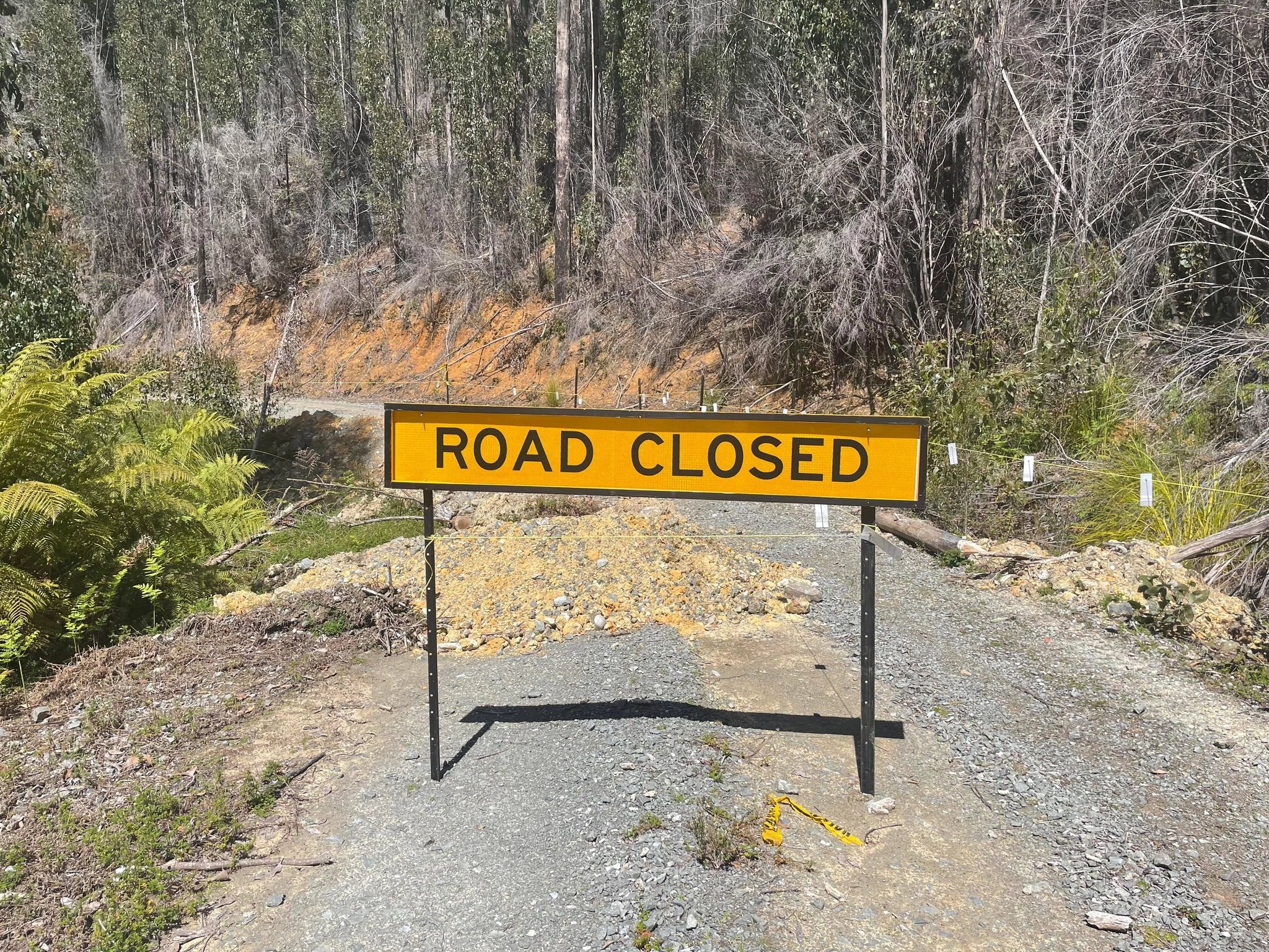
The damaged road preventing access to the usual carpark 3.5km further south.

Walking access only from here.
Bender, Sally-Anne, Lucas and myself would be walking the Farmhouse Creek Track as far as the junction to the Lake Sydney track. At the junction Bender and the others would continue on west to Cutting Camp to climb Federation Peak whilst I soloed off south to Mount Bobs.
As of the time of writing this, there is an extra 3.5km road walk (each way) due to flood damage preventing cars reaching the Farmhouse Creek track carpark. I knew Bender and his mate had taken a bit over six hours to reach Lake Sydney without the extra 3.5kms so I was allowing 6 hours at the absolute minimum, but realistically thought about 7 hours. In the end it was just under six hours for the approximate 17km to the lake from the car, and under 5 hours on the homewards journey! Mind you I was racing the clock on the way out, eager to reach the car and a cold can of Coke!

Road walking for 3.5km.
I left Lucas, Sally-Anne and Bender at the tree marked with multiple ribbons that marks the start of the Lake Sydney track. I was on my own from here. Type 2 fun, come at me! And boy does the fun start straight away. Cutting grass and bauera have reclaimed much of the track. Taller than me, the sharp tendrils were neck height and before I could lift my head they cut into the side of my neck. Barely a few minutes in and I was bleeding. It was going to be a long day! The cutting grass opened up into a small but comfortable camp site that lies less than 100m in. It was a nice spot with room for a couple of tents, but lacks a water source and is so close to the Farmhouse Creek track that I wondered if it ever gets used?

The ribbon’d tree marking the point to step off the Farmhouse Creek Track and onto the Lake Sydney Track.

The “track”!
Leaving the dry camp behind I dived back into the cutting grass, studying the pad underneath carefully as I pushed through. There were quite a few false leads so I was concentrating hard on staying on the main pad, while at the same time trying not to trip over all the hidden roots or cutting grass! Very occasional pink tape would confirm I was still on track.

The “dry” camp about 100m in from the Farmhouse Creek Track.
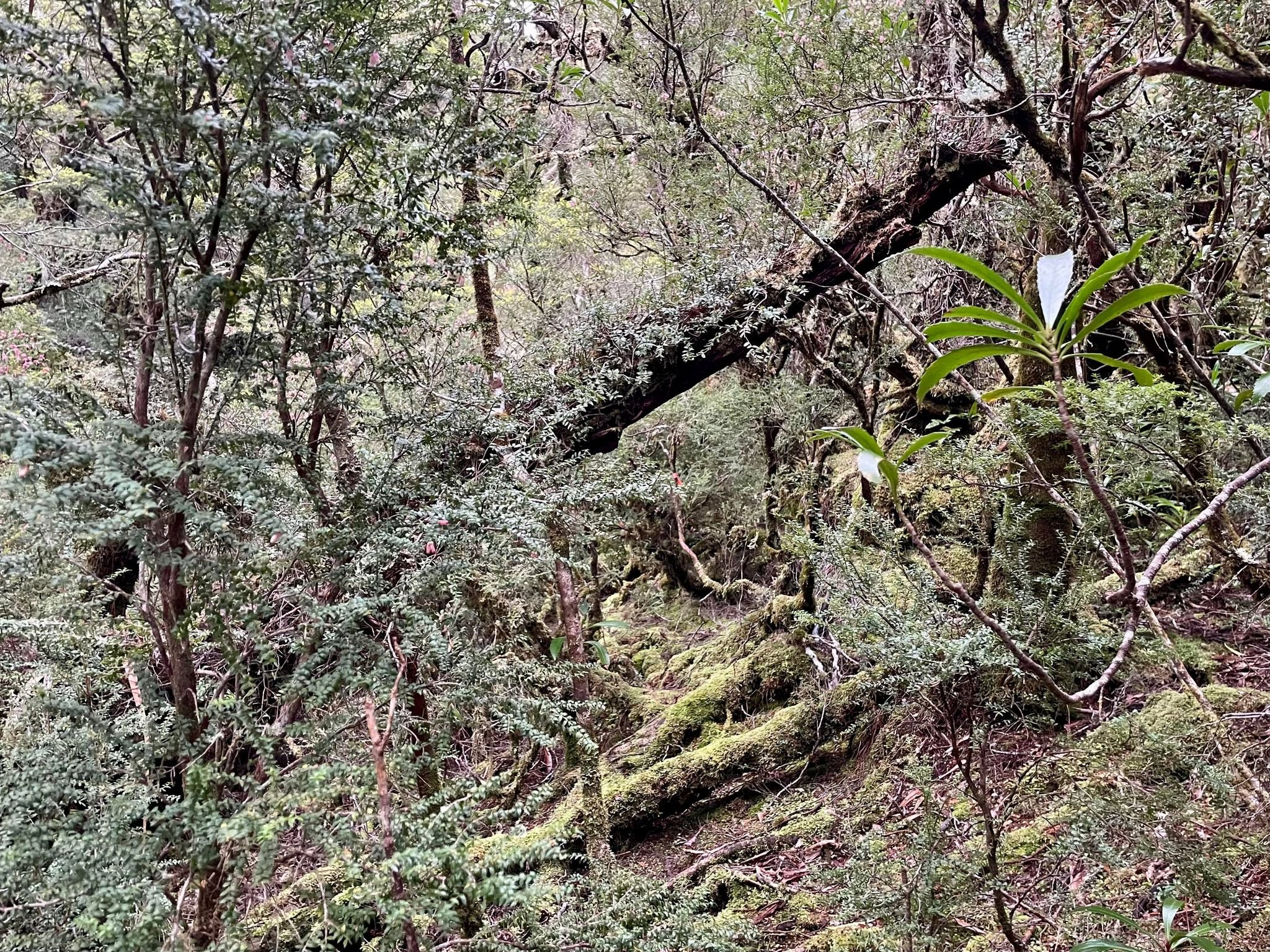
As I started climbing up the shallow ridgeline, the vegetation changed to rainforest, which was both a help and a hindrance. Whilst it was free of menacing cutting grass and other scrub, I was having to constantly look for pooled water, trodden pads, scraped moss off fallen tree limbs or broken vegetation from people hauling themselves through. The old-school indicators of human passage.
The officially marked track on ListMap does not accurately follow the actual physical track and tapes and other track markers are scarce, reading the land is far more useful than any map or GPS route. Plus, I had set myself a challenge to not use my GPX file and do the walk into Lake Sydney ‘old-school’. I’m happy to say I didn’t open it once. It’s silly the things that satisfy you!
It was upsetting to see evidence of lyrebirds this far in the southwest, but in their own way they were helpful, as they tend to scratch up the pad and help it to stand out.

Ferns and other vegetation reclaiming the old Lake Sydney Track.

The “track”.
I wasn’t really using much energy on the climb as it was so gradual, but I was expending plenty of effort climbing. Climbing up and over fallen trees or logs constantly. Or crawling under limbs when climbing them or going around them wasn’t possible. This same forest litter would obscure the pad and make extra work of navigating and searching. I was happy to finally reach the look out and get some fresh air and a well-earned breather from the constant and slightly claustrophobic forest cover.

Occasional pink tape helping with navigation.

Fallen trees covering the track were quite beautiful.

Open forest sections made for easy enough walking, but hard work staying on the faint pad.
From my rocky vantage point, I could see across to the Cracroft Plains and wondered where the others had made it to. Now came the rather steep descent down towards Lake Sydney. This section of the track was comparatively easy to follow initially, as the rocky ground and dense scrub either side of the descent made the path forward obvious. As the track levelled out into a gorgeous King Billy forest, mud became my track marker. Deep pools of mud, often knee deep, showed the way forward. Disappointingly, so did track braiding. Just walk in the mud, peeps!

Views from the lookout rock.

The entire track had muddy sections, but these were much more prevalent as you neared the lake.

Re-entering the forest one last time as I close in on the sink hole.
Finally popping out at the northern end of Lake Sydney, I was pleasantly surprised with both the time taken and the fact that I hadn’t got lost. Bonuses all round! It was early afternoon and the sun was shining - time to make camp!

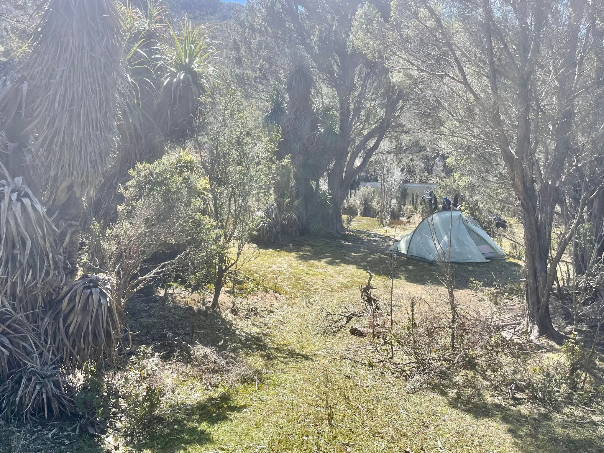
Camping at the sinkhole - a bit wetter than usual!

This part of the sink hole was not under water and thus made for lovely camping.
Doesn’t get much better than this!
Due to heavy rain in the previous week, the sink hole was partially flooded which limited my choices for camping. But within a couple of minutes I found a lovely sheltered spot at the north-eastern end, just on the outlet of the lake. It allowed for lovely views of Mount Bobs, and fresh water was all of a few steps away - perfect! It was also home to a delightful bunch of noisy nocturnal Tasmanian Devils for the duration of my trip. Talk about spoilt!
There is no real clear space for tents on the lake itself due to dense scrub surrounding its rocky (and on one side, steep) shoreline. As such, camping is rather restrictive when the sinkhole is completely full, as Bender discovered during his wet winter trip, barely managing space for their two tents.
After making camp, I headed over to the lake to check out whether I would use the eastern or western side of the lake to start my attempt on Mount Bobs the next morning. I chose the eastern side - and I boy did that decision cost me!

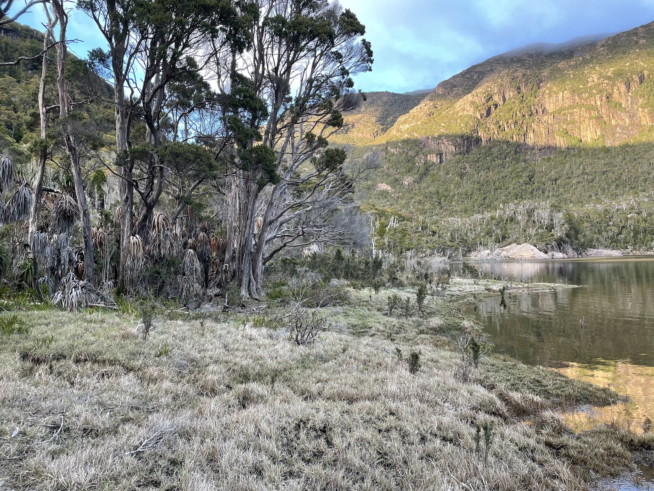
Another view of the large sink hole.
Rising early the next morning, I dressed quickly, scoffed down some museli and slung my overly-full day pack on my shoulders. Even though the forecast was for hot weather, I never walk without a set of wet-weathers and thermals. Leaving the tent behind I skirted the sinkhole, heading north and up the very small climb before the lake. From my vantage point standing on the edge of the lake, I could see that the western side looked like much drier and easier walking than the eastern side. But to get to the western side I would have to first cross the outlet, and due to the heavy rains it meant wading thigh high water. I didn’t relish starting off sopping wet! (Friends had crossed the outlet a few weeks earlier and barely got their toes wet!)

The easy sections of walking on the eastern side of Lake Sydney. Pity they were the exception, and not the norm!
The eastern side definitely looked doable - the parts I could see anyway. Ben and his mate has taken the eastern side, and complained of ending up in steep scrubville, advising to stay as close to the lake as possible. Lucas had previously taken the eastern side under much drier summer conditions and said it was quite doable! Decisions, decisions!
Another brief walkable section of the eastern side of Lake Sydney.

Nearing the sections that required wading in the water.

Looking back at one of the sections where I had to climb high into the scrub, as the lake shore was impossible to walk without being thigh deep in the water.
I decided to chance the eastern side and set off. Initially, it was quite easy skirting its shores. Short, perfectly-walkable rocky sections or saturated grasses made for quick work. Unfortunately, the further south-westerly I pushed along its shores, the more difficult skirting the lake became. In some spots I was wading in water about mid-calf height, but then would reach small cliffs lining the lake. These short rocky cliffs rose straight out of the water and the depth of water increased to almost waist height.
To avoid these mini-cliffs, I had to contour high away from the lake’s edge where the scrub was dense and near-impossible to push through in places. I’m quite little so can usually thread myself under and through most scrub, but here I was cursing and swearing loudly as I used brute force to make forward progress. Occasionally I would try to drop back down to the lake, only for the loose ground to give way underneath, leaving me hanging precariously off tree limbs! Nothing gets your heart racing like the ground disappearing under your feet!

The scrub on the edges of Lake Sydney that required pushing through.

Some sections of the scrub hid substantial drops, so I had to push yet higher and further away from the lake’s edge.

Great hand holds where often at a premium climbing through the rock-strewn scrub.
The measly single kilometre to reach the Farmhouse Creek inflow north of the Boomerang/Bobs saddle took just over 1 hr and was hard work! In comparison, on my return I took the western side of the lake and was back in 15 minutes! Suffice to say, take the western side if lake levels allow!
Climbing up out of the creek, I stumbled across the first of a few pink tape markers. The furry green rainforest was much easier walking than that of the previous hour, but it did take some small measure of detective work to locate the next piece of tape as I wandered deeper into the forest. As is usually the norm, the ribbon trail then just up and vanished! The Abels recommends heading towards the Boomerang/Bobs saddle, but I decided as I was on my own anyway I might just try a more direct approach straight to the summit plateau.

The creek that would act as a handrail for sometime.

Finally, more open walking!

Occasional rock walls to skirt.

It’s not what you’d call a full marked trail, but a few key ribbons of pink tape assisted with navigation.
Reaching the 920m contour, I turned north-westerly instead of continuing on south to the saddle. The Abels recommends continuing to the saddle before turning and mentions tapes/pads, but I was far too impatient for that! Bee-line time! Ducking, weaving, grunting and pushing, I made what felt like slow upwards progress. The climb was starting in earnest now! It certainly wasn’t the worst vegetation I have ever pushed through, but it was no piece of cake, either, especially on my own. Sporadically, open sky would appear above my head and I could glimpse Lake Sydney below, before plunging back into the green tunnel of scrub!
The easier sections of forest made for very pleasant off-track walking.
Sections of rock began to appear through the slowly diminishing vegetation as I gained elevation. It was a welcome relief to finally be able to see my way forward and pick my path ahead. Great slabs of sheer rock rose above me, but with enough green belts scattered across it that I could continue upwards without climbing the sketchy stuff. With a few hundred metres climbing before the summit plateau, I rested briefly, enjoying the view and chatting to a pair of snakes. They were intertwined and enjoying the sun. Two different species!

Deep in the denser scrub climbing Mt Bobs’ eastern face.

The tree (left in picture) I would use to climb up and out of a particularly dense section of forest.

Finally, the canopy opens above, and the scrub becomes much more navigable.

My two snake friends. I saw approximately eight this trip!
Breaching the summit rim from the south (the Boomerang end) avoided all the cliffs on the northern end of the plateau, and the views that greeted me were ah-mazing! I raced across the plateau, cairns now present and leading across to the highest point on Mount Bob’s massively flat expanse.
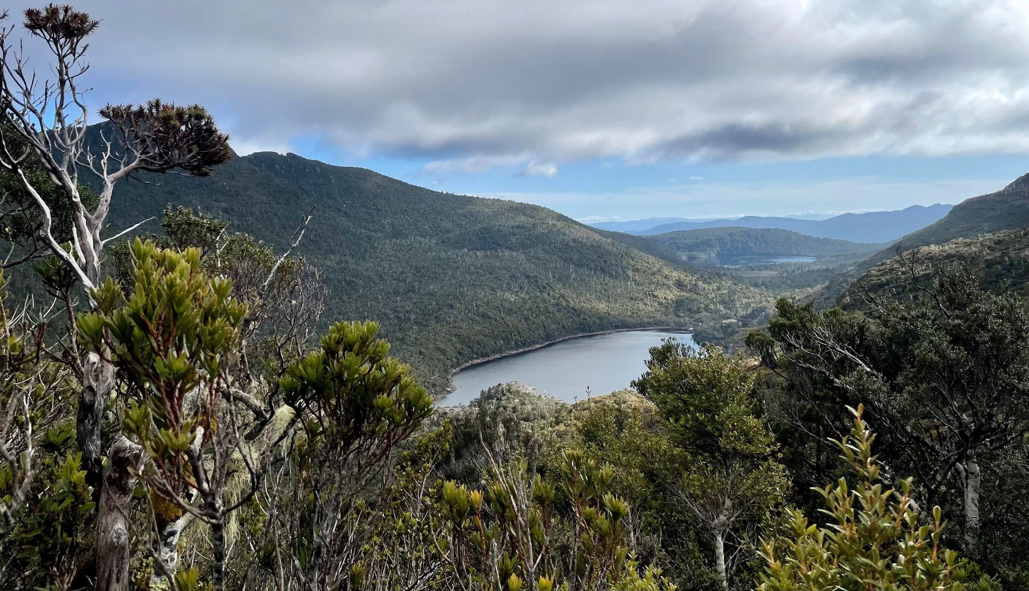
Looking back down towards Lake Sydney from three-quarters up Mount Bobs.

Lots of rock now breaking up the scrub and providing useful leads towards the summit plateau.
The sun was shinning, the skies clear and it had only been approx. 2.5 hrs since leaving camp. I had made great time, which gave me longer to now enjoy the fruits of my labour. It was too early for the lunch I had planned up there, so I made do with a juicy orange, and wandered around trying to make out the mountains surrounding me!

The final rocky push to the summit plateau.
Whilst I wandered its open top, I thought about my return journey. I would return exactly the way I had come up initially, but would branch off at Farmhouse Creek before Lake Sydney and head north. That would bring me onto the western side of the lake. There was no way I was taking the eastern side back, knowing what I now knew!

Mount Bobs’ open plateau.

One of the two large summit cairns (some distance apart).

The second large-ish summit cairn.

Hot, sweaty summit selfie.

Federation Peak from the Bobs plateau.

Another view of Federation Peak.
The descent was quick - bum sliding down through the steep scrub helped make light work of what had been a tough climb on the way up! Back in the rainforest I re-joined the taped track, which interestingly lead off to the western side of the creek, and only ended when I was a stone’s throw from Lake Sydney.

Looking towards The Boomerang on the return journey.

Reaching the western side of Lake Sydney.
The western side of the lake treated me very well! It was a mere 15 minutes of easy walking over very manageable sized boulders and I reached the crossing alongside the sink hole. The wade across the outlet was only about 20 metres and was not fast flowing nor technically difficult. Although it was mid-thigh deep I knew I would be back at camp within minutes, with access to dry clothing. It was actually quite nice wading the freezing water as the day had heated up considerably.

Much easier walking all the way back than on the eastern side of the lake!

Easy walking and pretty mini-waterfalls amongst the rock!
Sloshing in my wet boots for the final hundred or so metres I felt that warm glow of accomplishment. And it was only 12:15pm! The whole round trip had taken under six hours return, including a long and leisurely morning tea on the summit. There would be plenty of time for lazing about camp, drying out my legs and reading in the sun. What is not to love!

The crossing from the western side of Lake Sydney back to the eastern side. Deeper than it looks but not fast flowing.

Thigh-high but cool, refreshing and short lived.

Back at camp and looking towards the successfully-summited Mount Bobs.
I packed up and set off early the next morning, keen to beat the predicted heat. Navigating the return journey of the Lake Sydney track was much easier and I powered along, with thoughts of icy cold Coke in the car giving me wings! I raced, I tripped and I stumbled but it was worth it. In under five hours I was back at the cars, wearing clean clothes, drinking Coke and watching a movie whilst I waited for the others to return. They too had enjoyed a successful and rewarding trip. Soon enough, we were all eating Gozleme in Geeveston, sharing stories about just how damn good we have it here in Tassie!
The Stats.
Distance: Cars to Lake Sydney approx. 17km each way.
Lake Sydney to the summit of Mount Bobs return approx. 7km.
Time taken: Cars to Lake Sydney just under 6 hrs.
Lake Sydney to Mount Bobs return just under 6 hrs including almost an hour at the top.
Lake Sydney to the cars 5 hrs.
Difficulty: Moderate. The Lake Sydney track is very overgrown and takes some amount on concentration and skill to follow. The climb from Lake Sydney to Mount Bobs is very infrequently marked and should be considered off-track walking, so good navigation skills are essential.
Type of track: A mix of unmaintained track and off-track.
Access from: Farm House Creek Track.

Car to Lake Sydney.

Lake Sydney to Mount Bobs return.
The Map.
Routes taken into Lake Sydney and then to Mount Bobs return.