Mount Field East
Date: 29th September 2019 - Summit: 1274m

The snow and non existent views I had..!
Having climbed Mt Field West, Florentine Peak and the Rodway Range on a previous visit south, I was long overdue to climb Mt. Field East, the simplest of the 'Fields'! We had invited my brother-in-law and niece along for the walk, as I thought it would be a gentle introduction to hiking given they are setting off on the Overland Track in January 2020. They were however unable to join me this particular Sunday and this would prove a bit of a blessing later on in the day. The weather was forecast for minor winds and passing showers. As is common in Tasmania though, we had all that and a whole lot more! Another friend would join me instead.
I was particularly excited about this trip, as I had recently found out my father Michael was the inventor of - and holds the patents for - the 'SPS' sole design of my much loved Lowa hiking boots! As a youngster I had no interest in ugly footwear (that is what I considered hiking boots then) or the bush. To become an adult, discover hiking, spend years trying to find comfortable boots and to then find out by chance that my father designed an integral part of them is pretty darn cool! The universe really does work in mysterious ways!

The final small scree climb to the summit.
My friend and I drove into the car parking area near the Lake Nicholls Track about 8:30am. We usually like setting off on foot around 7am this time of year due to the shorter daylight hours on offer but we had both needed a little sleep in! A later start wasn't cause for concern as we knew that Mt Field East is an easy and relatively quick Abel to climb. The good book says under two hours each way. Even starting at 8:30am and allowing for contingencies we had ample time up our sleeve.
During the drive into the Mt Field National Park we resolved that we would take the Lake Nicholls Track instead of the Mt Field East Track. As it was forecast to be a windy day with intermittent rain falling the more sheltered route seemed to be the wiser choice. Whilst a little steeper than the Mt Field East Track, the Lake Nicholls Track offers more protection from the weather by way of the forest canopy. The overall elevation would be relatively easy and we mused that it was a bit like Mt Rufus, steady and climbing with a few little pinches but mostly gradual and easily overcome gains in altitude.
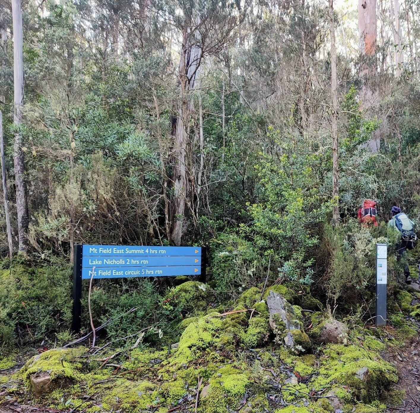
The sign in the parking area. Photo Credit: With thanks to John Ralph @ Ascent Fitness
The rain had stopped as we were getting prepared at the car, but incidental moisture from wet forest brushing against clothing as you walk had us donning the wet weathers straight away. We figured the track probably doesn't see much foot traffic this time of year so the bush might well encroach on the track in turn making us damp. Slightly damp clothes combined with strong winds isn't a great combination. The initial part of the track by the car parking area was wide and well maintained. The climb started almost immediately but was not particularly taxing at this stage.
Following just a short stint of walking we happened across the first warning sign on the track. It is important to note that whilst we consider this Abel a relaxing and easy few hours walk in fine weather, the opposite would be true in inclement weather. Clearly Parks feel the same, hence the warning signs. We were protected in the forest canopy but we could hear wind howling above us the entire hike. The well padded out track was still extremely easy to follow at this early stage.
A little further along the track changed from a padded forest floor to a mixture of padded floor with rocks strewn through it. In some areas there was less rock but on the whole for the remaining hike it would be over rocky forest floor or small scree fields. Even though the skyline was becoming visible the forest still offered us shelter from the elements. We had at this stage removed our upper body outer wet weather layers as it was no longer drizzling and the sun was shining.

Glimpsing Lake Nicholls. Photo Credit: With thanks to John Ralph at Ascent Fitness
The track wound gently up before plateauing slightly as we got our first glimpse of Lake Nicholls off to our west. It was right at this moment that the weather gods showed us how quickly they could change! We were standing and admiring the lake in the warmth of the sun when what we initially thought was gentle rain began to fall. A few seconds later we realised it was intermittent bursts of soft snow falling. By the time we arrived at the Lake Nicholls Hut a mere 15 minutes later the snow was falling steadily. Looking over the lake and watching the snow fall above it was a special treat.

Lake Nicholls Hut. Photo Credit: With kind thanks to John Ralph at Ascent Fitness.
The descent down the track to the edge of Lake Nicholls was brief but somewhat steep and a little slippery in the days weather conditions. Immediately upon descending we reached a small creek that needed crossing. In summer this could easily be stepped through to the other side. However, there are some well placed boulders across the creek so even in winter it didn't pose a problem for us to cross and keep our feet dry.
It was snowing in earnest now so we were eager to keep going. We both love Winter hiking and see snow as a treat rather than a hindrance. Mind you we are always prepared with the right gear. Had we not had thermals, wet weathers and thick gloves the snow would not have been so welcome! The hut is large and would be a very much appreciated sight for those hikers caught out in bad weather.
After exploring the hut for a few minutes we were keen to push on. Whilst we were enjoying the falling snow, the wind had started to pick up and we were conscious that our weather window might close. When standing immediately in front of the door to the hut there was a choice of two paths.
One path right next to the hut seemed to lead directly behind it. A second path was visible a little further away from the hut and closer to the lake. We chose the further path and a small distance along it a reflective marker appeared indicating we were on the right track. From here the track climbed much more steeply. We were expecting this from our assessment of the map contours.
The track changed once again from rock strewn forest path to the first of a few small scree fields. Pole markers and yellow reflective triangles helped with our navigation through each of the scree fields. We found the scree fields easy to climb even though the rocks were a little damp. Small pockets of snow littered the ground from this point on.

Beautiful Pandanis line this section of track. Photo Credit: With kind thanks to John Ralph at Ascent Fitness.
As we neared the plateau at the base of the summit we began to get glimpses of the summit through the trees. The weather was worsening rapidly now and we were leaving behind the protective cover of the forest. The snow patches were becoming more frequent as we climbed to the plateau and we were hopeful of a snowy summit. Instead we stepped out of the canopy into a mini blizzard of 30-40 knot winds, ice covered scree and horizontal face-stinging, eye watering snow!
The final push to the summit from the signposted junction involved a continuously steep and icy boulder hop. That said it is less than half a kilometer from the sign to the large summit cairn. There were enough small cairns placed along the route that navigation was still easy even though by this stage the weather gods were doing their best to force us to turn back! The wind was so strong that it was pushing Tracey over as we were moving up the scree!
We finally reached the top of Mt Field East about an hour and forty after leaving the car park. The huge rounded summit cairn allowed us some measure of shelter to eat a quick roll and drink some hot coffee. Each time we stood upright and our bodies were no longer sheltered by the enormous cairn we were blasted by the weather. We didn't spend any length of time at the summit as thick mist took away any photo opportunities and we were eager to reach the shelter of the forest canopy below.
Immediately upon entering the forest canopy again it felt like a totally different day! We could hear the wind screaming above the canopy but all was calm below! We were a little worried that the wind might bring down some trees and so made quick time back to the car with the return journey taking us just under an hour.
Back at the car again and I was very impressed with my new car set up. I had recently purchased large plastic tubs which would allow me to chuck all my wet hiking gear, muddy boots and packs straight into after a hike. Small tubs held my change of clothes. It was nice to be able to place a lid on all my dirty gear shutting in the mess and smell! An added bonus meaning the whole tub is lifted out of the car and placed into the laundry for cleaning when I got home! A hot coffee at the Mt Field Visitors Center finished off a fun day of exploring before the long drive home to Launceston.
The stats.
Distance: 8km out and back.
Time taken: Under 3 hrs, including breaks.
Difficulty: Very easy in fine conditions. The upper reaches to the summit are extremely exposed however and should be treated with caution in bad weather.
Type of track: Formal, marked and signposted single track with some open scree and cairns.
Access from: Lake Dobson Road.

Route up to Mt Field East.
The Map.
Route to Mt Field East.