Mount Hyperion
Date: 21st March 2021 Summit: 1480m
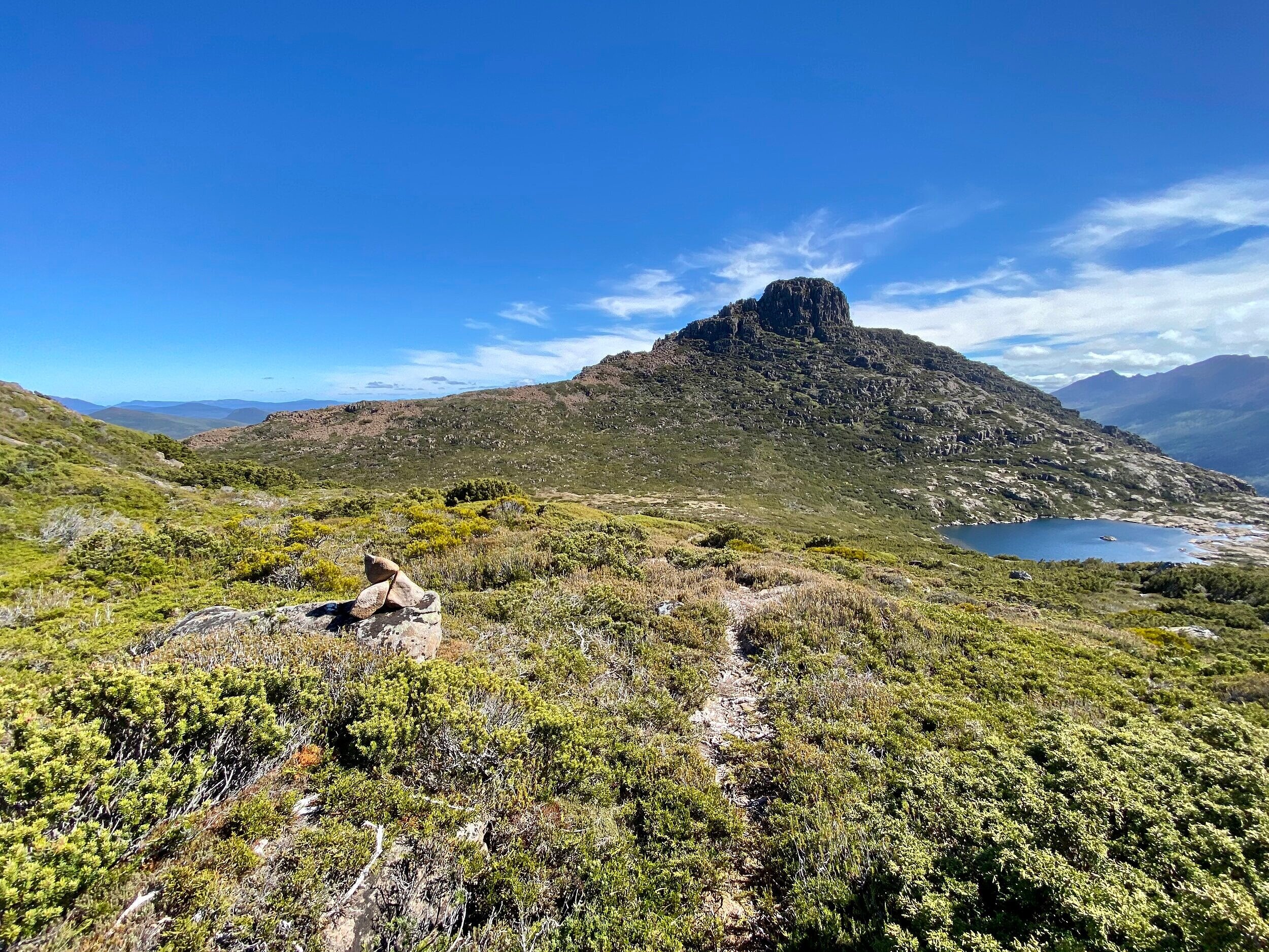
Mount Hyperion from the Du Cane Range Track.
Mt. Hyperion was always going to be the tougher of the Abels that I would climb on this adventure. A friend and I had summitted the relatively straightforward Walled Mountain the previous day, before camping at the Pool of Memories. Our original plan was to enjoy camping on the Du Cane Range after summiting Mt Hyperion and the Du Cane Range High Point, but alas my pesky knee put paid to that!
Instead, we would attempt Mt. Hyperion and the Du Cane Range High Point and then drop back into the Labyrinth for the night. Having summitted Mt. Hyperion and knowing what we know now - the delightful Lake Helios that lies at its base would also make a splendid campsite. Maybe next time?

Kicking back and enjoying the views!
Why not watch & read?
Please enjoy a visual trip to Mount Hyperion in addition to the blog below. Whilst the blog gives you greater detail on the trip (including route information) the video allows those that may never reach its summit a virtual experience.
Day 3 this Du Cane Range adventure.
Both of us were a little disappointed - if not entirely surprised - that my knee wasn't holding up so well. Our disappointment stemmed from the fact that we were not going to get a full traverse of the Du Cane Range in. We were already one and a half days behind our target. But we were intent on making the most of our time away, and that meant day trips - long day trips! Today's day trip would lead us to Mt. Hyperion and all going well, the Du Cane Range High Point. We set off around 7am from camp, as we wanted as much daylight as possible, knowing we would be moving slowly.
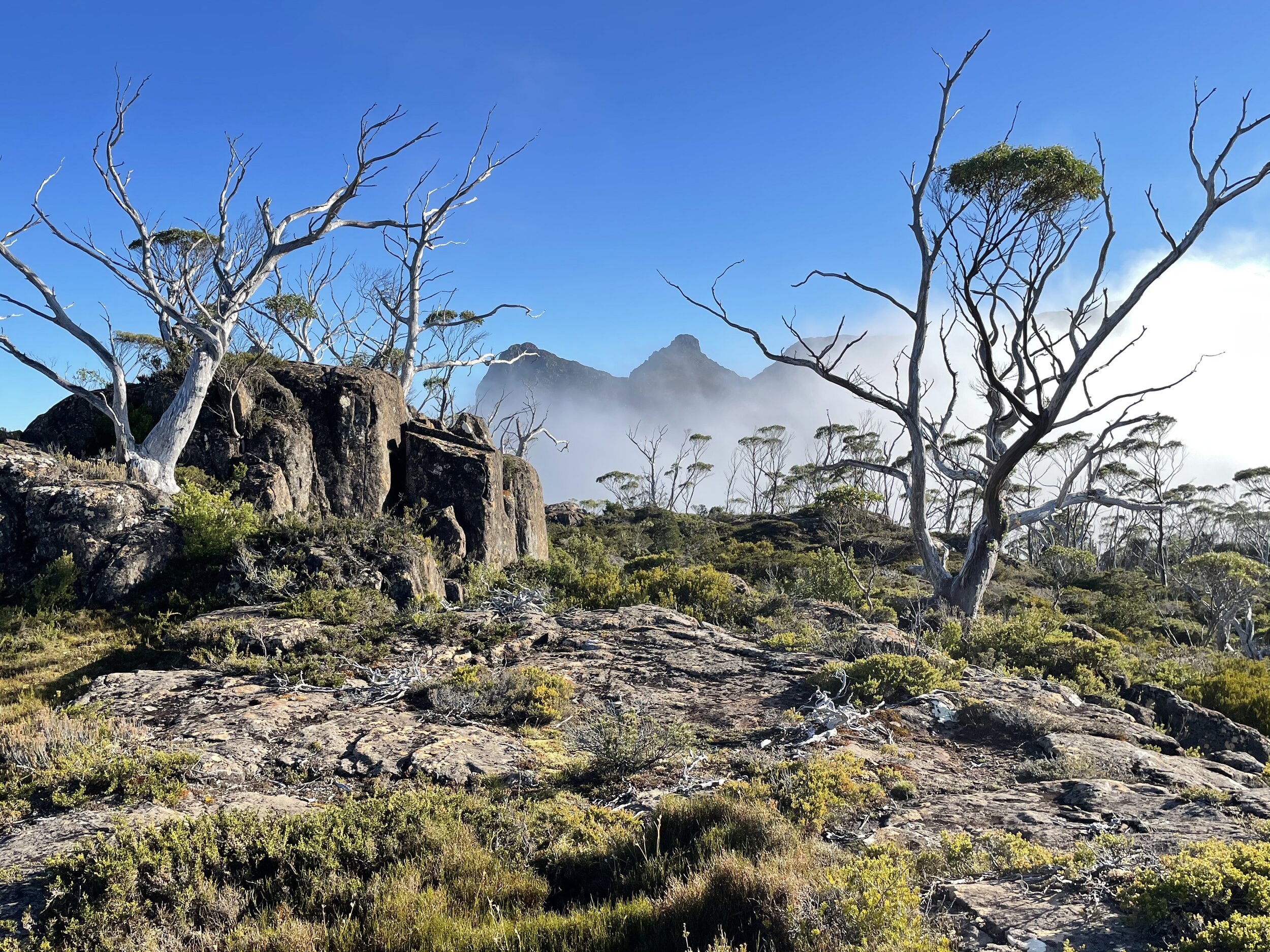
Misty mornings on the way to Mt Hyperion.
Wandering the western shores of the Pool Of Memories is a visual treat. Mt. Geryon rises sharply to the east across the water, while the track winds in and out of pockets of fagus and Pencil pines, climbing steeply at first before levelling as it traverses mostly rock and low vegetation. The morning was cold and the wind chilly so we were rugged up, but the forecast was for another hot day. I led the way whilst Bender filmed, the frequent cairns made my job easy. The natural beauty around us encouraged us to slow our already slow pace and just appreciate where we were.
How much better can it get?

Fagus just starting to turn.
We won't dwell too much on the journey from the Pool of Memories to the Mt. Hyperion track junction as this essay will start at the junction, but we will say it is some of the prettiest country we have ever seen. Tarns sparkled in rocky beds, Pencil pines, Pandani and fagus as well as other vegetational delights lined the pad, and the huge mountains surrounding us seemingly in every direction were awe inspiring. Even if you don't climb any peaks, The Labyrinth and the Du Cane Range are worth a visit.
Find the pad - make your life easier.
When it comes to Mt. Hyperion one of the most important tips we can share is to properly locate the cairned route from the Du Cane Range track down to Mt Hyperion's base. We only located this route on the return journey as none of research mentioned a cairned route! Although it wasn't terribly taxing to bee-line it for Lake Helios as we did, it is much easier and quicker travelling on the padded route!
To locate this pad, head along the main Du Cane Range track. When you reach the final saddle before the climb up to the Du Cane Range, you will reach a few small tarns. Leave the main track just past the tarns (grid reference 208586) heading north-west towards Mt. Hyperion. Although you will be tempted to drop straight down to Lake Helios - as we did, because it appears very close - instead err more to the south-west to locate a cairned route. Staying on the cairned route will allow for easier travel and also prevent multiple pads springing up through the lowish alpine vegetation.
Marsupial trimmed grass.
The cairned route leads quickly down to a lovely, obvious patch of marsupial-manicured "lawn" right at the base of Mt, Hyperion. All the research we had done mentioned using Mt Hyperion's pineapple grass "ramps" to reach the final summit climb. From our vantage point it appeared it was instead made up of many 'terraces' of pineapple grass ledges and that these ledges were separated by large chunks of dolerite.

A small cairn indictaing others have ventured here before!
From our patch of "lawn" we could just make out a faint pad leading towards small scree outcrops. Scree was going to be easier than the scrub we could see, so we headed straight for it. There were a few small rock cairns leading up the scree, but they soon disappeared and it was 'a choose our own adventure' as to the best path forward. Climbing where we could over the pineapple grass ledges, whilst maintaining a north-westerly direction, became the order of the day for the next thirty minutes or so.
Less pineapple grass, more rock!
As we gained elevation the ledges began to become less pineapple grass and more rock. From prior research we knew that we would continue in a north west arc around Mt. Hyperion's northern flank to the western side. From there we would locate a steep gully and that would allow us access to a ledge below the summit. Once on that ledge we would cross back to the eastern side for the final climb to the summit. Knowing when to make each directional change would be be the tricky thing. With my knee already protesting, the fewer false steps and back tracking we could do today, the better!
The morning sun was now particularly warm and while it cast a lovely light on Lake Helios below, the heat coming off the rock was making for hot work. I have a bad habit of being impatient and just bee-ling for summits, but the steep cliffs of Mt. Hyperion's eastern face weren't having any of that! Approaching the northern end we reached a wall of rock blocking our path. My Friend figured we could go straight up but I was being cautious, so he decide to do some recon. When they yelled back "its doable but you aren't going to like it" - that was enough to make me start looking around for a lower access point! It was a good thing too, as I managed to locate a faint pad and a lone cairn. We were back on "track"!

Top part of the chute to the summit area.

Initial part of the chute to the summit area.
Here's where the type-2 fun starts.
The faint pad was now leading us up a steep gully towards the summit - we were getting excited. Our Garmins were telling us we were less than a hundred metres from the summit. Who knew that this last 100m or so would be the most time consuming and tricky part of the climb! With the last of the vegetation behind us, cairns made a reappearance as we began climbing a minor patch of scree. The scree soon gave way to a somewhat sketchy section of rock scrambling, but thankfully there was an ample supply of roots and scrub to hang onto. It is definitely not where you would want to be in the wet, that's for sure. Friends who have previously climbed Mt Hyperion have used a rope for extra security here but for us we didn't feel it was necessary.
After several minutes of near-vertical climbing, we reached the ledge we would use to cross to the eastern side of the summit. The ledge was giving me flashbacks of the Western Arthurs - walking over scrub with nothing but fresh air underneath your feet is never a particularly nice feeling - even if it is for just a few steps. "Don't look down and sorry Mum", "Don't look down and sorry mum" I was repeating to myself in my head. The ledge crossed, it was time to start picking our way up and through some rather awkwardly sized and placed boulders. Man, I was looking forward to just being on the top and having a secure footing under my feet!
Finally the top!
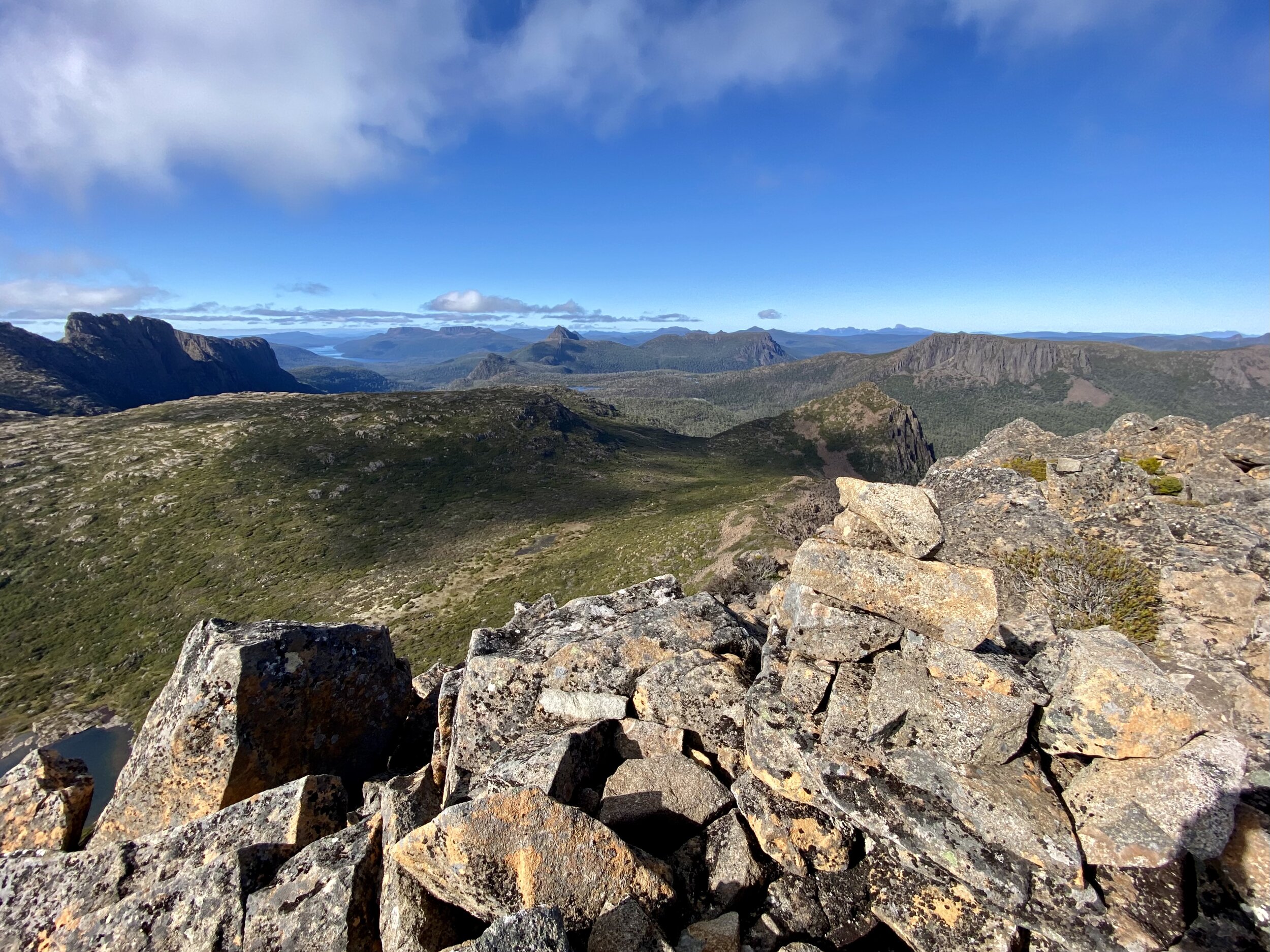
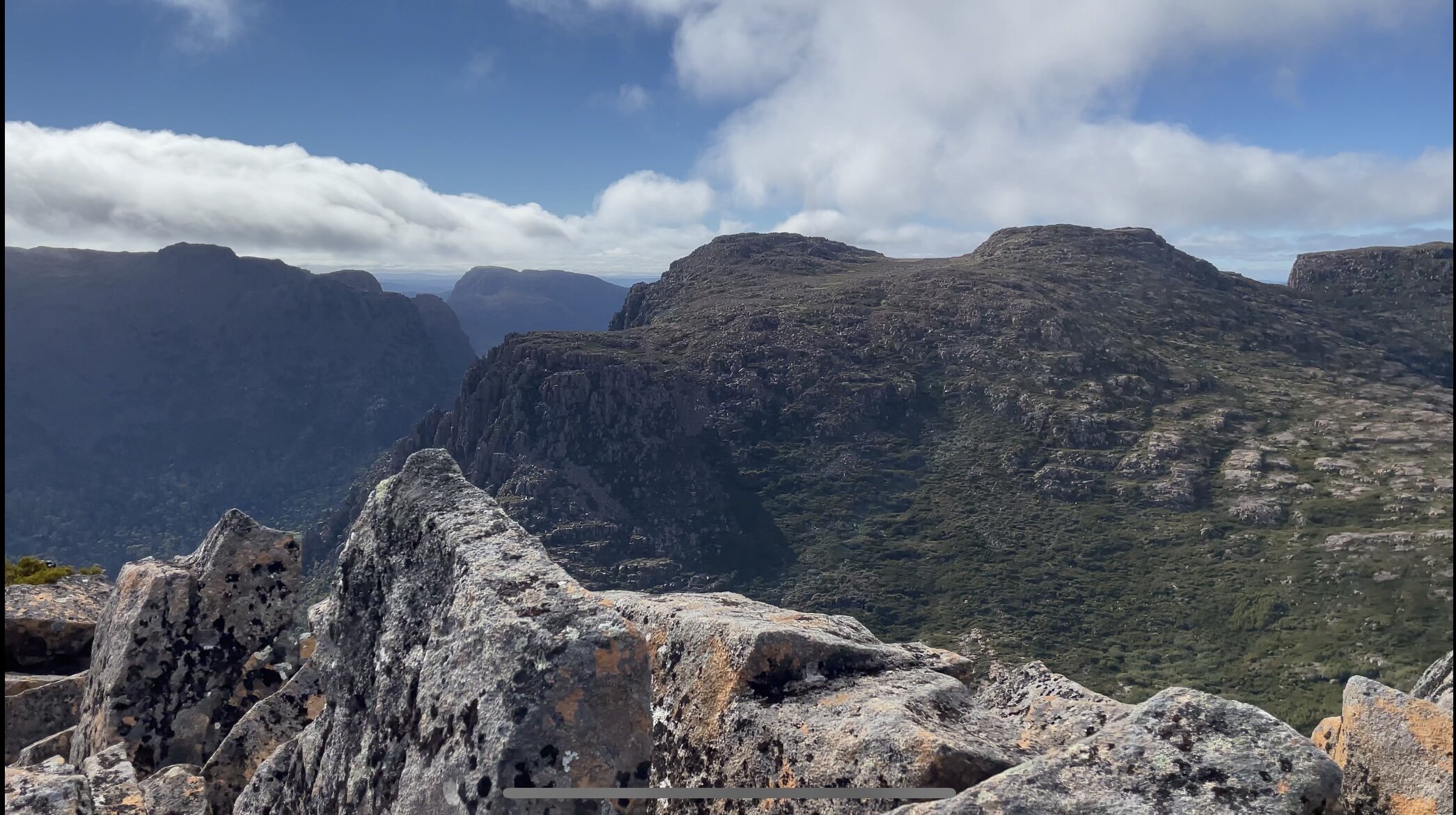
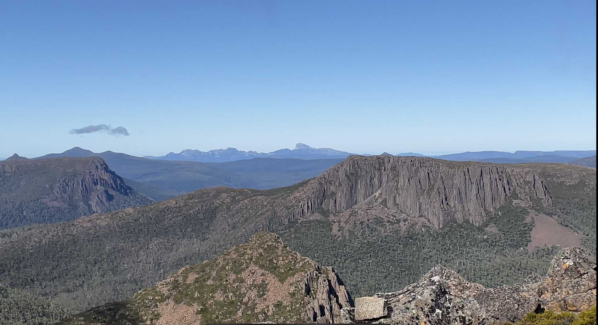
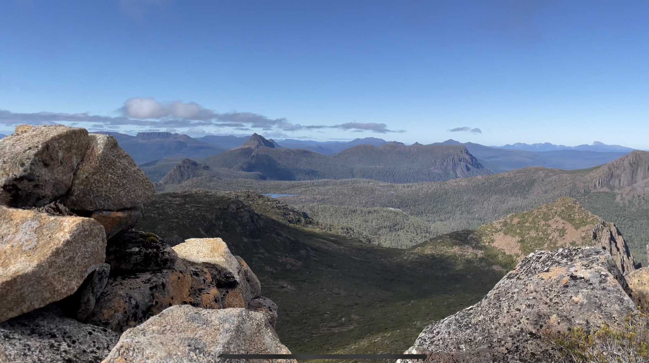
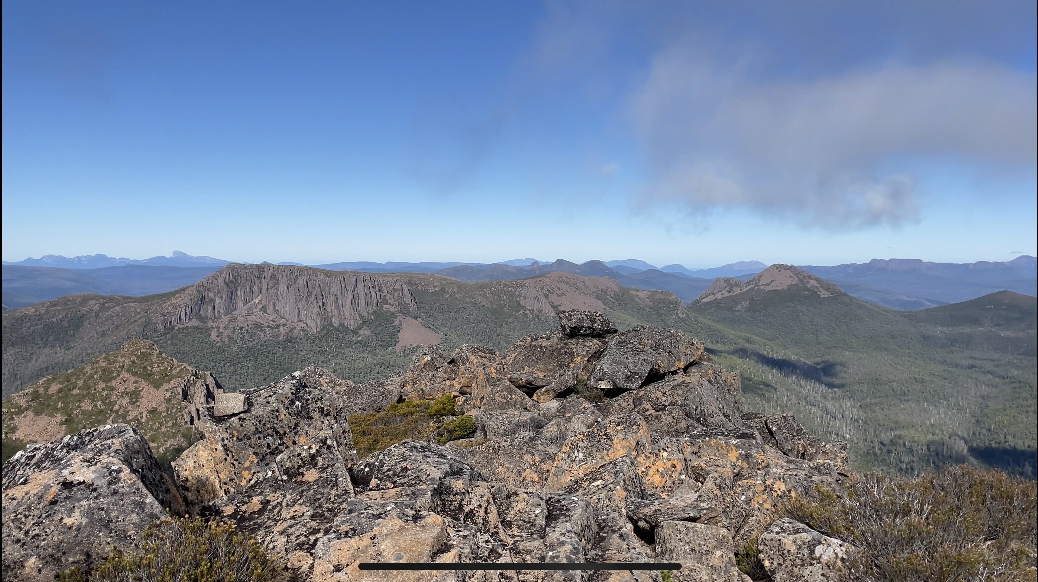
Finally, we reached the summit. The awkward and somewhat sketchy last half hour had been totally worth it as we stood on this giant among giants! Virtually every mountain within central Tassie was putting a show on for us. Immediately east the Du Cane Range, Mt Geryon and The Acropolis dominated our view. Swinging around south to Lake St Clair, Mt Gould and Mt Olympus. Frenchmans Cap peeked out behind Walled Mountain. Macs Mountain and the reclusive Mt Nereus were visible. Perrins Bluff and the huge bulk of Mt Thetis dominated the skyline to our North as did glimpses of Mt Pelion West. Just WOW!
Looking across to the Du Cane Range High Point - our target for later in the day.
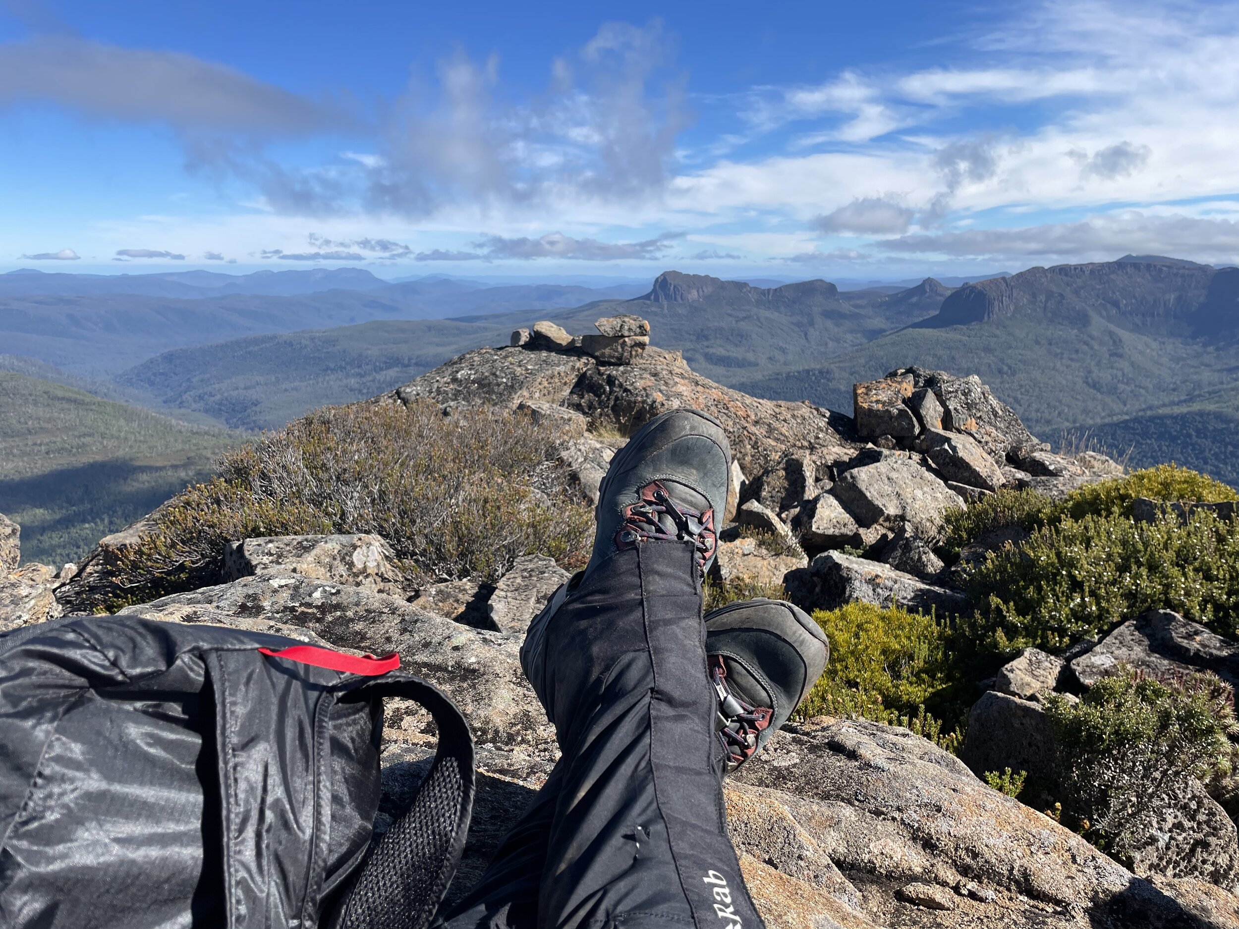
I wanted to stay up there all day, mostly because I was dreading the sketchy descent a little! Perhaps it was the happy endorphins from summiting, but the descent wasn't as daunting as I had feared. Back down on the grass patch at Mt Hyperion's base, I spied the pad and cairned route back to the Du Cane Range Track, so that was an added bonus. We still had the Du Cane Range High Point to visit but we had conquered the tougher of our two Abels for the day. A couple of Nurofen, some icy cold water from the lake and a snack, and it was game on for Abel #100!
The stats.
The Stats.
Distance: Approximately 7.2km return from Pool of Memories. (Approx. 18.4km return to Pine Valley Hut or approx. 39km return from Narcissus Hut).
Time taken: From Pool of Memories to the summit was 2.5 hours, at a relatively leisurely pace. The return journey was much faster as we weren't stopping for photos/filming.
Difficulty: Hard. There is a padded and cairned route from the Du Cane Range Track to the base of Mt. Hyperion. From there the track becomes less distinct and the cairns sporadic. Rock scrambling is required for the latter part of the climb. There are varying amounts of exposure involved towards the summit, so those not comfortable with heights may find it challenging. We'd recommend climbing Mt. Hyperion only on dry weather days with good visibility.
Type of track: Well defined to the junction of the Du Cane Range Track and the Mt. Hyperion turn off. From there a good pad and cairns lead to the base of the mountain before the pad becomes less distinct and the cairns sporadic.
Access from: Pine Valley/Labyrinth/Du Cane Range.

Route taken from Pool of Memories to Mt. Hyperion and the Du Cane High Point.