Mount Mueller
Date: 25th July 2020 Summit: 1245m

Heading towards the summit. Photo Credit: With kind thanks to Sohee Kim
I find there are generally two types of bushwalkers/Abel baggers: those that share their tips, tricks and knowledge and openly encourage others to take up the "sport" ... and then there are those that don't. We avoid the latter and seek out the former. In the words of Richard Stallman - "Sharing knowledge is the most fundamental act of friendship. Because it is a way you can give something without losing something."
Recently we were lucky enough to be included on a hike to the summit of Mt. Mueller with the Pandani Walking Club where we thoroughly enjoyed the company of 12 of their members. Mt. Mueller is without question a beautiful mountain with many fine attributes, but the most delightful experiences on this day came as a result of the genuine warmness of the welcome we were extended.
Mountain views. Photo Credit: With kind thanks Sohee Kim
Why not watch & read?
Please enjoy a visual trip to Mount Mueller in addition to the blog below. Whilst the blog gives you greater detail on the trip (including route information) the video allows those that may never reach its summit a virtual experience.
As seems to be my norm of late, I left Launceston late on the Friday night heading south. My loose plan was to car camp at Mt. Field National Park for the night, then meet up with the Pandani Club members the next morning at Maydena. Car camping at Mt. Field ensured that the drive to nearby Maydena was completed in short work, leaving me time for a leisurely breakfast.
After a quick meet and greet, our convoy of happy hikers were driving southwest along Gordon River Road before we turned west onto the signposted Mueller Road. After passing Mueller Road Spur 3 the road briefly deteriorated before the condition again improved. Around 4.6km from the gate at the beginning of Mueller Road we turned right onto Mueller Spur 6 (not signposted) and then took the left fork towards the trail head. Ordinarily you might be able to drive right to the track proper but a large fallen log had us pulling up stumps approximately 150m from the start of the single track.

Pulling up stumps literally. We decided not to drive over the fallen log.

The closed in and quite boggy single trail that begins the walk to Mount Mueller.
The single trail commenced after a short walk from our cars and was signposted with a lonely piece of ruben tape and a little cairn that appears to hug the almost bare tree whose base it surrounds. It became apparent immediately that we would be in for a wet, boggy and muddy day.
The path underfoot was wider than I expected, with far less scrub encroaching upon it that my research had indicated. Some of the members who have previously visited Mt. Mueller in recent years mentioned that it appeared considerable track maintenance has been completed. This was substantiated by the evidence of freshly cut branches along the track.
The path leading to Fossil Lake loosely follows what is said to be an old bulldozer track. At times the track was almost spacious, but for the most part wide enough only to walk single file. Our fabulous leader Isobel was setting a goodly pace up front as we climbed steadily towards the lake. Mud squelched underfoot and we were walled on all sides by a mixture of bauera, cutting grass, waratah and even pandani. When we weren't sploshing through mud or climbing over a few timber obstacles, the track became a rocky, running creek! There would be no shortage of water today.
It made a pleasant change to be in a group and to chat with the other walkers, delighting in the shared passion of visiting Tasmania's natural playgrounds. I love to hear the recounts of adventures others have done, places they have seen and to be inspired by them. We reached the ridge above the lake in just on an hour due to our swift pace. I was surprised to note that we had gained over 630m of elevation in the first 3.3km to the lake, as it had felt like a continual climb, but not a sharp one. The steep bit however was not too far away though, according to my perusal of the map!

The small clearing before dropping down to fossil lake.
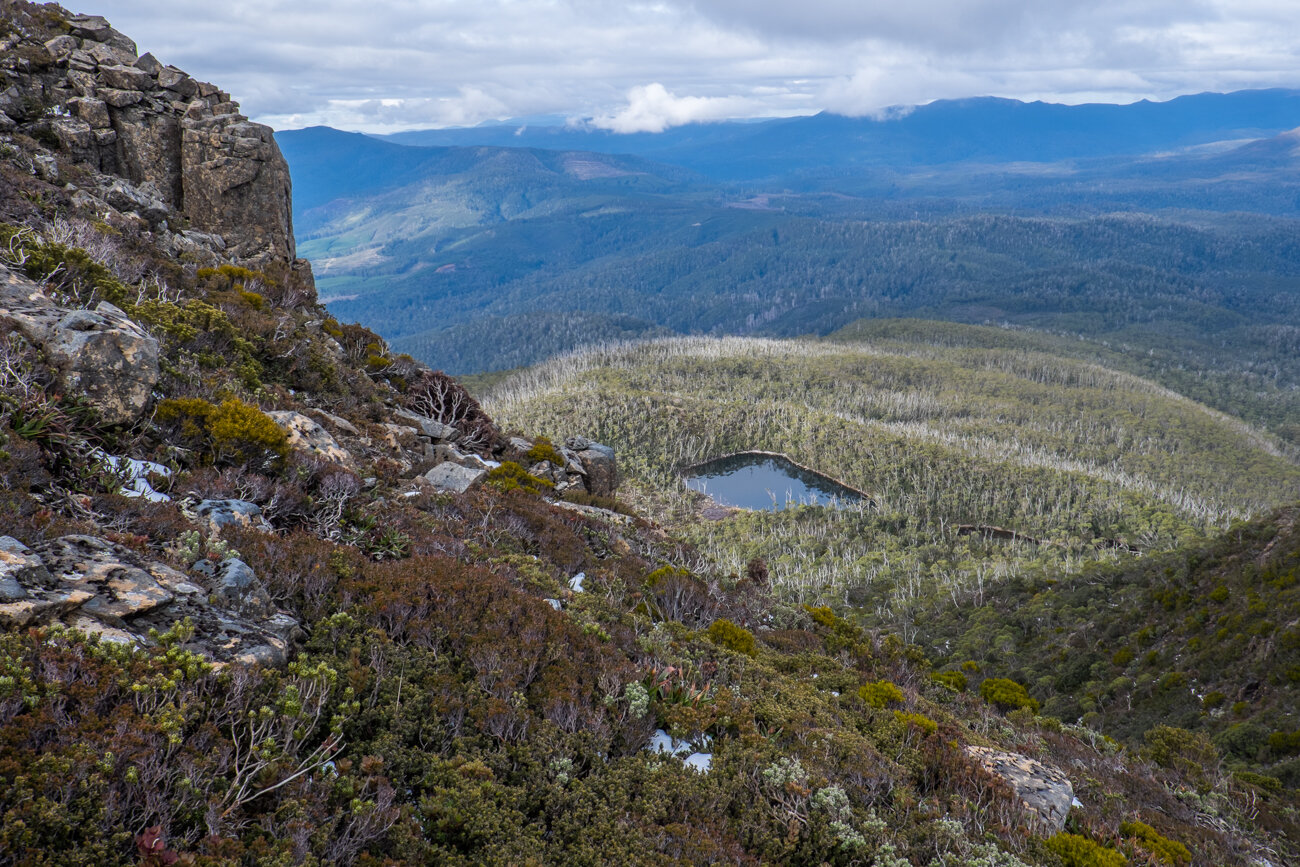
Nearing the top of the ridge, the scrub had retreated from the path and become more open, allowing us a glimpse of the snow-speckled eastern high point of Mt. Mueller rising ahead. A small gravel landing gave us a clear vantage point to look down towards Fossil Lake. Regathering the group, we began the short but quite steep descent towards the lake and morning tea. Here, the track was much more overgrown, so our progress slowed temporarily. There were quite a few in our group looking forward to fossil hunting at the lake - me included.

One of the fossils on the rock at Fossil Lake.
Looking down to Fossil lake from the clearing above. Photo Credit: Ben Young
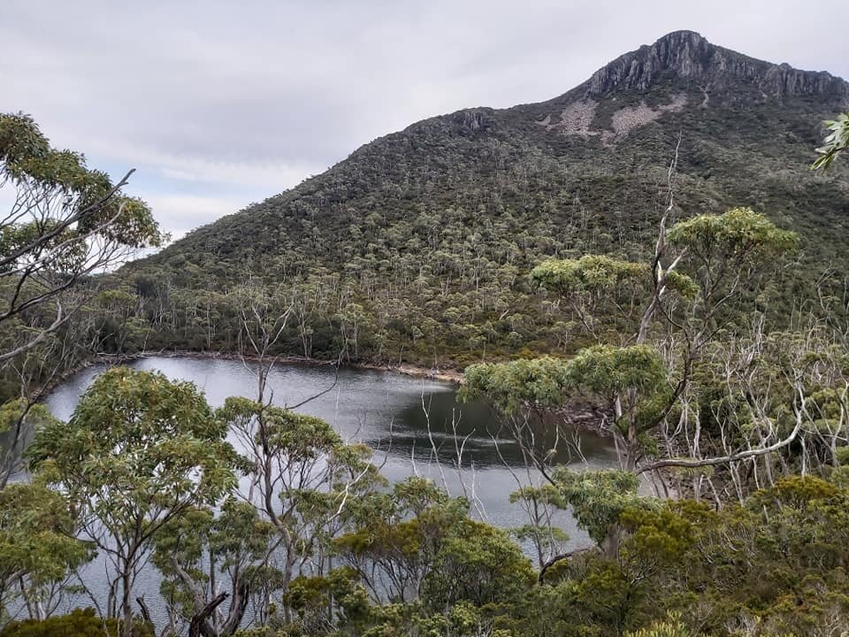
The drop down to the lake took just a matter of minutes and only lost us 20 or so metres of elevation, as the lake sits at around the 1000m contour. Fossil Lake is unique not only for the fact that fossils are easily found along its shores, but it is also hemmed in entirely by a morraine covered with snow gums and there is no outlet creek. It simply seeps away rather than runs off. Sohee and Ian quickly located some fossils. I love a window to the past, and am a romantic at heart thinking of how this place has changed over the huge spans of time it has endured.
Looking back down to Fossil Lake. Photo Credit: With kind thanks to Sohee Kim.
The weather gods were looking after us and we enjoyed a fabulous morning tea sitting at the lake in the mornings sun. Bliss! From here we could see the steep pinchy climb ahead to reach the southern shoulder of Mt. Mueller. I wasn't super excited about the steep ascent, as I figured there might be some need to pull ourselves up sections with our hands, and I was still sporting a broken thumb from our Snowy North trip a few weeks earlier. This would have meant the throbbing and pain in my hand was only going to increase from this point onwards! Totally worth it though, to enjoy a day out with such agreeable company.
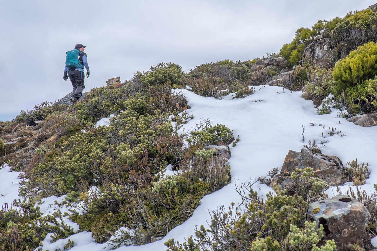
Locating the pad that would lead us up took a little hunting around as it is hidden under regrowth, however a tiny blue piece of ruben tape caught our eyes and we were soon off. I knew I would be a little slower going up the steep eastern face due to my hand, so I hung back to allow some others to go on ahead and took my time. This section of the hike was indeed steep! In the 900m climb towards the eastern high point we would gain 230m of elevation. Not bad! The track, whilst now steep and narrow, remained easy to follow and was marked with the occasional ribbon or cairn. After cresting the shoulder, the terrain transformed from scrub to a short section of ice and light snow over talus.

Heading towards the saddle below Mount Muellers summit. Photo with kind thanks to Sohee Kim
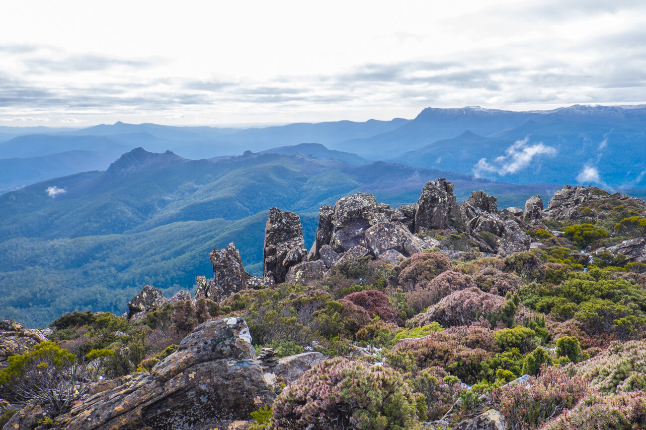
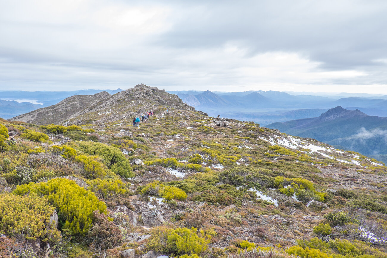
Now up higher with the vegetation reduced to low alpine heath, we got our first views across towards the Mt. Field range and the Styx Valley. The sun was shining, the cloud was lifting and the views were getting better each step. Yay! Cresting the eastern high point we could see the true summit laying to the west a mere 1km away. The ridgeline consisted of lower alpine scrub interspersed with rocky outcrops of dolerite scree. Our course towards the summit would involve crossing the ridge then dropping down into a small saddle, before the final push to the mountains peak.
The stunning almost 360degree views. Photo credit: With kind thanks to Sohee Kim.
Snow littering the trail. Photo Credit: With kind thanks to Sohee Kim
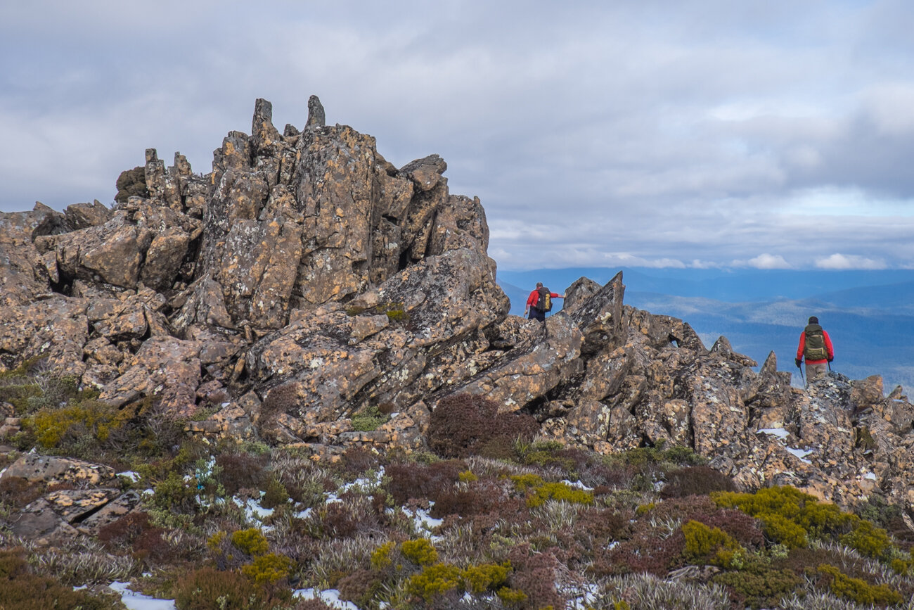
I was thoroughly appreciating the relatively flat wander over the ridge and the sun on my back. The wind had picked up as the ridgeline is very exposed, so we had all layered up to counter the westerly chill. It certainly would not be an ideal place if the weather turned bad, as there is very little to no shelter to be found along Mt. Mueller's ridge. We stuck mostly to short sections of lower scrub, before using a small rock field to drop us into the connecting saddle. The rock was large enough to make the going easy, but in some areas was coated in slippery moss and ice. What you could jump across and down in summer needed due care this time of year.
From the base of the saddle we had a measly 700m left to climb. It would take us about 20 minutes for the last push ,as it involved crossing vegetation with a heavier covering of snow which hid a few trip hazards, then a clamber over icy rocks to the top. Nothing difficult, but certainly an area where in the conditions we had for the day a little more concentration was needed.
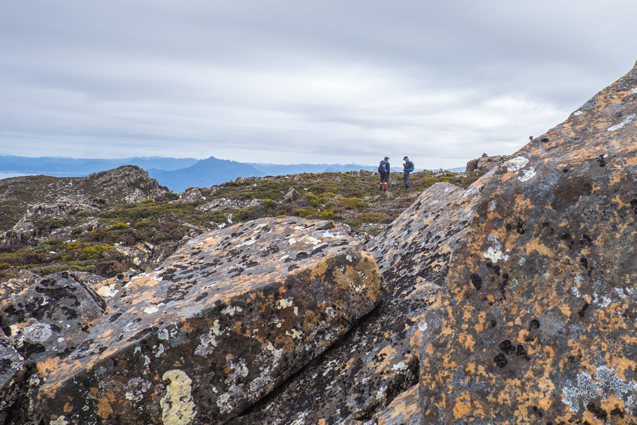
Crossing a small section of scree before the summit saddle. Photo Credit: With kind thanks Sohee Kim
Conversation and nature. Bliss. Photo credit: With kind thanks Sohee Kim
As exciting as it was to touch the summit cairn and have Mt. Mueller in the bag, it was even better to enjoy a leisurely lunch up at the summit. The sounds of conversation, laughter and collective enjoyment punctuated the air while all around us nature showed us how insignificant we really are. Mountains and valleys, trees and lakes and views as far as our human eyes could take us. Certainly the best restaurant in the world to enjoy one's lunch of a fruit bun and coffee! I think Sohee was right: that a glass of wine would have gone down just nicely!

The rather underwhelming summit cairn!
Soon enough it was time to begin our return journey, carefully making our way over the summit rock back down to the saddle. We had discussed that we might like to contour around the rocky scree field we had climbed over on the way down to the saddle and stick lower on the ridge to avoid the rock and make the most of the low alpine vegetation.
While this return route looked fine and dandy from high above, the reality was different. The scrub was not low and easy to walk through, and was instead a rather awkward and energy sapping. Halfway through we decided to cut our loses and head straight back up towards the rocky ridgeline and return the way we had come, now content in the knowledge that the original route over was the best option!
Our objective for the day complete, we all relaxed as we enjoyed the remaining ridge walk towards the eastern high point, and the descent back down to the lake. So relaxed we were, that a few of us wandered straight past the drop off point to the lake from the southern shoulder! Set straight, we turned back the few steps and were back on track. It is important to note that a false lead and a false cairn here has probably caught a few hikers out in the past!
In short time due to the steep descent, we were enjoying our afternoon tea back at the lake. After a snack and rest the group made light work of the remaining few mud-filled kilometres back to the car with plenty of daylight to spare. It was time to change into less filthy clothes and head to Maydena for our customary post-hike hot chips fix. The long drive back north later that evening was filled with recounting our tremendous day out and plans to walk with our new found friends at the Pandani Walking Club again soon.
The stats.
Distance: Approximately 12.5km return.
Time taken: About 7.5 hours return, which included breaks for morning tea, lunch and afternoon tea.
Difficulty: Moderate. Clearly tracked for the most part, but once up on the ridgeline you are exposed to the weather with little in the way of shelter should the weather deteriorate.
Type of track: Well-defined pad for the majority, with only a few small sections along the ridge being indistinct. Occasional ribbons and cairns. Very boggy and muddy until the ridge is crested.
Access from: Mueller Road, Spur 6.

Route taken to Mt. Mueller.