Pokana Peak
From Pokana Bay/Lake Gordon
Date: 13th March 2022 - Summit: 1127m
Photo credits: Ben Wells, Simon Kendrick, Jess McDonald and Tracey Orr

A hard earned summit!
I should start by saying that when I first sat down in front of my computer to write this blog, I had no idea HOW to tell the story of our Pokana Peak adventure… or should I say, misadventure! It’s been almost a week since we returned… my body still sports the usual bruises, scratches, aches and pains, but in this case my head is still buzzing with the craziness of our latest escapade.
Perhaps when the four of us named our Facebook group chat “Pokana Peak or bust” then “Pokana Peak - we’re taking head torches” and finally “Pokana Peak we’re taking head torches with fresh batteries” we should have fully appreciated we all knew precisely what we were undertaking - with zero desire to again fail in our quest - and what ultimately would become an all night mission and end in emergency bivvy bags…
Kayaks loaded and the adventure begins.
I couldn’t possibly recount this epic journey without first providing a little background information. Situated in one of the most remote and hard-to-access parts of Tasmania, Pokana Peak is not a commonly climbed mountain, generally sought out only by very keen and experienced bushwalkers and determined peak baggers.
Most who do climb it do so from the Denison Ranges, traversing west from Bonds Craig (north of Lake Rhona, already an involved multi-day trip) typically as part of a week-long-plus, entirely off-track trip to the even-more-remote Spires Range and the picturesque Lake Curly.
The remainder use a boat or kayak to cross Lake Gordon and attempt to climb it from Pokana Bay via The Pleiades ridgeline further south. Vague mentions of individuals attempting a more direct ascent on Pokana’s cliffy southern and eastern sides occasionally pop up on forums, usually alongside descriptors such as “utterly stupid” or “you’d be mad”! Certainly, there was no precedent nor any recommendation…
A long, long time ago…
Back in early January 2021, a group of us from the Pandani Walking Club had attempted to summit Pokana Peak via The Pleiades ‘way’ - as a three-day combined kayaking/bushwalking trip - and failed. The intense summer heat, endless steep button grass ridges, limited water, relentless elevation gain and loss as well as our largish group size had ultimately been a recipe for failure.
Two of our group had a spare day up their sleeves - the unstoppable force that is Becca AKA Rock Monkey Adventures and fellow walker Tim - and attempted the same route the very next day and summited! Read about that adventure here. Unfortunately Simon, Jess, Bender and I as well as the rest of us had to get back home to work and study commitments the following day, disappointed we’d been beaten - and swearing then and there we would never again attempt Pokana Peak that way!
Fast forward a bit over twelve months and Simon, Jess, Ben and I suddenly found ourselves planning another Pokana Peak attempt - again from Pokana Bay. The only excuse I can give for our madness is that perhaps mountain climbing is a bit like childbirth: with enough time, you forget how horrendous it is!

Launching the kayaks at the end of Clear Hill Road.
Simon fixing my misbehaving rudder.
Pokana we are coming for you baby!
Our Facebook group chat was busy with all manner of discussions leading up to step-off date. Minor details like how to coordinate picking up kayaks, to major factors like the weather and possible routes kept the chatter going. Do we err on the side of caution and repeat the exact route we had previously attempted? We had GPX data for it, knew precisely what we were in for and had completed what was apparently the hardest section? According to Becca, from where the group turned back to camp, the remaining couple of kilometres to the summit was quite easy in comparison.
Or do we try a completely different approach, try to get up onto the ridgeline closer to the summit and avoid the lengthly, awkward and dry ridgeline walking that worked against us previously? Pros and cons were thrown back and forth, but eventually we settled on deciding on the day. Let’s keep it fluid and see what happens? I had dropped a few waypoints on Gaia Maps, where the scrub was least dense, marking out potential chinks in Pokana’s armour where we might make our attack.

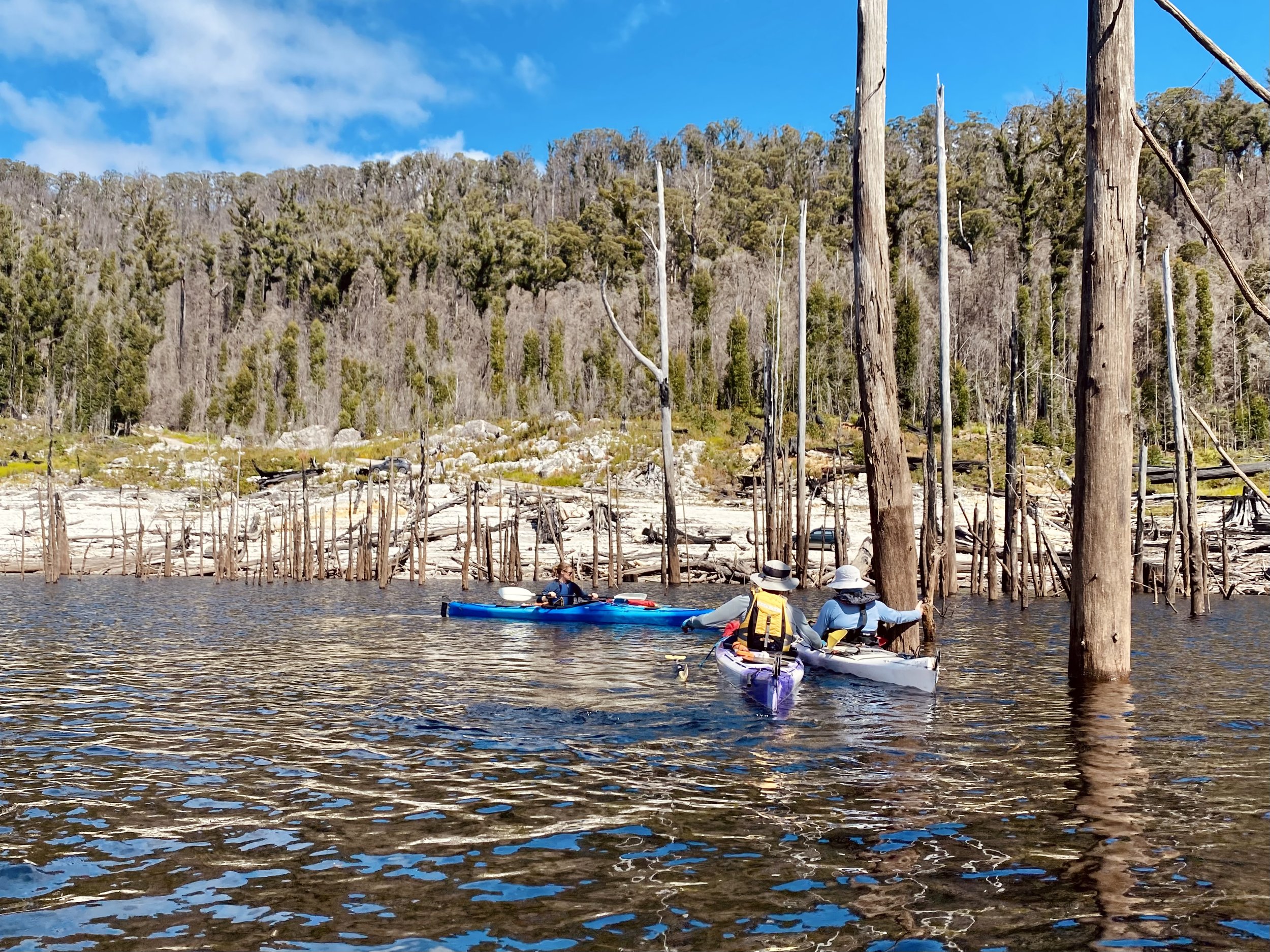
Paddling towards Pokana Bay.

Paddling towards Pokana Bay, The Pleiades immediately ahead.
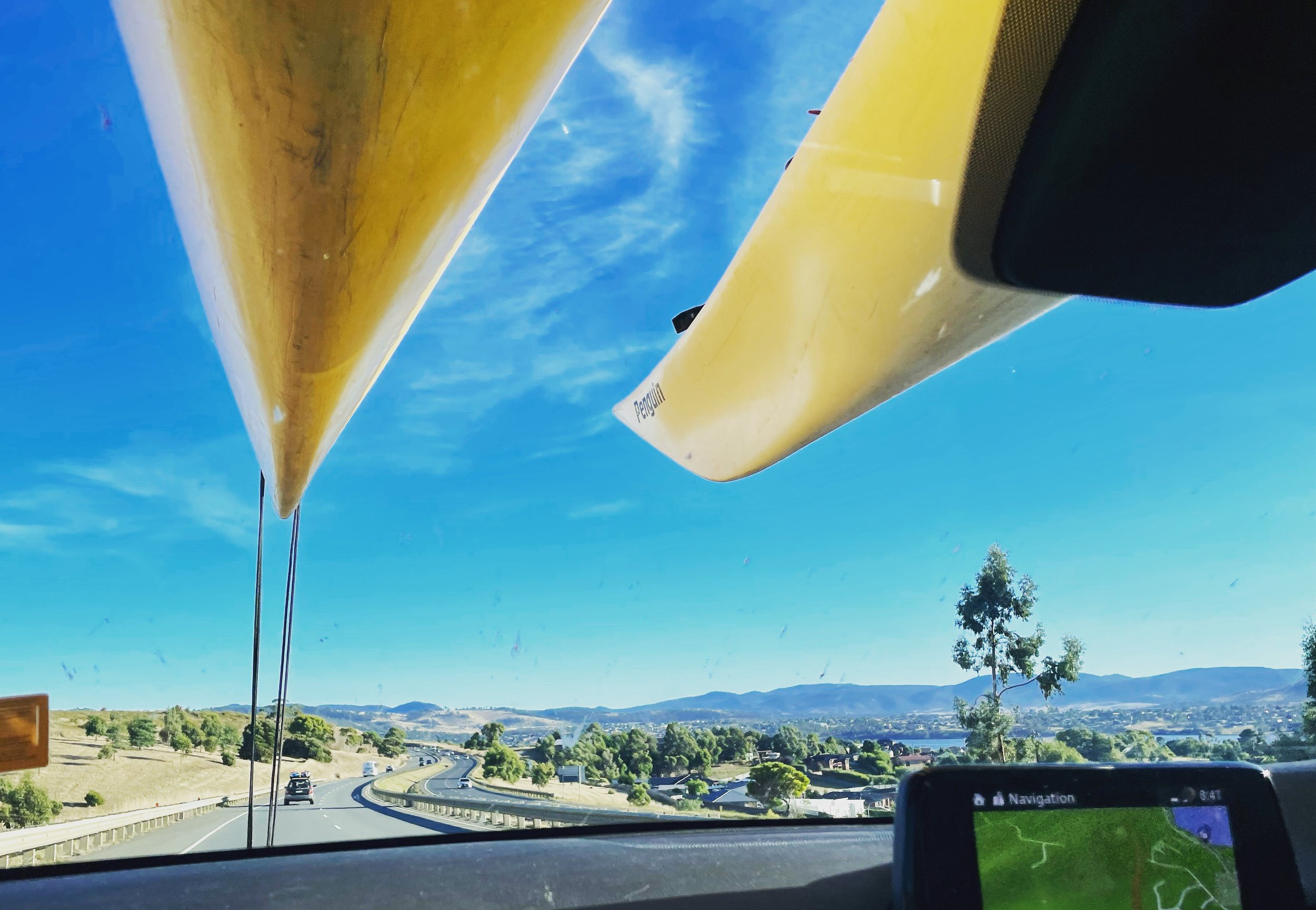
I was equal parts excited and nervous to kayak over to Pokana Bay, as this time I would be paddling all by myself. The last time Bender and I had shared a double kayak, which made my utter newbie experience less intimidating. Simon and Jess had organised the kayaks (Becca and Tess generously loaning us theirs!) and we set off from Simon’s for the long drive to the end of Clear Hill Road.
After loading up our kayaks and finally getting underway, we all got a bit of a giggle at the fact I couldn’t steer mine… the giggles assuming my inexperience until we realised the rudder was genuinely stuck! Steering fixed we began paddling towards Pokana Bay. This is a truly spectacular area to paddle. Weaving in and out of submerged trees while surrounded by mountains. Lake Gordon may be a modified hydro lake, but it is still beautiful!

Paddling towards Pokana Bay 📸 Simon Kendrick
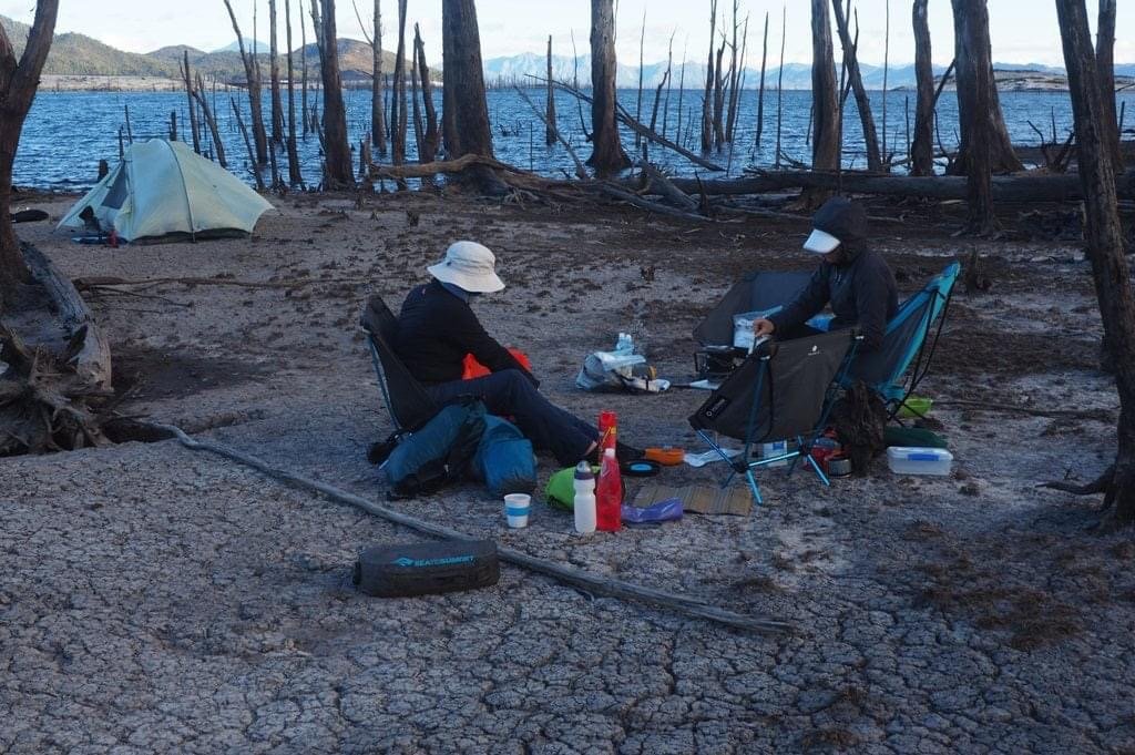
Camping in the lake. 📸 Simon Kendrick

Luxury camping - a table!
Just like our last trip, the lake level was so low (some 28 metres below full) that we would be camping well inside the lake bowl itself, along the seemingly desolate shores of grey sand and long-dead trees that ring the lake for hundreds of metres.
It was far from all bad though. The luxury of kayak camping is that you can bring extras you don’t normally take bushwalking because weight and space isn’t such an issue. We all had camp chairs and Simon even bought a table! One of the highlights for me for any trip is the company. Simon and Jess are the best sort of humans, and we had a lovely evening playing crib - even if my fast-and-lose sense of the rules couldn’t escape Jess’s eagle eyes!
I was enjoying the evening immensely, but was suitably nervous about the next day’s adventure. We all knew it would be long and very tough! I was just putting it out to the universe for good-but-cool weather. The one remaining memory of the last trip was the burning sun, which was intensified by the seemingly endless button grass. Button grass has a knack of absorbing the heat and then reflecting it back on you ten-fold. Please don’t let it be hot!

Me attempting to cheat at Crib! Jess is suitably unimpressed.

Sunset over Clear Hill.

Sunrise the following day.
A warmer-than-preferred morning greeted us and we were all eager to make haste to get some of the days torture over before the sun was high in the sky. We had agreed to roughly follow the few waypoints I had dropped through (hopefully) less dense scrub and climb to the summit much further to the north-east along the connecting Pleiades ridgeline than our previous trip.
Setting off across the sand we headed almost due north. Our electronic topo maps still showing us in the lake itself, but thanks to the magic of offline aerial imagery, we had a bird’s eye view of reality to help guide us. Weaving around minor patches of scrub and through low vegetation and button grass, we were all enjoying the easy walking. We continued along, negotiating small log jams, creek crossings and minor patches of varying density scrub. We pushed outwards towards the east to make the most of walking up the expansive button grass plain to the ridgeline’s east. On our eventual return we would push even further east to find clear, easier walking.
We met a couple of lovely, healthy looking tiger snakes amongst the buttongrass in the early morning sun, giving them right of way of course! We only saw two in the end, but there would be many, many, many that call the endless button grass plains home.
Chatting away we ended up getting momentarily disorientated and briefly passed the point we had wanted to swing to the north west, and so had to back track slightly. Here we got our first real taste of scrub pushing back on us.

Setting off across the lake. Once upon a time this was all well under water.

The ridges of The Pleiades on our left.
Light and easy scrub initially.
Our original plan was to head due west and then north, bouncing between the pockets of lower vegetation and climbing the more gradual looking spur about two kilometres south along Pokana Peak’s ridgeline. But…. This is where things get interesting! Realising this would put us up against the same long, steep and rocky outcrop who’s awkward traverse was where we’d pulled the plug on the previous trip, we decided to turf our original idea and take a bet on what now appeared to be a better option. Instead, we’d bee-line a more direct route further north onto Pokana’s ridgeline, using a large patch of lowish scrub that sat just below the ridge to our advantage. Between that large patch of what appeared to be relatively easy walking were three things:
One, a band of thickish looking scrub immediately ahead. We placed bets on the fact that it might have an open understory and be relatively easy to move through. At least it would be in the shade!
Two, a very steep but short-lived button grass climb. Tough but we could navigate visually with confidence and pick our route.
And three, a band of trees at the highest point that hid who-knew-what was on the other side! Could it be a huge drop in elevation? Could it be dense forest? Could it hide cliffs on the other side? The maps weren’t showing hideous contour lines, but even 10m contours can hide a lot in between. So we decided to take a leap of faith and change course.

Our first taste of scrub.
After several kilometres of flat walking, our mountain climb began in earnest from this point. For the first time we were gaining elevation and we were gaining it quickly. With not enough forest cover yet to shield us from the now unrelenting sun we were all sweating - a lot. We were losing a lot of bodily fluid and drinking a lot to replace it. Up until this point we had been coming across enough water sources to replenish our reserves but the higher we climbed the less likely we were to find water. I was carrying almost two litres, as was Ben but we were going through it rapidly. I had packed my MSR Trail Shot water filter if necessary and we also had about 500ml of raspberry cordial stowed in Bender’s pack, notionally for a celebratory treat at the summit, but also as an emergency backup.
(Note: I mention water now because the simple fact is - if it weren’t for both Simon and Jess carrying considerably more water with them which they generously shared with us when we ran out, Bender and I would have ended up dangerously dehydrated. Lesson one for Bender and I - we need to carry more water in summer.)

Simon refilling at one of the many creeks we would cross early on.

Cooling off and looking back - we hadn’t covered much ground!
With the sun roasting us from the sky we did our best to try and stick in whatever bands of scrub we found on the way up the ridge. It was a slow and painful dance upwards; weaving through cutting grass, button grass, bauera, tea tree, wattle and myrtle. No sooner would we have some open walking, then the forest would show us it was boss again. But the scrub dance was preferable to the heat of the open button grass! A few times we tried to cross bands of scrub, only for it to be almost impenetrable and we would retreat with our proverbial tails between our sweaty legs.
Our plan of attack changed and we edged the forest using the sizeable mounds of button grass to pull ourselves up. It was here that a sharp bit of button grass foliage seemingly pierced my right eye. I let our a howl of pain and a barrage of swear words! My vision was now foggy in said eye and it was painful to open, so I kept it closed thinking it would right itself in the next few moments. Oh I thought wrong, didn’t I?!
Finally we made the sloping button grass field we had aimed for and set our sights upon a small boulder in the middle of it, a convenient halfway rest spot for some food and to shelter from the heat for a few minutes. Bender reached it first, pushing forward the route, followed by Simon and Jess and then me. Each one of us was starting to feel the effect of the heat and our muscles were fighting against us. Moral was a little low but it was Pokana or die, baby! So we refuelled, pepped ourselves us and dragged ourselves back into it. Jess led this time in the final slog to reach the ridgeline. We mustered what enthusiasm we could when we finally stepped onto the ridgeline that we would follow all the way to the summit. But we had a surprisingly long way to go, and the afternoon was rapidly becoming early evening.

Choosing which scrubby ridge to follow. Our initial plan to follow the gently sloping ramp on the LHS of the photo changed to aiming to the small rock outcrops half way up the ridge, then progressing east on a diagonal to the Pokana ridgeline.

Crossing endless button grass to the base of the slopes.

Aiming for the small rocky outcrops before the ridgeline.
At least now the walking was a more agreeable slope, but the lumpy and knee-to-waist heigh button grass still made walking much harder than is typical of open, over-1000m ridgelines and plateaus. It was something of an unbalanced stumble for me, as I was still walking mostly with my right eye closed and so, like a blinkered horse, I would err left. Step up on button grass, feel it sink, use your muscles to take another step - repeat. Occasionally we would enjoy faster progress over hardened ground or rock, but such sections were fleeting.
Rounding the first of the remaining rocky outcrops before the summit, I deflated like a helium balloon let loose! Sooooo many more ups and downs to the summit! Well, actually only two very small shoulders, but they felt gargantuan. We hadn’t actually progressed that far in terms of distance from our last rest spot, but we were all thirsty again.
Simon and Jess generously shared some water with Bender. I was still travelling OK and had meagre reserves and didn’t want to take Simon or Jess’s water, but Simon insisted. It felt a bit disingenuous to take it after he had carried it all this way!
The four of us wound in the final few hundred metres to the summit at a relative snail’s pace - no sudden summit fever here - with each of us taking a slightly different route up the short rocky climb to the old concrete survey point. We had arrived! It was every bit as tough as we all remembered and we were beaten, flogged, spent. But we had made it! Little did we know the real adventure was only just about to begin.

Climbing up. No shade for parts, just intense heat.

Still a long way to go!

Jess and Simon working their way through one of the more open sections of scrub. 📸 Ben Wells
It had taken us an entire 9 hours and 47 minutes to reach the summit from camp. We had been faster than our previous attempt, for sure, but we would nonetheless be returning back to camp in darkness soon enough. Gravity at least would be on our side, but it would be no cake walk in several sections. We sat for as long as we could afford up on the summit enjoying our hard earned views and resting.
We seriously discussed calling in a helicopter for my eye. By now it was like looking through a foggy windscreen and the pain was coming in stabbing bursts. We joked perhaps the rescue team would take us all! But as long as my legs still worked I would get myself off the mountain. I grabbed out one walking pole and announced that it was as good as a good right eye! Packs back on, we set off back along the way we had come, until we made one seemingly small judgement call that would have a huge impact on the outcome of our Pokana trip…

Aiming for the ridgeline up high between the two formations of rock.

It looks so open and easy, but progress was painfully slow given the lumpy button grass and scrub.

Finally ridge walking but a long way to go. Skirting rocky outcrops as we reached them.

The summit area finally in view.

A very well earned rest on the summit. Reeds Peak and Bonds Craig in the distance.
Light was fading fast as it always does in the mountains. Bender was starting to struggle with dehydration and again out of water, and although we were losing light, we weren’t losing heat. If we returned exactly the way we had come, just to reach the point at which we even started our descent, it would likely be a few more hours. Standing in front of one of the small rocky knolls we had skirted on the way to the summit, we looked down the ridge right in front of us. From where we were standing it looked sparsely vegetated - waist to chest high at worst - until the gully way below where the creeks should junction.
If we bee-lined it down - gravity would help, of course - we should make most if not all of the descent in the last of the light. The button grass plains back to camp would be no issue by headtorch. So, after a quick discussion and unanimous vote, we headed straight down the broad ridgeline with gusto.
Initially the scrub was manageable, calf to waist deep but easy to push or fall through. Bender was leading, me behind him and Jess and then Simon. But after a few minutes of encouraging progress we hit the gates of scrub hell. The vegetation suddenly become over two metres tall and much less pliable to our advance. It fought us as we fought it. Scoparia, cutting grass, banksia, tea tree - nothing relented. The ridge was steep and we were descending rapidly but struggling to make steady progress through the mess.
As Bender tired I would take over, forcing passage through the relentless scrub. The cutting grass was neck high and its razor sharp tendrils were cutting at our chests, faces and necks. Sometimes the ground would disappear under our feet and the warning “hole!” was a constant yelled back along our bush-bashing-conga-line.

Retracing our steps off the summit as far as the front of this rocky outcrop. From there we would decide to bee-line it down!
It was fast becoming apparent we had chosen poorly. Very poorly! But there was nought that we could do now - retreat was borderline impossible - but push on downwards. Our head torches came out as the sun finally disappeared. Eventually we made the creek - much to Bender’s delight, who came back to life after drinking his thirst and replenishing all his bottles. We continued down, using it it as our handrail, our theory being to follow it down until we reached the junction where it branched off in the direction of our ascent route further south.
We were now in thick forest, in the dark and the temperature was dropping to a more comfortable degree. The tangled web of rotten timber that surrounded both sides of the creek was becoming increasingly hazardous. It would give way under our feet and it was a scary feeling when you were effectively standing in thin air over the creek. We took it in turns picking through the maze. At one point Jess found a great lead which gave us what felt like our first real progress in hours, but it soon disappeared and the hard work and tedium continued.

Our original route way off in the distance near that rocky outcrop, so we decided to push down through this lowish scrub instead. Pity it didn’t last!
Our progress into the night was painfully slow. Navigation in the thick scrub was tough as we could not see more than a few metres in front of us. Picking a clear route through the mess of fallen timber was incredibly tough at times, further taxing our weary minds. Our GPSs were suffering too due to the dense forest cover, lagging behind our actual position which started to hinder our navigation rather than help. I would lead out front whilst Bender guided behind me saying “left” or “right” or “get back on the creek” but it felt like we were just going in circles.
It was getting close to crunch time. Clearly following the creek wasn’t working for us, so I suggested we bash a straight course south away from the creek, gain a little elevation and get back on our previous route which was now just visible on my Garmin watch only a few hundred metres away.

Scrub and two-metre-plus drops off hidden rock outcrops starting to become a bit too commonplace. 📸 Simon Kendrick

Note the rotting timber below Bens feet. 📸 Simon Kendrick

Dense vegetation slowing our progress. 📸 Simon Kendrick
As happens with fatigue in trying conditions, your ability to make good judgement calls is affected. Reaching yet another sharp drop ahead, I decided I could hang off a tree limb to drop down. Not my brightest moment! Simon promptly told me not to do that again! I think I must have had some sort of delirium at this stage from being over tired, as I was quite enjoying our night time adventure! The others weren’t though and even Bender - who does endurance events like The Cradle Run for fun - was pretty fed up with our state of affairs.
The reality is though that clambering over forests of rotting timber suspended in the air is unsafe. Crossing another rotten log that held a nest of bees was the straw that broke the camels back ,and a decision was made to look for a bunk out spot to wait out the rest of the night.
Simons years of group leadership shone through here. He reminded us that if one of us fell now and broke a leg, there would be no way a helicopter could reach us in our current position. A ground crew would be a day away and actually extracting an injured person would be difficult to say the least. We would emergency bivvy until morning and continue on at first light.
And so began the search for a cave or patch of clear, level-ish ground with room for four. We needed to get up and away from the creek to avoid a cold, damp hollow, but also find somewhere with enough overhead tree cover for some protection from any cold winds or rain that might eventuate.

Our ‘beds’ spread out for the night!
We stumbled upon an adequate spot not far from our ascent route and with our watches now showing midnight, decided it would be home for the night. It was exciting and nerve wracking all at the same time! We would finally get to use the emergency bivvy bag I had bought Bender several years ago, which he’d dutifully carried up probably 80-odd Abels and along several ultramarathons, never using. Until now!
Now, I should mention here that making a choice to bivvy was the smart move. Choosing to bivvy and locating a good spot on your own terms is way better than being forced to bivvy in an unsafe location as you left the decision too late.
As we laid our previously unused wet weathers on the ground to insulate us from the bottom up I thought briefly of our nice warm tent back at camp, with our toasty down quilts and comfy, insulated mattresses. But they weren’t here and we were, and so our wet weather gear would have to suffice! At least we carried them regardless of the good forecast! Next, we put on our thermal layers that we always carry in our day pack, again regardless of the forecast. Then boots off and it was time to climb into our bivvy.
Bender climbed in first and I squished down the side of him. Good thing I’m only little! It was so tight that we had to coordinate to roll over. It was a weird feeling being squashed into a glorified tin foil bag with another human being! Our heads stuck out and we were using our packs as pillows.
Looking across to Simon and Jess, I could see Jess had kept her boots on. They had laid their wet weather gear down for insulation too. Over the top of that they placed one space blanket. Then they shared the other space blanket as a sort of “doona”. In this way they had insulation both below and above them, rather than just one blanket each - very clever.
It was well past midnight, I was sleeping in a large plastic bag in the middle of nowhere and I was loving it - a real adventure! My excitement wore off pretty quickly though. The combination of mosquitos biting my face and the bivvy turning into a large bag of human sweat soup ate into my enthusiasm. I rubbed sunscreen on my face hoping it would deter the mozzies - it did. Bender started snoring next to me and I was jealous of his ability to still sleep in such circumstances. I couldn’t even toss and turn as I was wedged in tight, but at least he was helping to keep me warm as the cold ground underneath sucked away our heat.
I must have dosed off eventually as I woke at first light - with a big fat leech having a big fat feed on my forehead! Gross! But on the bright side, I had almost clear vision from my right eye again! Yay!

Space blanket city!

“This is fine” says Bender. Two of us squished into one bivvy bag.
Sitting up and looking over to Simon and Jess I could see they too had survived the night. The same couldn’t be said for their top space blanket - boots and space blankets are not a good combination it seems! In my annoyingly positive way I reassured them: “oh well it saves trying to get it folded and back in the bag - those things never fit back in the packet”. I know this as the first Salomon running vest I ever bought myself - a Christmas gift to myself - came with a pack-of-cards-sized item that was shiny gold. I thought “cool - they give you wrapping paper!” Um, nope! It was a space blanket, much to the mirth of the guy that sold it to me when I said was chuffed with my wrapping paper. That particular blanket eventually got used on our trip to Mount Field West, as I sat shivering in K-Col Hut trying to warm up. Could never get it back in the bag after that! Anyway back to our misery - I mean adventure!

Back in the scrub - with the benefit of daylight again!
It hadn’t been the worst night I have ever had, but it wasn’t the best either. We all felt somewhat less tired but hardly what you’d call refreshed. We had been just warm enough, thanks much in part to the very mild evening which eventually clouded over. It’s a weird warm though, warm on top, cold where you feel the ground. If the night had got much colder I think the four of us would have to have taken our friendship to a new level and group-spooned for warmth! And the little one said - roll over! We chuckled at the notion, spirits renewed from surviving our impromptu overnight stop intact, as we packed up our meagre belongings and continued on down through the scrub.

The scrub dance continues!

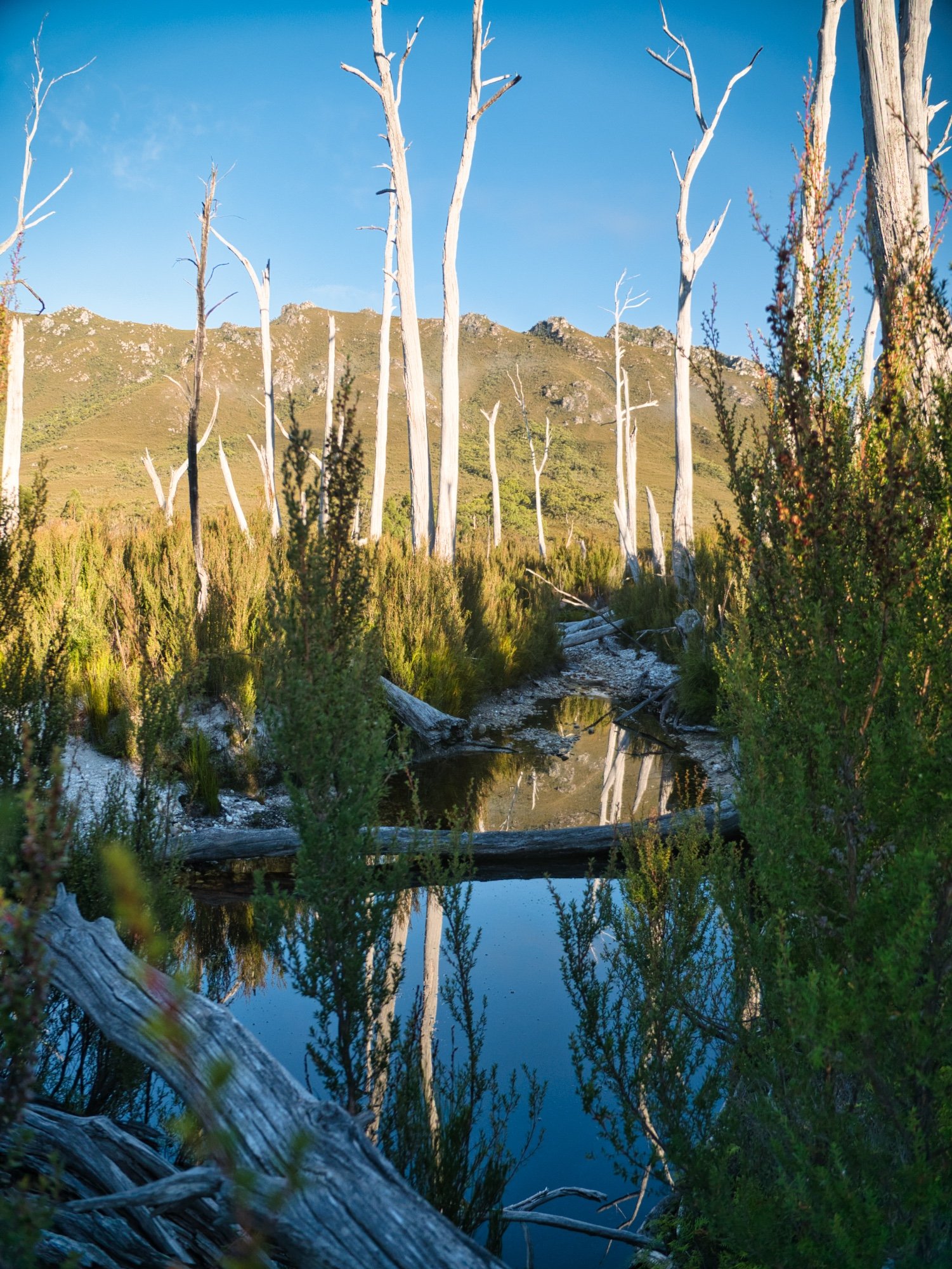
The scrub low enough for us to see over now. Pokana Peak now shrouded by morning mist in the distance.
With the advantage of light, we were quickly back on our original route and ducking and weaving through the more open forest. The other thing we now had were views below. As much as changing our route on the fly hadn’t really been the biggest success thus far, we agreed to push straight down the button grass ridge in front of us (a slight deviation from our route up) until we reached the creek. We would then cross it onto the lower button grass plains that would lead us onto the flat plains and onwards home. I dug out my compass and took a bearing of the trees we needed to reach so as to not take us off course.
Walking, tripping, bum sliding, weaving, sliding and occasionally falling over, we reached the creek below. Oh how good fresh, cool water is when you find it. We drank and drank, then like camels filled the water vessels on our backs. Back out into the button grass we pushed and finally, after another two hours of walking, we stood in the open button grass plain that would lead us back to our tents.

Simon summing up how we were all feeling at this stage!

What we really thought! ;-) Seriously, it’s a sign of respect for one tough mother of a mountain.
Looking back up at Pokana Peak, we were in total agreement that we would never climb it from this direction again, nor recommend anyone attempt the same! Pushing out much further east into the plains on our return journey we were rewarded with easier walking for the death-march back to camp. When our tents finally came into view across the shoreline it was happy dance time! Hugs all round - we had done it!
Boiling up coffee and scoffing down food we recounted our journey, compared war wounds and limped around camp in a tired but ultimately satisfied daze. A real adventure had been had! But there would be no time to rest, for it was time to pack up the camp, reload the kayaks and head home. Several hours behind schedule too!
Paddling back across Lake Gordon, as Pokana Peak disappeared behind us, a little part of me was wondering if one day we could go back and try our original route, just to see the difference. Then I slapped myself in the face for considering such insanity and continued paddling!

Nearly back to camp!

Back on sandy soil! 📸 Simon Kendrick

Homeward bound - well an hour’s kayak and six hours of driving to both ends of the state anyway! And of course a stop for pizza first!
The Stats.
Distance: Approximately 20km return.
Time taken: 21 hours of walking and 6 hours of bivvying!
Difficulty: Very difficult! Regardless of the route taken to Pokana Peak, this area is very remote, very challenging and very much only for experienced and well prepared bushwalkers.
Type of track: Completely off-track.
Access from: The end of Clear Hill Road, then by kayak.

The Map.
Route to Pokana Peak from Pokana Bay