Rats Castle
Date: 4th October 2019 - Summit: 1393m

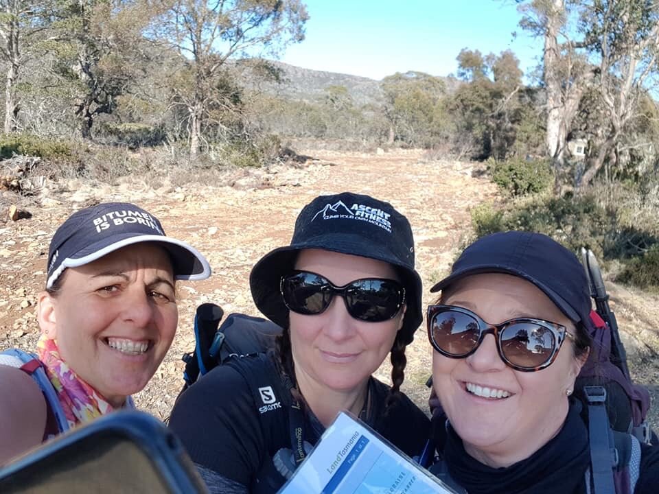
Lynnda pretty happy with the view!
It was time for another all-girl Abel bagging trip. I drafted two of my close hiking buddies, Natty and Lynnda in for the journey. I gave them fair warning that we would not be using the route as described in the Abels book but a shorter, more direct but completely untracked route I had devised. They blindly placed their trust in me and it paid off with a successful summit.
Proof of life shot!
I had marked out a rough route and bearings a few days prior and shared the map with the girls. We knew we would face some degree of “bush-bashing”, some scree and some marsh. Most hikers that have climbed Rats Castle talk with disdain about two things – endless scree and dense bush. The "usual" route follows an old fence line traveling almost directly west until the summit ridge line is hit, and then requires an almost full traverse of the ridgleline to reach the summit trig at the opposite end!
From all accounts its somewhat arduous and a bit tedious. Interestingly enough in most of the blogs I read hikers follow the Abels book instructions to the summit and then just b-line it back to the car instead of retracing their route up. I had decided when I tackled this Abel to just b-line it for the summit and cut out a whole lot of excess and relatively pointless ridgeline walking and some of the larger scree fields.
Close study of some satellite photos showed scattered small and dry creek beds throughout the scrub. The presence of these underlying creek beds indicated that there would be pockets of less dense vegetation. The plan was to latch onto some of these creek beds and chose less densely vegetated areas to cut direct to the summit, avoiding the long ridgeline walk.
We left Launceston early and the hardest part of navigating all day was the drive to Brandum! Whilst I am more than a fair hand with a map and compass, I am useless with locating Westbury! We mused that for all future trips Natty’s husband Haydyn would be in charge of pre-programming the sat nav on the Mazda!

Getting our bearings before setting off.

Natty all smiles for the day.
We parked the car at Middle Brandum Crescent which is just before the bridge off the Highland Lakes Road. We had initially thought a small area right next to Middle Brandum Crescent might give us access to cross the creek. After a few minutes exploring we decided rather than bush-bash we would cross the creek via the bridge. Whilst the creek wasn’t particularly flooded it would have wet our feet and legs early on and we preferred a dry crossing. Lynnda took a bearing of the visible summit of Rats Castle from our carpark and would hold that bearing. We would use my compass and pre-set map bearings throughout the day to ensure we were on-track when the summit disappeared from view.

Heading for the scrub!

Easily negotiated scrub. Not too dense at all.
After crossing the creek via the bridge (guard rail on our RHS while we were on the verge) we dropped down into the bush. The initial part of the hike through this scrub was very easy as we looked for animal pads and naturally low areas of vegetation. The sun was shining and we knew we were in for a clear but especially warm day compared to recent weather standards!
It was very nearly a blessing to hit the first of two sections of thicker scrub as the sun was quite intense and the scrub offered some degree of shade. The bush whilst head high in some spots wasn’t too difficult to push through, or climb over as it was old, dry and not incredibly dense. We kept the old creeks beds under the scrub in sight as that enabled us to select areas of easier walking. At this stage we were following our map and compass bearings as the summit was no longer visible. Lynnda and Natty were both in short sleeves indicating that even though we were surrounded by untracked bush it wasn’t difficult.


The small sections of semi-dense scrub opened intermittently to low lying alpine vegetation and keeping our bearings we chose the paths of least resistance. Glimpses of the summit would reappear at times.
We reached the section of marsh we had marked on our map and took a bearing for the small scree field that lay at the base of, and almost directly beneath the summit. We decided to head to this small field and then make a call on whether to summit via a small gully or continue directly to the summit via the face of the mountain.

The only descent sized scree field we would tackle for the day.

The rock giving way to vegetation again.
This small scree field then steered us to a larger scree field, the only one we would have to tackle during the day. It bought us to within a kilometre of the summit trig. It is interesting to note the scree in this larger scree field seems to have formed almost in waves. We were all curious as to why this is? Could it be to do with the ground beneath or impacts from severe weather events.
We resolved to use a visible green belt to bring us up onto the summit plateau. This was the steepest part of the day so far. The elevation was increasing noticeably but it was easy climbing and offered small pockets of shade.


Once on the plateau we noticed a few scattered cairns. These cairns are the end point of the Abels book route that starts from the car and ascends to the northern end of the ridgeline. It then traverses the length of the ridgeline until the southern most tip before the trig is reached. We were glad we had taken a shorter more direct route and not had to traverse the entire ridgeline or endless scree to the north. The minor amount of scrub walking was far easier and shorter.
With the trig in sight and the wind increasing we continued on. The breeze was very welcome as we were all feeling a little heat affected! The Rats Castle ridgeline is made up of a continuous series of up and down rocky, protruding sections to be navigated and skirted or climbed over. Thankfully as we had come up almost directly below the summit we had avoided most of this rollercoaster of ridge.

Three very happy ladies!

Summit selfie.
It was then time to touch the trig, take a few selfies and enjoy lunch in the sun. Perched up high it was a little sad to see how much of the area to our west and south west had been burnt by the recent fires.


We discussed our return route from the summit as we had a birdseye view straight back to the car. We determined our return route would be almost identical to our summit route but we would veer off to the North slightly upon reaching the marsh as I wanted to see the fence line that is pictured in the Abels book. The fence line would be a good option for those that aren’t comfortable with navigating as it is an obvious point of reference and surrounded by scree on both sides. We enjoyed seeing the fenceline but agreed that we preferred our route to the summit over the alternative longer route.
With only a couple of hundred meters left to the car we had an option to cross the creek at the bridge (as we had on the way in) or to explore the bush to the south of where our car was parked. We chose the option to explore and can highly recommend taking the bridge crossing instead!
Whilst we were giggling and enjoying the added challenge of head high dense bush that required our full body weight to push through, others may not! That said in reality it was only a five minute push through and we hit the gravel road back to the car.
Our first port of call before the long drive home was the great Lake Hotel for a cold beer and some of the best hot chips you will find! Huge big thanks to Natty and Lynnda for keeping me company!

A well earned drink!
The stats.
Time taken: Under 5 hrs total including rest breaks, navigation and lots of photos!
Difficulty: With the ability to follow a map and use a compass this shorter route is relatively easy from both a terrain and navigation point of view.
Type of track: Completely untracked.
Access from: Highland Lakes Road.

The route taken to Rats Castle. Note our route differs from the Abels route.