Snowy North
Date: 27th June 2020 – Summit: 1262m

Having climbed Snowy South the week prior, we were keen to visit its northern partner. Snowy North has a reputation for making hikers work for its summit. Throw in more than a little snow on the day and it was unquestionably a worthy adversary. For all the difficulty that snow added to the climb, it made up for it with winter wonderland views and a sweeter touch of the trig point when our frozen hands finally grasped it!
🌅 Big thanks to Bender and Ben Y for the photos. 🌅

Looking back from the Trig point to the snow covered plateau below.
It would be irresponsible not to mention that only experienced hikers and those confident in off track walking and navigation should use this route. Although we undertook this hike in winter, we would not recommend it unless you are confdent in winter hiking and pay close attention to weather conditions. The saddle and summit plateau area are extremely exposed to changing weather and snow covering the alpine vegetation makes the final few kilometers across the plateau and up to the summit physically challenging.
Why not watch & read?
Please enjoy a visual trip to Snowy North in addition to the blog. Whilst the blog gives you greater detail on the trip (including route information) the video allows those that may never reach its summit a virtual experience.
A fellow Abel-bagger Matt generously gave me some hints and tips on where he had started his ascent of Snowy North, and another Abel-bagging friend Chris sent us his GPX file from his summit a few weeks’ prior. As it turned out, the GPX file wasn't particularly accurate in sections due to drift so we did "wing-it" a little. Our Snowy North adventure started with us heading southwards late on a Friday night after work, with plans to sleep in the car and set off very early on the Saturday.

The Mazda parked up at the junction of Waterfall Creek Road and Ted Ransleys Road.
Our loose plan was to make it as far down Waterfall Creek Road as was possible to save a little road walking. The roads were an unknown quantity to us, but we did know that South Styx Road was boom gated much further back than Waterfall Creek Road, hence choosing the latter to bring us as close as possible to the track proper. Using Avenza Maps to track our location on the web of old logging roads, we navigated the boggy, bumpy and very second grade track as far as the junction to Ted Ransleys Road before a “Road Closed” sign had us parking and setting up camp for the night. We had organised to meet with fellow hiking friends Ben Y and Cathy at 7am the next morning.

Heading off along Waterfall Creek Road on foot past the land slip area.
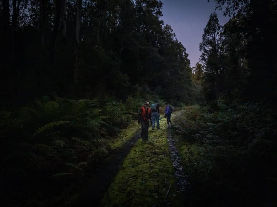
A dark and cold start at 7:15am saw head torches in use for the first kilometre or so.

The junction to turn to our east off Waterfall Road onto the more minor road.
It was surprisingly dark when we set off along Waterfall Creek Road at around 7:15am the next morning. So dark, in fact, that we still needed head torches. The morning was crisp, cold and clear. Perfect. Following the road along we were looking for the first major left that would send us in an east-nor-easterly direction, before eventually taking another right hand fork and heading south-westerly to the start of the unofficial ‘trail head’. My Garmin InReach had decided for some reason it didn't like Chris' GPX file and wouldn't load it and so we were relying on Bender’s InReach, Avenza Maps and Ben Y's paper copy of the map to navigate the forestry roads. As the roads climbed higher, we were getting the glimpses of sunlight through the trees.

Forest debris across the road.

The incline increasing and the road becoming more littered.

A waterfall cascading down the side of the forestry road. No shortage of water today.

The last section of road just prior to the track commencement.
The almost 2km of forestry road was possibly driveable in some spots and most definitely undriveable in others, so we had made the right decision to park up before the collapsed road section. It also allowed us to warm our legs before the known steep climb of Snowy North.

The rock cairn indicating the start of the track proper.
Tape indicating the entry to the scrub.

The initial, obvious path.
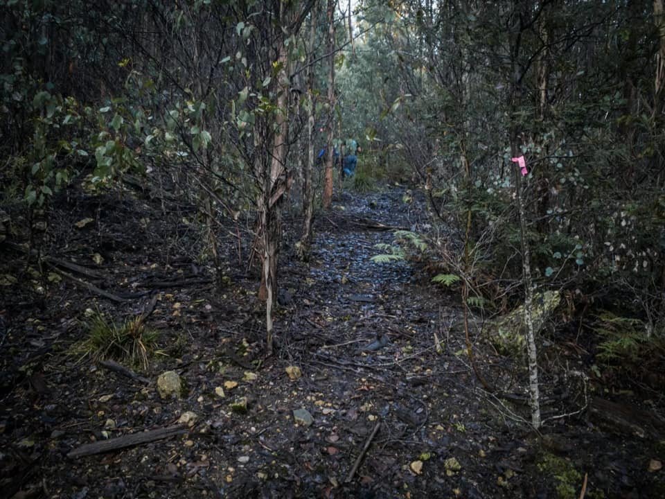
The commencement of the track proper was obvious due to the large cairn and pink ribbon marking its junction. Leading into the scrub was an initially spacious and well padded track. It climbed only very gently for the first hundred metres or so before the scrub encroached on the track. After mere minutes the track then disappeared from view, and here a glance through the scrub to our right revealed the tree stump with a cairn that indicates its time to officially head bush!

Climbing one of the many short pinchy sections.
Sporadic tape led the way through the forest.

Giant eucalyptus trees and green lichen combined for a fairy tale forest.

The elevation increasing consistently.
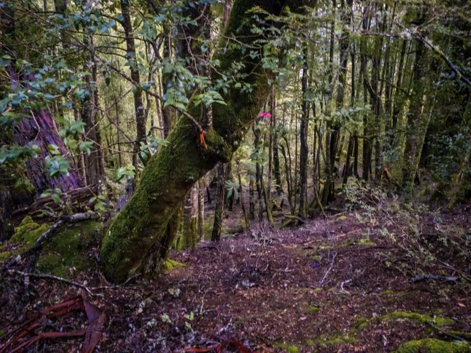
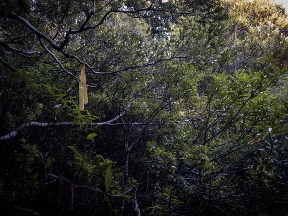
The climb consistently increased in elevation - and occasionally very steep -but short-lived sections would require us to use hand holds to pull us up the damp muddy ground, or over loamy soil. The track was non-existent but rueben tape of varying colours assisted with navigation. There was enough tape but not an abundance of it, and so it was a constant search for the next piece.
The elevation increasing consistently.
Lichen and moss covered every available surface.

Short sections of very steep terrain required more climbing than hiking.
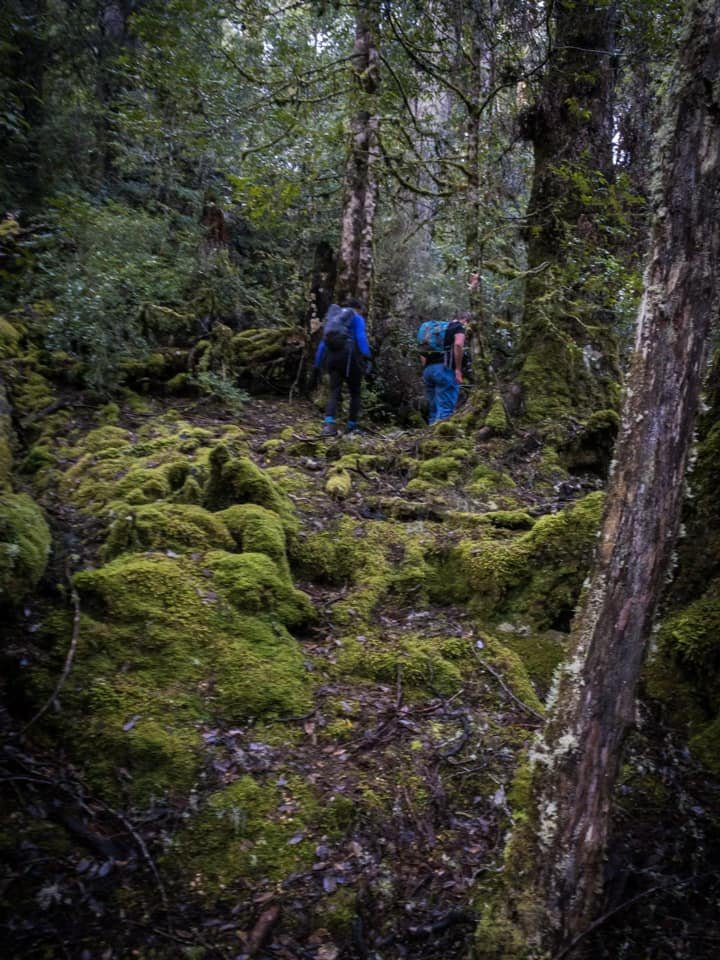
Mosses and lichen covered almost every surface like fine, textured green blankets, but made for slippery going. The elevation pinches kept us working as we climbed higher through the forest of ferns, myrtle and fagus. Mounting a diminutive hill within the forest, we popped up to see our first pandani. It would be the first but certainly not the last. Our world was soon to become nothing but towering pandani!

Our first glimpse of beautiful pandani.

The initial glimpse of Snowy North’s northern rim.

Cathy entering the forest with some of the tallest pandani we have seen.

Entering the field of giant, almost impenetrable pandanis.

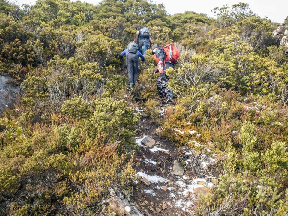
Time to fight the scrub.
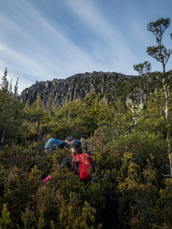
The ribbon led through a splendid green pandani field mixed with fagus and celery top pine. The pandani were waist to head height, lush and dense enough to ensure we were weaving through them but not so dense that we were scrub bashing. The forest floor was almost entirely covered from view by the vegetation but we carefully picked our way along stepping over logs and rocks hidden beneath the foliage. It was here we got the earliest glimpse of our mountains snow-dusted top. Cathy was growing apprehensive about how much snow might be up there whilst I was excited. Snow increases the challenges but also the rewards.
The ribbons led us through the lower pandani and into an open almost amphitheatre like arena. Broken forest litter lay on the floor and sky high pandanis towered above us. It was marvellous. Ahead of us a profuse pandani forest led up the spur towards the saddle we needed to enter. Profuse is actually an understatement. Impenetrable is a better descriptive. It was also here that the ribbon became non existent. Pfft.... gone! After wandering the clearing and searching for the next tape marker to no avail we had three choices. One, follow the GPX file which seemed to be leading us off to the right and in the wrong direction. Two, go straight up the centre and head towards where we should cross path with the GPX higher up or three, head upwards and keep left towards the creek bad that we had loosely been following. The group consensus was to go straight up the middle. I wanted to go due left till we hit the creek and use that as a "track" but followed behind the others.

Fighting the alpine vegetation after finally breaking free from the dense pandanis.
Glimpsing the northern end of the snowy range.
Pushing through the tall, dense pandanis was arduous work. The pitch of the forest floor was steep and slippery and we were all having to use considerable force to make any headway. Finally through the dense panadani field and we were in head high alpine scrub. Tripping, falling, pushing, cursing! At this stage Bender reassured me that in about 80 more metres we should cross the GPX path. I was over scrub bashing and announced - after some very unlady-like language - that I was heading to the creek and if the others wanted to bush-bash I would see them at the top. I made a bee-line for the creek bed on my map. A few minutes later wouldn't you know it I was back on track and excitedly staring at pink ribbon heading up an open, dried creek bed!

The obvious creek bed track making easy work of the climb upwards.
Rock trail and more rueben tape indicating we were back on track.

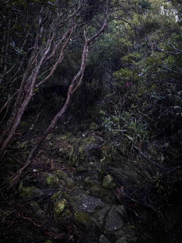
The track overgrown with scrub in large sections.
We had lost at least 30-40 minutes pushing through the scrub and pandani forest but were now back on track and making better time. My tip to all those following in our footsteps is to spend some time looking for the track whilst in the amphitheatre- like pandani forest. Look to the LEFT (East) and up the mossy bank and you will see hidden pieces of pink tape that are behind dense scrub and logs. Climb through to the next piece of ribbon and you will find the correct track. Do not do as we did unless you want to waste both time and energy! The obvious creek bed track winds steeply but easily up towards the Pluto Bluff and Snowy North Saddle. The real fun was about to begin.
There is a track in there we promise!

Our first glimpse behind us of Mt Field across to the north.
Ice and snow beginning to appear.
Snowy North’s notorious steep ascent begins.
The vegetation again covered over the track and the ribbons were sparse, but are there when you look for them. Looking through the vegetation towards the trodden ground and other faint signs of a pad assisted us with staying on track where the ribbons were missing and we started the ridge climb in earnest. Steep, slippery and did I mention steep? Most of the climb towards the saddle was done by way of hanging onto whatever tree root we could grip and pulling ourselves upwards. The ground was slippery, boggy and sprinkled with snow in places, but we had our first views behind us of snow covered Mt. Mueller and the Mount Field Range.

Continuing the ridge climb towards the Pluto and Snowy North Saddle.

Looking back down at the scrub we had been pushing through for the last few hours.

Winter starting to appear by the way of frosted plants.

Reaching the icy, snow-covered rocks just below the saddle.

Looking back at the opening in the rim we used to enter the saddle.
As we climbed higher still, the path narrowed and shifted from mud and scrub to snow and ice-covered rock. Not enough snow to make it easy going, alas, but just enough to make it a little precarious. Cathy was starting to feel uncomfortable at this stage as she hadn't planned on snow. Ben was trying to reassure her it wouldn't get any worse and I stayed quiet as I was pretty sure there would be plenty more covering up top! Bender and I had even packed Microspikes, just in case.

Cresting the rim to a frosting of white.

Picking the easiest path towards the top of the rim.

On the plateau making our way across the saddle in a south-easterly direction.
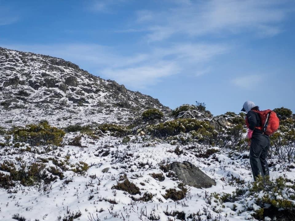
It was with some relief that we then stepped out onto the saddle. The elevation over the preceding few hours had been seriously steep, and it was relief to know that for at least a little, while we would be passing over flatter terrain. On entering the saddle, cairns began to make an appearance and generally seemed to once again follow a minor creek bed - albeit one now mostly hidden under snow. In fact the entire flat expanse was covered in the white stuff - yay! I was so excited to see it - Cathy not so much. Having no gaiters or wet weathers, Cathy's boots were filling with snow and her socks and trousers were saturated. She was understandably concerned about being cold. A few minutes after we began walking across the plateau we stopped to put my gaiters on Cathy. I had wet weathers on too, so gaiters were just being plain greedy when Cathy had nothing. Alas, it wasn't enough to make her feel that she could continue on and she decided to turn back. I must mention here that whilst I don't feel comfortable splitting a group, Cathy is an adult and can make her own choices. Making sure she had a PLB on her, we set off confident she could follow our footsteps back off the ridge into less inclement weather.

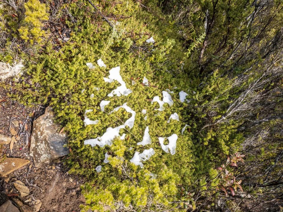
Snow covering all trails, animal pads and vegetation.

The snow getting thicker and deeper as we continued across the plateau.

The last cairn we saw before changing direction for the summit.
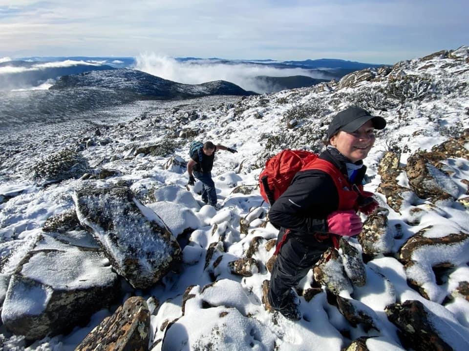
Bender, Ben Y and I continued on across the saddle following the occasional cairn and discussing the route we wanted to take to the summit. We noticed Chris' GPX file went well round the north eastern edge of the spur that lead to the ridge that would take us onto the summit. We had no visibility of the underfoot terrain ahead due to the generous snow covering on the ground. What we did know was that the snow hid scrub that when stepped upon gave way under our feet and instead of being able to pick a path it was a ‘lunge forward and fall through’ type action; tiring on the legs, not to mention a little risky when you don't know exactly what is under your feet! For this reason, we decided to take a shorter more direct route over the edge of the spur to save distance, time and energy.

Leaving the flatter plateau for a more direct route to the summit.

Looking towards Snowy Norths distant summit area.

Ben Y - The only man to hike in denim jeans and get away with it... well so far!
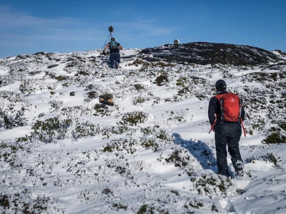
Once on higher ground we could gaze across to the summit area. Reaching it would involve dropping back down to the flatter ground below us, before once again climbing upwards. From this vantage point we could see snow now hid all the tracks, animal pads, and creek beds which made selecting a path forward difficult. Our game of Russian roulette commenced. Sometimes we would step on top of scrub only for it to hide rocks below. Or step onto what looked like a rock to find out it was a hole! Another few inches of snow would have made the going easier but alas that wasn't what the mountain had in store for us today. But hey - if it was easy everyone would be doing it!

Snow makes for hard-going at times, but more scenic walking.

Finally, the summit area is within our grasp - but very deep snow in sections made the going tough.

Arms out, lets do the snow plant dance. Step, fall. Step, fall. Step, fall. Repeat 😂
Blue skies and a trig point somewhere in the distance!
We were well behind on the time we wanted to be on the summit, given our snow hindered progress. Our turn back time was 12:30pm and we would be pushing hard to get there in the conditions of the day. None of us wanted a "half sucked lolly" and so it was time to dig deep and just get it done. Sinking, tripping, slipping and cursing we edged closer to the final summit rise. Ben Y was still in a t-shirt with no gloves on and Bender and I were fretting about hypothermia setting in so we kept at him until he at least put gloves on! (Note: Ben Y hikes in denim jeans - and has done for a long time - but we want to point out that the average punter would end up freezing with heavy cold jeans on. It’s something we explicitly don't recommend!)

A shot showing the depth of snow we had traversed.

Ben Y and I studying which would be the least slippery way up the rocks.
Just prior to my fall from grace!
After what seemed like an eternity - of what ought to be described as single legged lunge walking - we arrived at the base of the final climb. You can see from the pictures, the snow and scrub was often up to my knees - even my thighs a few times. This made every giant step out of the heavy snow laden scrub feel like an Olympic effort. Only. A. Little. Bit. More! - became my mantra. At least this final climb had generous sized rocks to break up the incessant snow-covered scrub. Scaling a large rock covered in snow saw me slip down into a Tracey-sized hole which also unfortunately slammed my left hand into boulder, causing an instant shooting pain in my thumb as I sought to tug it out from under the rock. ‘She'll be right’ I thought as I couldn't feel my cold fingers and thumb anyway (Turns out it went an ugly shade of purple and became so bruised and swollen that it couldn't bend it for near on a week and three weeks later of persistent pain and an xray revealed I had fractured the thumb. The joys of Abel bagging!)
Ben Y sees the trig and he is off!
Finally though, the summit was in sight! The trig point coming into view was a glorious thing! It had taken us just shy of five hours, which was a lot longer than we had anticipated. How sweet it was to touch the frozen trig, stop for a moment and enjoy some hot coffee. The sun was shining, but the wind was chilly. Mother Nature put on a fog-bow for us - to those that don't know, it’s a rainbow of fog! We could glimpse snowy covered mountains in every view to the distance. It was like a slide show. For a few minutes we could see Mt. Anne. The mist would cover it and instead open views to Mt. Mueller and so on.

Victory is ours. The summit of Snowy North.
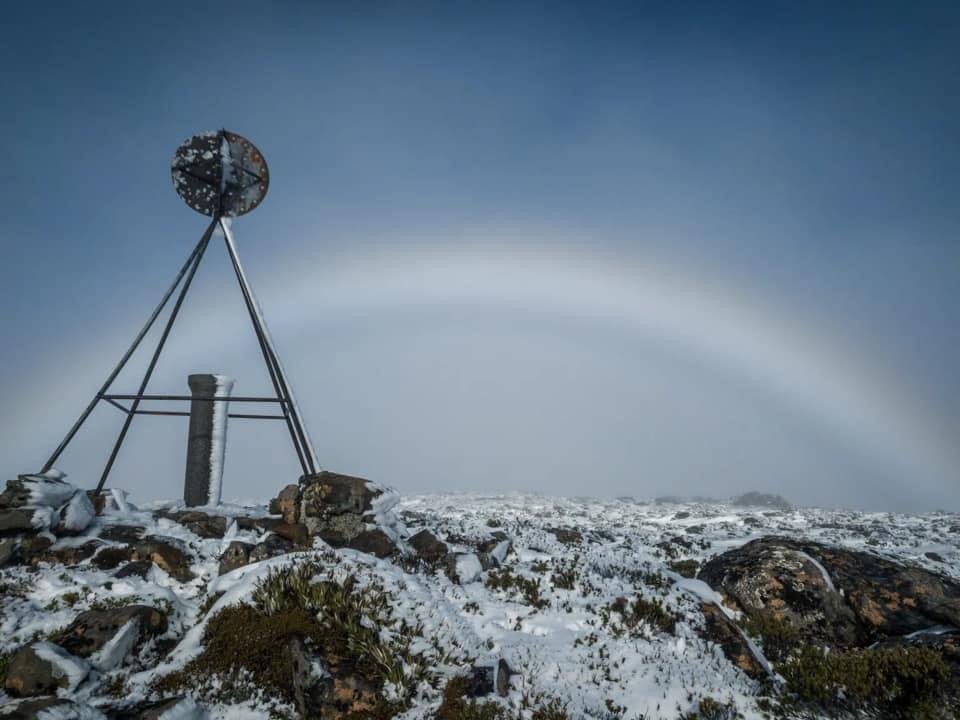
Limited views but a special fog-bow to make up for the lack of views.

Mist and snow combine with sunlight to give us the best of winter beauty.
After a quick lunch it was time to start the long-lunge home! None of us were enthusiastic about the return traverse through the snow and decided we would go down to the flatter terrain at the base of the summit, sidle back round towards the Pluto-Snowy North saddle and avoid making it harder than it would already be. I was happy to lead us back and set off into the now-misty abyss below us.

Time to head home.

Mist rolling in on our return journey.
The return journey across the snowy plateau was a little faster as we had gravity on our side for sections of it. It was still hard going, but we managed to take a great line for the most of it. Never gaining or losing too much elevation and keeping to a north-easterly bearing until we were almost back at the saddle. In fact we went a few metres too far as we were all enjoying the summit high and chatting. Once almost at the saddle we changed course and headed back towards the rim that we use to exit down off the range, and were back on course.

Reaching the slight drop towards the rim off the saddle.
The mist had settled now taking our views with it. Even without using my Garmin‘s TrakBack function I was able to easily navigate us back to the rim using the landmarks we had passed on the way up. I love winter hiking, but do think it extra important to memorise useful landmarks for the return journey. I'm always scouting high, low, far and near for memory markers. Soon enough cairns came back into sight as well as the frozen creek bed (which could have had a path underneath it for all we knew). We wondered whether Cathy had waited for us lower down out of the elements, or returned to the car.

Back in the scrub and glad we had enjoyed views on the way up as they had all but disappeared now.

Briefly enjoying the short break in the vegetation, before we would reenter the dense bush for the rest of the journey homewards.
Dropping back down off the snowy saddle to the steep scrubby decline we began the descent. Poor Ben Y's legs were cramping up and so our descent was a little slower, but it was fun literally bum sliding down the muddy sections. The three of us were eager to follow the ribboned creek bed back to where we had lost the route earlier. Curiosity was nagging at us!

Crossing the creek and following the tape down.
Not surprisingly the correct route followed the creek bed down and led us through open myrtle forest. Much nicer than bush bashing through the dense pandanis and alpine scrub! Just after crossing the creek the ribbon led into a very small section of dense pandani after which we popped out into the amphitheater area where we had gone off track earlier. We now know that if we had looked deep left into the scrub a tiny pink ribbon up high would have led us to the hidden creek bed/path and saved us a good 30 minutes or so of scrub bashing.

The last pandani patch of the days walk.
Eager now for hot chips at Maydena we made short work of the final forested section and soon stepped out onto the road. A few minutes down the road and we met up with Cathy who had arrived there just prior to us. A successful day out it was time to head to the car and reminisce about the days adventures... oh and plan the next days climb of Mt. Wedge.
The stats.
Distance: Approximately 16km out-and-back.
Time taken: About 6.5 hours moving time. 8.5 hours total with numerous stops and proceeding slower than normal due to snow cover.
Difficulty: Difficult. Steep, off-track walking through often thick vegetation.
Type of track: Mostly off-track with the odd faint pad, and minimally marked with tape. Only experienced walkers should proceed along the route from the north that we used.
Access from: Access off South Styx Road, Waterfall Creek Road or Ted Ransley Road to reach the collapsed section of road after which you need to proceed on foot. We used Waterfall Valley Road.

The Map.
Route taken to Snowy North. Note the differing routes south-west of Pluto Bluff - the eastern-most route is the correct one. Also note Strava's map shows the summit waaaay off the actual high point. This is so frustratingly common with digital topo maps these days.