Twin Spires
Date: 8th March 2020 – Summit: 1406m
📸 Ben Wells

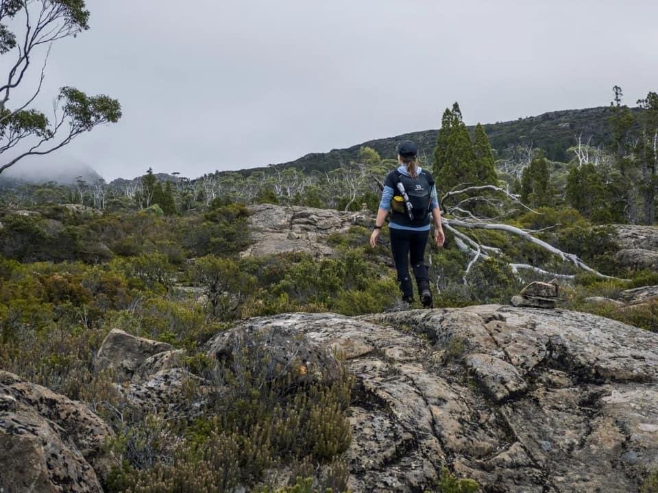
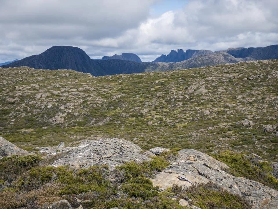
The mountains of The Overland Track rising majestically out in front.
It was whilst wandering The Overland Track that I first glimpsed Twin Spires and thought "one day my pretty, one day". Well that day had arrived. It had arrived by way of a three-day long weekend with ambitions of summiting not only Twin Spires, but also Mountains Of Jupiter. The day before we had conquered Mountains of Jupiter as a long day walk from Chapter Lake, but alas I had the misfortune of coming off second best to a wasp nest. A sore, itchy and swollen right leg (compliments of seven wasp stings), a gloomy, overcast and misty morning and the threat of a semi-flooded creek crossing had me less than enthusiastic to even bother hiking to Twin Spires. Five minutes after leaving camp the negativity was replaced with wonder as we traveled through the Walls Of Jerusalem National Park past cascading waterfalls, frog filled tarns, mystical lakes and ancient forests. Bliss!

Why not watch & read?
Please enjoy a visual trip to Twin Spires in addition to the blog below. Whilst the blog gives you greater detail on the trip (including route information) the video allows those that may never reach its summit a virtual experience.
After a long day hike to Mountains of Jupiter a day prior, we were both happy to hit snooze on the alarm when it sounded at 6:30am and consequently broke our normally very strict early start rule - again! Setting off around 8:30am from our camping spot at Chapter Lake, we began following the pink ribbons that continued down the Moses Creek Track through the forest on the eastern side of the lake. Prior research indicated that there are many false leads to cross the stream to Grail Falls. I headed down one pink taped trail, whilst Ben headed up another. Ben's trail led to a substantial cairn indicating an ideal crossing point where a large rock and a few strategically placed tree limbs made crossing easy. Just after crossing the stream another smaller cairn gave us confidence we were in the correct area and after not more than a few steps we were standing below Grail Falls.
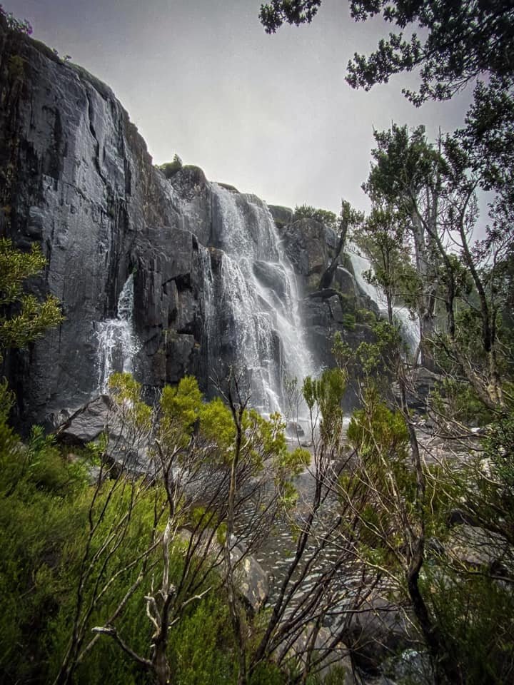
Grail Falls. Recent rain meant the Falls were in full show.

Grail Falls.
Crossing the outlet to Grail Falls.

The trail leading up the southern side of Grail Falls.
The steep climb up alongside Grail Falls.
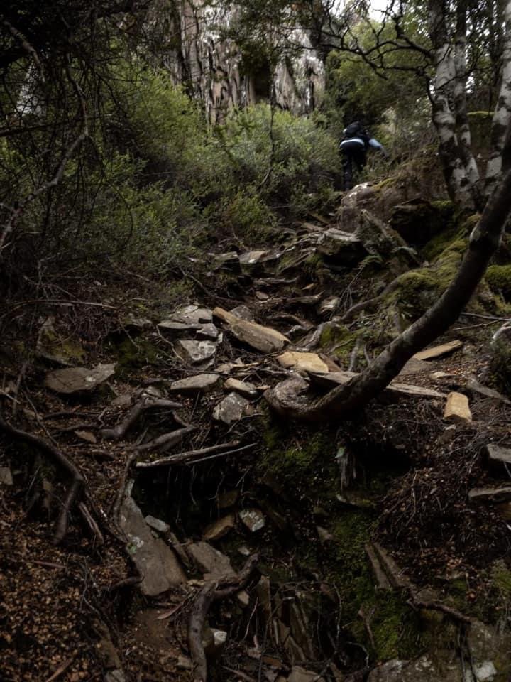
After stopping to admire Grail Falls - which were delightfully full, fast flowing and noisy as a result of recent rains in the area - we followed the cairns along the well padded track on the southern side of the falls. The track climbed gently initially through myrtle forest but as we sidled around some large cliff faces within the forest, the track began to climb very steeply upwards beside the falls. Padded forest floor gave way to rocky, rooted terrain and at times was so steep that we were climbing more than hiking, using roots and nearby rocks to pull us up. We both commented that this would not be easy in the wet and/or with large packs on and we were glad we were only wearing day packs.
Smooth dolerite boulders that need climbing to reach the top of Grail Falls.

Standing above Grail Falls, with Chapter Lake to the north and east.
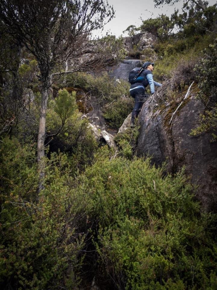
Continuing up the southern side of Grail Falls, the track climbed steeper still and as we neared the small dolerite outcrop above the falls, there were definitely a few sections that required more concentration and effort than others due to steep and somewhat slippery rock sections. Once again, we were glad not to be hauling our big packs up. Standing on the boulder outcrop above Grail Falls, we enjoyed views of the northern side of Chapter Lake as well as Clumner Bluff and Western Bluff.

Following the cairned trail over the rocky outcrops.

Small scrub sections break up the rocks.

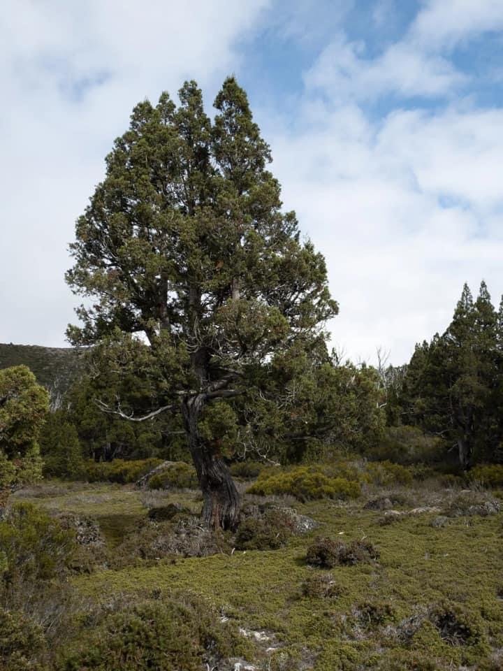
Looking back down towards Grail Falls, Pencil Pines and Fagus edge the creek.

The track winding closely along the cliff edges at times.

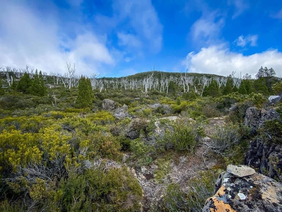
Pockets of dense scrub hiding the track. Clumner and Western Bluffs can be seen just below the cloud.
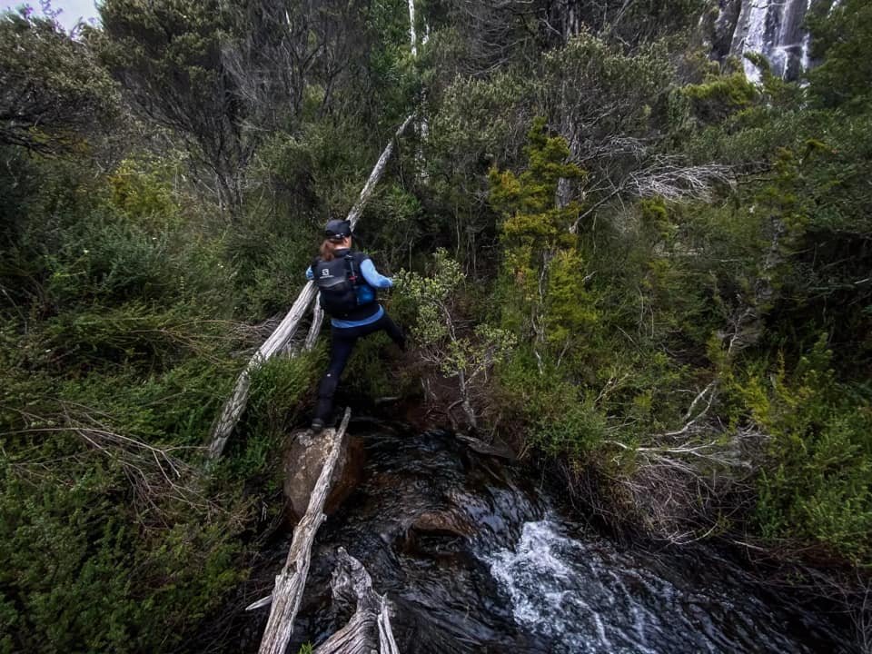
From here cairns led the way along the eastern side of Moses Creek across rocky outcrops occasionally interspersed with short scrubby sections. Ever so slightly undulating up and down the whole way. The creek was lined on both sides with spectacular pencil pines and fagus. We were high above the stream and knew before we could cross to begin our journey towards the northern end of Chalice Lake, the track would need to drop back down to creek level. I was mindful to not miss the crossing point. The track we were on would continue on well past the crossing point but any attempt to cross upstream at the wrong section of track would result in deeper water and dense scrub! Our big tip: Look for the cairn on the opposite side of the stream indicating the ideal section to cross the stream.

The location to cross from the eastern side of the stream to the western side.

Looking back towards the track on the eastern side of the creek.

From the eastern side of the creek look for this large cairn on the opposite side to indicate you are at the correct crossing point.

Ben being a gentleman and carrying my boots over the creek.
Less than 900m from the rock slab at the top of Grail Falls and we located the crossing point. There was a small cairn present off to the right of the track which is easy to miss in the scrub. Instead, look out for the large cairn on the opposite side of the creek up on the river bank. (See the photo above). The creek was in full flood, flowing quite fast and what would normally be an easy, dry feet-kinda crossing was definitely going to involve wet feet today! I do not love fast flowing creek crossings and was feeling a tad fragile already after the previous day's antics, and so took one look at the creek and said to Ben "Let's just come back another day!" Ben wasn't having a bar of that, and promptly sized up the best way across! I had carried along my new wetsuit booties/camp shoes and whilst I was taking off my boots, Ben checked out the water flow, professed it was safe, hoisted my boots around his neck and poles at the ready, began to wade across. The crossing was composed of two sections. A main section studded with boulders that we could step between whilst using our poles to steady us against the current. Once on the largest rock in the stream we could then step onto the western side of Moses Creek. Ben went in boots and all, moving fast to limit any water ingress. My turn next - big girl pants on, I entered the stream and was soon on the other side. Yay!

Using the cairns to lead us towards Chalice Lake.

Moses Creek on our left as we head to Chalice Lake.

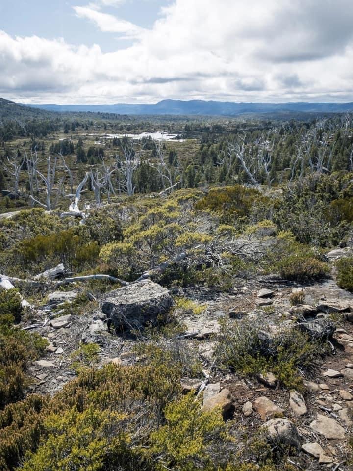
One of the many small tarns we would pass during the days hike. Note the low mist still hanging around our summit (top-right).
Booted up again, we set off for Chalice Lake. The vegetation became much more open from here on in, and the track was ridiculously well-cairned. Almost too many cairns, I suspect - a little cairn art has been in play. It was a simple matter of rock hoping over the outcrops of dolerite which were broken up with alpine vegetation. We still had mist ahead covering any view we may have had at this stage of Twin Spires but as usual I was optimistic for a sunny, clear summit. We had been shadowing the stream towards Chalice Lake in a south-south-west direction but on reaching the northern end of the lake we changed bearing and followed the cairns heading north-westerly.

The obvious pad leading through the low alpine scrub.

Another small stream crossing.

The trail leading up and away from the lake briefly to ascend and then descend a small hill.
The obvious pad and well-cairned route led us continually over rocky outcrops, through small patches of low vegetation and over a number of minor creek crossings. Access to water certainly wasn't going to be an issue for us today! As the mist high on the mountains drifted in and out we began to have occasional glimpses of our goal. It was very easy and pleasant walking along the lake. We noted the lack of camp sites around Chalice Lake, unless you were happy to pitch your tent on rock or head well away from the lake towards the scrub to locate a camp site! This was the opposite of what we had been informed by several sources, curiously enough, who rated Chalice Lake preferable to Chapter Lake for camping.
Our goal for the day misted over in the distance and we headed towards Tent Tarn.

One of the many, many, many, many cairns!

Another small stream crossing on the northern side of Chalice Lake.

Tent Tarn.
Chalice Lake is a surprisingly large lake beautifully adorned with fagus and housing numerous miniature islands. Weaving along the path we continued to wander in and out of rocky outcrops, tiny creek crossings and patches of snow gums before reaching the open area approaching Tent Tarn.
The coral fern and a lone Pencil Pine towards the western edge of Tent Tarn.

The ridgeline to Cathedral Mountain and Twin Spires now visible as the mist had began to lift.
Led now by a well-formed pad we began to head in the direction of Tent Tarn and the ridge behind it that we would follow towards Twin Spires/Cathedral Mountain. It was here that we met a fellow hiker returning after camping on the summit. Hi Stephen! He had waited at the summit as long as possible for the mist to lift but with no luck. Now down at Tent Tarn of course it had lifted! He mentioned that the track basically led all the way up to the Cathedral Mountain ridge and from that ridge we could continue on over to Cathedral Mountain or change direction and summit Twin Spires. Although we had originally planned on both summits, with my wasp-ravaged leg already swollen and aching we had agreed early on that if it was a choice between the two then the Abel of Twin Spires was our primary goal.
Heading back into the scrub from Tent Tarn on the way to the ridge.

Following the many cairns and looking back down towards Tent Tarn.
Climbing higher Tent Tarn now fully visible.

The gentle switchbacks taking the sting out of the steady elevation gain up onto the ridgeline.
The pad continued along until we were below the ridge. The sun was warm now and we were both a little low on energy after Mountains of Jupiter the day before, so were pleasantly surprised - and pleased - that the track wound gently upwards using switch backs! Cairns once again took the guess work out of how to reach the ridge plateau and with only a gentle climb we were able to relax and enjoy the views. Maybe we became too relaxed, as half way up the climb I tripped on some low lying scrub and landed heavily with my left (aka good) knee straight into a sharp rock. After a few minutes laying flat and letting the colour return to my face we lifted my leggings to see skin off, a large lump already forming and dark bruising immediately spreading around my knee. Dammit! I was cursing my clumsiness, but now I had two dodgy legs so at least they were even! After my fall I was even more glad of the gradual ascent!

Nearing the top of the ridgeline.

The only small scree field so far.
The track weaving in and out of scrub.

Nearing the junction point to head over to Cathedral Mountain or branch off to Twin Spires.
Bouncing between small smooth rock slabs, low lying scrub sections and patches of pineapple grass, we proceeded upwards reaching a minor area of scree. That lead us out onto a large rock slab behind which lay a beautiful green grassy area which would make a stunning camp site if one was prepared to trek a little for water. It was at this junction that we could choose to continue to follow the cairns over to Cathedral Mountain or veer north towards Twin Spires. Given I was now sporting two mildly useless legs, we headed directly for Twin Spires, not sure my legs would have the extra few kilometres in them for Cathedral Mountain too.

The views opening up to our west - Ossa, Pelion West. Pelion East and Barn Bluff lying on the horizon.

The high point of the ridgeline is marked with this squarish cornice. From here one can continue over the ridgeline to Cathedral Mountain, or veer north to Twin Spires.

The southern and northern Spires ahead and a party of walkers making their way back down.
Here, our elevated vantage point allowed for the spectacular views to our west to shine. WOW! We were mesmerised. I was hard to watch our footing, so distracted were we by the sights of mountains for days. The sun was high in the sky and our views were uninterrupted. Thank you weather gods! To make the most of the views and enjoy easier walking, we stuck to the high side of the plateau as we headed north. We didn't want to waste a second of the glorious vista afforded us. Skipping between rocky outcrops, low vegetation and the occasional pad we could clearly see Twin Spires ahead. We could also see another party of walkers descending from the summit.

Mount Ossa and Pelion West dominating the view, with Cathedral Mountain in the foreground.
Falling Mountain, Walled Mountain, Mt. Geryon.

Walkers descending the ridge in front of the southern spire.

The southern and more distant northern spire.
As we approached the final gentle climb towards the summit we passed multiple small tarns and neared the southern spire. I was very glad it was not the high point as to reach the cairn placed at its very tip one would need to be capable of rock climbing and very comfortable with serious exposure - I am neither! Not far from the base of the northern spire we stopped and chatted with the party of walkers we had seen from the distance. We enjoyed some time swapping mapping information and hearing about their hidden camp site. One to commit to memory!
A few minutes after passing the southern spire we summited its higher northern sister and had our hands on the summit cairn! We had admired the views afforded us on our hike in but had no idea just how amazing they would be from the summit. We could see Falling Mountain, Mt. Pillinger, Lees Paddocks, Kia Ora Hut, Barn Bluff, Cradle Mountain, Mt. Ossa, Pelion West, Pelion East, Mt. Gell to name just a few! After greedily enjoying the view there was nothing more to do but sit back and enjoy lunch on top of the world.

The view from south, to west, to north - mountains for days!
The stats.
Distance: Approx. 14km return from Chapter Lake.
Time taken: 6.5 hours including multiple breaks for photos, lunch on the summit and numerous stops to chat to other hikers.
Difficulty: The Abels book grades Twin Spires as "hard". If one was to complete it as a long day walk from Mersey Forest Road in summer with good conditions, we would classify it more as "medium". Bear in mind much of the route is over elevated and fairly exposed terrain however, with limited options to shelter from bad weather if not carrying a tent etc. We were camped at Chapter Lake and had fine weather (after a dreary start) and considered the hike relatively easy given the shortish distance and easy to follow track.
Type of track: Officially tracked to Tent Tarn, but cairned all the way through to the summit from Grail Falls.
Access from: Mersey Forest Road.

Route taken to Twin Spires from Chapter Lake (Tent Tarn Route).