Western Arthurs Day 1 & 2
Day 1 - 2
18th January 2021
Scotts Peak Dam to Lake Cygnus

The crew setting off on our WA adventure. Photo Credit: With thanks to Simon Kendrick
We knew Day 1 would be a long and tedious slog through mud. We also knew bad weather and strong winds had been predicted. But how bad could it really be? Well friends - it would be with more than a little relief that we arrived wet, cold and thoroughly exhausted into Lake Cygnus nine long hours after leaving the car. The Western Arthurs range is known for wildly unpredictable weather, with a mixed bag of roaring winds, cold temperatures and rain smacking you at a 45-degree angle. We were lucky - we got the whole mixed bag on Day 1. 'Welcome to my playground' said the Western Arthurs.

The flooded track. Photo Credit: With thanks to Simon Kendrick.
Why not watch & read?
Please enjoy a visual trip to The Western Arthurs in addition to the blog below. Whilst the blog gives you greater detail on the trip (including route information) the video allows those that may never reach its summit a virtual experience.
Let the torture begin.
Mud glorious mud. Wind glorious wind. Floods.
A friend and I would set off a day earlier than the rest of our Western Arthurs crew. The doomsday weather forecast wasn't worrying us as we set off, as we had all the safety and wet weather gear we needed. Bit of wind? Pfft, who cares. Bit of rain? Pfft, who cares. Been there, done that. I chuckle now, looking back on the nine-hour slog that was our Day 1 on the track... but in all seriousness, be prepared for horrendous weather on this trip.
We set off around 8:30am from the car. The air was misty but it wasn't raining or cold. Our game plan was to camp at Lake Fortuna for the night. After duly signing in our plans at the log book we set off. The initial part of the walk took us through delightful forest; lush, green and sheltered. The softly padded forest floor made up of fallen leaf debris cushioned the weight of our packs on our back - heavy with over a week's food - and we could barely contain our excitement.
The first thing you notice about Day 1 of the Western Arthurs is how many warning signs there are around. Multiple warning signs scream at you. First from the Walker Registration station, then a few steps along the track before the boot washing station another loud red sign reminds you of the dangers. Yet again, before leaving the canopy of the forest, a more direct sign nailed to a tree tells all who pass by that this is not a walk to be trifled with.
"Turn Back Now" it says if you are not prepared. Our advice to anyone wanting to compete a Western Arthurs traverse is to heed the warnings. Make sure you have not only the gear but the physical preparedness, experience and know how to stay safe in the Tasmanian Wilderness. It cannot be stressed enough - this this not a walk for inexperienced hikers.
Leaving the signs and shelter behind.
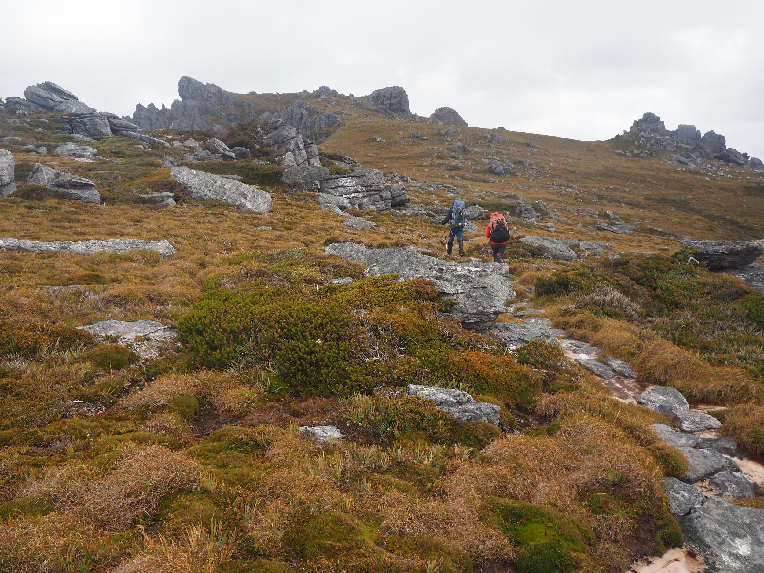
We had barely started to enjoy the lush forest when it ended and we stepped out onto a pad made of gravel surrounded by low-lying button grasses and vegetation. Occasionally, the rock and gravel path would be replaced by sections of boardwalk. From this point forward the track was more exposed to the weather.
Although the mist was damp it wasn't raining. The wind was relatively light and we both agreed that we would happily keep this weather rather than hot sun for the day's walking up the steep climb of Moraine A. We were making a good pace, even with frequent photo stops as the terrain was relatively flat, the path obvious and the walking easy. At this stage, there was not any of the notorious mud we had heard about... but then we were less than a few kilometres in.
Gradually, with each step the rocky, white gravel changed to board walk, then the board walk changed to old decaying board - and then that old decaying board to mud. Soooo much mud! I had worn shorts in preparation for the mud and water, so just waded straight through it all (this also stops braiding of the track). By now it was raining so the mud was washing off as quickly as we could coat our legs in it.
It was smelly, squelchy, thick and slippery - and sort of warm. Add to that the deep puddles and minor creeks that frequented the track and there was no way we were going to stay dry or clean today. Ordinarily by this stage of the journey to Moraine A, you would see the craggy and imposing outline of the Arthurs in the distance. Instead a white wall of mist blocked any view at all, with only a dark and foreboding shadow laying behind it.
More mud. More rain and now wind.
The mud, rain and frequent creek crossings were all slowing our progress, but not dampening our spirits. Even in summer, this section of the Western Arthurs is a muddy trudge. We had a lot of extra mud and a lot of extra water but there are worse things in life. One thing I hadn't prepared for, however, were how many deep creek crossings there were!
Not deep enough that you would drown, but deep and fast flowing enough that the water could knock you over and wet you and your gear. Some creeks were thigh to waist deep so we had to use precious time finding ways around them. Constantly negotiating these crossings was adding extra time to our journey. Our ETA was looking rather later than planned. The wind had now picked up and it too was hampering our forward progress a little.
Junction Creek

The guys crossing the now less flooded Junction Creek on the day after we walked in. Photo Credit: With thanks to Simon Kendrick.
Our first major navigational point of this day was Junction Creek, where the typical Western Arthurs traverse splits off up Moraine A via the Port Davey Track, and returns from Moraine K via McKays Track. Reaching its swollen flooded edges I was immediately crestfallen. Sh#t!
There was no way we were getting across it! We wandered upstream and downstream trying to find a crossing point but there were no shallower spots or convenient logjams to get across it. The stairs normally used were completely flooded, as was the camping ground across the creek. The last two thirds of the adjacent rope crossing was also flooded. Short of turning back, we would have to find a way to safely cross.
We slowly crossed the creek one at a time. The freezing water rapidly filled my boots and gaiters. The current pulled at my legs as I balanced on the wobbly submerged timber. Being shorter in stature the water in some areas was almost mid-thigh and every step took strength to go against the current and stay upright. I was so relived to reach the other side and the safety of calf-deep water to wade through.
Standing on the other side wringing out my socks while trying to settle my heartrate, I heard a scream and an almighty curse. F#$K I thought my mates pack has gone down stream. I started running through the water to him to see what had happened yelling to him above the wind and rain. His pack was safe, thankfully, but his new Insta360 Camera was gone. What. A. Bummer. (P.S - it was later found and returned to him. Bushwalkers are the best of humans!)
First hurdle the creek. Second hurdle Moraine A!
After the creek crossing a brief stop allowed us to eat some food, regroup and wring out our clothes. It was also when I put on my heavy weight wet weathers. Once on the Port Davey Track, we would be fully exposed to the wind we could hear howling above our protective tree cover and it was raining solidly. The predicted storm had started. Both of us were still feeling confident at this stage, but discussed a plan-B of camping at Moraine A base camp if conditions worsened. Heads down, we ventured on.
The Port Davey Track led through soggy button grass plains and gave us no shelter from the prevailing winds and rain. At times the track was little more than a running stream. We should have been staring up at Moraine A rising above us, but it was completely hidden. Not a great sign. Regrouping briefly we decided we would check out Moraine A Camp.
The words "camp" are a huge overstatement. There is naught but one small clear patch for pitching a tent. That clear patch was also sodden from rain and unlikely to hold a peg in the prevailing winds. Chapman's excellent guide South West Tasmania indeed suggests forgoing here and instead using Junction Creek camp, but as we felt the conditions weren't beyond us, we pressed on.
The climb.
To reach the westernmost end of the Western Arthur Range traverse you must first conquer Moraine A. Before conquering Moraine A we still had yet more sections of waist deep flooded track to negotiate. Moraine A is such a boring name for a solid workout! It rises steeply, 800+ metres of elevation gain over about 3km, climbing towards the skyline like the beanstalk out of Jack & the Bean Stalk. Well, if we could see anything in front of us, I am sure that is what it would have looked like!
The "track" from here is a mess of rocky steps, overgrown scrub and more mud. As we climbed higher we began to be punished not only by our legs carrying our packs up the increasingly steep incline, but also by the weather. The wind was so strong that occasional gusts would have us grabbing nearby scrub to stay upright. The rain pelting us meant that we were like two drowned rats - water dripping from our eyes and the tips of our noses. We were shouting at each other to try to communicate over the noise of the wind. More than a few FML's would occasionally slip out. Mother Nature was reminding us that she - and only she - was in control.
Up and up and up and up we went. It was the gift that kept on giving. Oh FFS I yelled at the weather - just five minutes break from the wind please?! Nope, nada, nup. The relentless wind, now turning to sleet, meant we were for the first time now feeling the cold, even with the energy we were producing to get ourselves up the monstrosity of the hill. We had no views above to lighten our spirits - just bleak white. It was a matter of a few steps, get shunted by the wind, cop a face full of sleet and then take a few more steps. Literally step by step we fought our way up the Moraine.
And then we were there... ok not quite!
Jess & Chris on the top of Morraine A in much nicer conditions than I had! Photo Credit: With thanks to Simon Kendrick.
Finally, finally we stepped out onto the top of the ridgeline. For a brief few seconds as we stepped onto the ridgeline, the surrounding rock gave us momentary protection from the elements and we could breathe and take in that famous rocky outline. Two steps forward, though, and it was game on. Ben's hat blew straight off his head! While he was chasing it I began hopping across the stone paved path towards the track that passes Lake Fortuna.
Now this is where things got really serious.
We were now completely exposed to the icy southerly winds blasting across the ridge. We were wet and we were cold - those two things are not a great combination. There was nowhere to shelter at all. As we moved along, the storm was in full swing. We would get gusts of wind that would simply us straight off the stonelaid track. I got a walking pole out to try to brace myself against the gusts but many, many a time I was knocked onto my knees by gusts likely over 60 knots. It's as if the Greek God of Storms Aeolus himself was raging on us.
Our progress had slowed to a snail pace fighting the wind and rain. We were both tired and cold. I shouted across the wind to my friend to just pitch "the bloody tent here" - which of course I knew we couldn't - but I was well and truly over it. Our initial plan was to drop down to Lake Fortuna to camp, but we knew it wasn't an official camp site. We could risk getting there and find no suitable spots and then be exposed for longer trying to get to Lake Cygnus. Hiding behind a small bush and rock ,I dropped to the ground to change into fresh gloves. My fingers were burning from the cold. My colour-change nail polish was red, indicating it was cold - no shit, Sherlock!
Exhausted from the pummeling we were getting, we made it to the track leading to Lake Cygnus. Nothing can quite describe the feeling I had when it came into sight. It was all our Christmases at once. It was an icecream at the corner store when you are a kid. It was the smell of a puppy. It was the level of happiness and relief that can only come from knowing soon you will be warm and sheltered.
Our weary legs carried us down the steel-reinforced stairs towards the lake and we stumbled, weather beaten and crushed, into the first camp site we came across. Two young blokes - who'd been holed up for two days due to the weather - eyed us off incredulously and asked if we had come through the storm. "Yes", we replied. We had come through the storm.
Together we pitched the tent quickly on the hard plastic matting that covers one of the three main tent sites at Lake Cygnus. We knew there were a couple of timber platforms - arguably more comfortable - but our concern was not finding the best spot but rather in getting our shelter up and getting ourselves out of the weather quickly. Once in the tent, we notified our safety contacts Haydyn and Natty that we were safe and settled in. There is something intensely reassuring about knowing someone is watching over you from afar. Dry clothes, a warm feed and a bed to rest on and Day 1 of the Western Arthurs was coming to a close. What a start to our trip!
Day 2
We would shelter at Lake Cygnus for Day 2 of our adventure, riding out the remainder of the bad weather and recovering from the ordeal of Day 1. Later in the afternoon, the weather would clear just enough for us to leave the tent and explore a little. Sadly the two young blokes who had been holed up at Lake Cygnus for days decided that their Western Arthur journey was over before it began, and they retreated out Moraine A, to return another time. We would stay at Lake Cygnus for a second night and meet the rest of our crew the next day.
Head over to our Western Arthurs Day 3 trip report to continue the journey with us....
The stats.
Distance: 19km.
Time taken: Approximately 9 hours.
Difficulty: Difficult. This walk should only be undertaken by experienced hikers confident in negotiating varying degrees of exposure/heights, rough terrain and in good physical shape with strong navigational skills.
Type of track: Obvious unimproved pad with some duck-boarding and stonework. Route to Junction Creek is unmarked, with occasional cairns once on Moraine A and the ridge.
Access from: Huon Camp, Scotts Peak Dam.

Route taken from Huon Camp / Scotts Peak Dam to Lake Cygnus.