Wylds Crag
Date: 29th August 2020 Summit: 1339m

With plans to climb the Chimera thwarted by a flooding Franklin River, we settled on Wylds Craig as an acceptable alternative. Viewing Wylds Craig from some angles it is easy to think you are looking at Frenchmans Cap's less substantial doppelganger. The views from the summit of this mountain are said to be spectacular. Being the last week of winter, we accepted that our chances of clear skies and views might be less than likely, but we needed a walk, wanted a challenge and were prepared to throw the dice on views. Turns out we got a walk, we definitely got a challenge and our roll of the dice paid off for the views.
Why not watch & read?
Please enjoy a visual trip to Wylds Crag in addition to the blog below. Whilst the blog gives you greater detail on the trip (including route information) the video allows those that may never reach its summit a virtual experience.
The forecast wasn't promising as we drove out of Launceston at 4:30am, southbound. Our good friend and fellow hiker Chris was joining us for the day's adventure to the summit of Wylds Craig. An extra early start was required as we had a good three to four hours of driving (and breakfast stops) ahead of us. What early starts lack in civility they often make up for in sunrises and today was no exception. Every hue of pink, purple, black and blue illuminated our journey south.

The Florentine River - No driving through that today!

The old bridge. Even if it wasn't blocked off by PWS I don't think I would drive on it anyway!
We weren't at all sure how close we could get to the track start, but a friend had told us the damaged bridge across the Florentine River had been repaired so we were hopeful of driving straight up to the trail head. Little did we know at this stage that our friend was referring to a different bridge on a different access road! The three of us were wholly disappointed pulling up at the clearly uncross-able bridge, over the equally uncross-able Florentine River. This would add an extra 6-7km to the day's walk, which is not insurmountable from a distance perspective, but given we were still restricted by winter's limited daylight, we would have to hussle to avoid darkness on our return journey.

Beginning the 3.5km road walk to the trail head.

Forest debris littering the road.

No moving this out the way!

More forest debris litters the road making it non-drive-able, even if the bridge was functional.
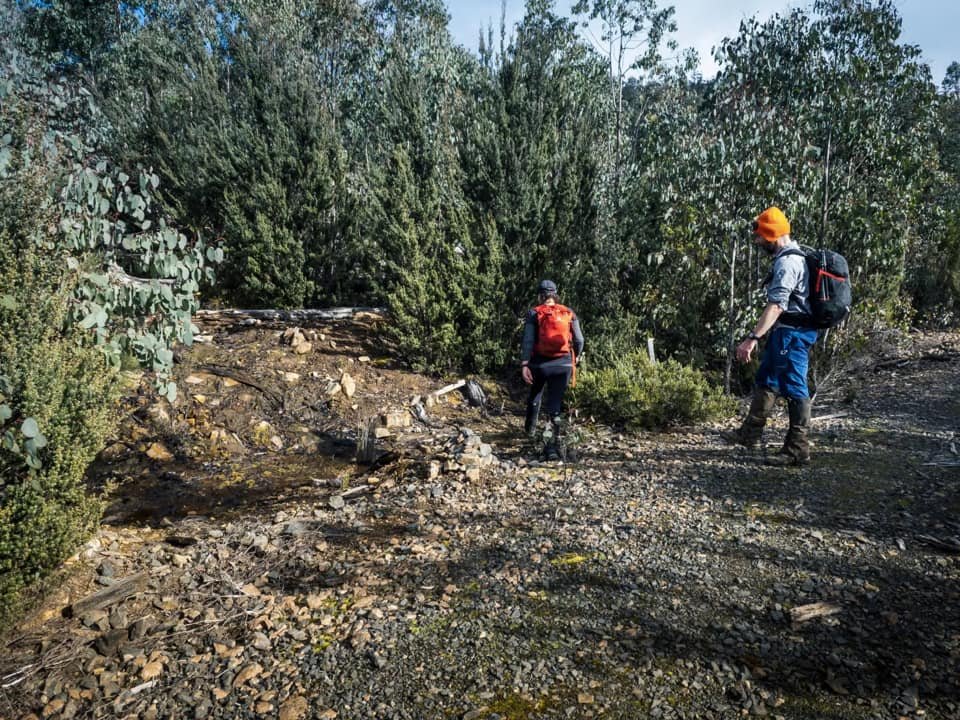
Boots and packs on we were finally on foot at a few minutes before 9am, some 4.5 hours after we had left home. Although we were a little irked initially that the bridge had prevented our car journey to the actual trail head, it became apparent in the first 50m or so that sheer amount of fallen trees and/or forest debris on the road would have made driving it impossible anyway. Chris had sourced a "short cut" to the trail head that he was sure would cut out at least some of the road walk. It was whilst heading along to the shortcut that the two of us realised the bridge our mate was referring to as fixed was the bridge on Tiger Road's southern end, many kilometres further south - an alternate access. After cursing Ben as the driver, we then had to eat our words later as that road would have only got us onto the other side of the bridge - assuming it was clear of fallen timber.

As we continued along the road condition deteriorated.

The steep 'shortcut' to the trail head.
The cairn marking the beginning of the track proper.
Just on 2km from the car we hit Chris's "shortcut". A steep, clay skid track that connected to either end of the forestry road that would lead us more directly to the trail head. It was time to warm up our climbing legs and lungs! Another 1.5km and we were staring at the cairn marking the beginning of the days hike to Wylds Craig. Initially cairns led us through a spacious area obviously under rehabilitation before we found ourselves swapping cairns for rueben tape, and spacious vegetation for dense scrub. This very short section of more dense scrub was infrequently marked with aged tape.

A large cairn leading us along the wide trail.

Initially the track was very open and appeared to once have been a 4WD track.

Soon the 4WD track changed to scraggly eucalypt regrowth on its fringe.

Cairns and ribbons led through the regrowth on the fringe of the 4WD track.
From here the track was obvious thanks to the well formed pad. Now, rising through open mossy forest, were shades of green and brown abounding and the rich tactile textures of moss clinging to every available surface. Under foot it was a jumble of softly padded forest floor, interspersed with rocks and tree limbs. The gradient was gentle, but we were required to consistently climb over logs or to scuttle underneath them. Up and down, over and under like human jack-in-the-boxes.

Occasional old tin plates marked the trail instead.

The pad was obvious for the most part until the creek crossing.

The up, over, under and through fallen timber pattern continued.
A Pandani with two "heads" in the centre picture - not something we have seen before.
When forest debris covered the trail, the occasional old piece of tape would help with navigation. At times equally old metal markers nailed to trees guided our progress, but generally to this point we had not grappled at all with staying on track. Before the gentle climb reached the 900m contour line, the track dropped abruptly and then levelled out, with the scrub diminishing in height and allowing us a glimpse of the snow-capped summit of Wylds Craig far off in the distance, partially obscued by cloud. It looked misty and bitter at the top, and the wind was howling above the trees we were standing below. Things did not look promising.

Evidence of nature adapting its growth to the environment.

Low bauera obscuring the track completely.

The tiny piece of tape marking the narrow crossing point of Coles Creek.

Stepping stones made the crossing easy.
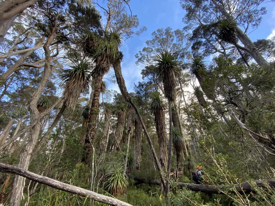
From this point the walking got easier with slightly less litter on the track. Glimpses of sky showed through the low forest canopy that still afforded us a level of protection from the elements. We continued along drawing near to the tributary of Coles Creek. Bauera crowded the pad but it still took only seconds to re-find it in the areas that were less visible. As we neared the creek we enjoyed passing through minor pandani fields before once again the vegetation changed back to bauera and low cutting grass. We managed to go a few metres too far past the creek crossing and so had to spend a couple of minutes looking for the crossing point. A tiny blue ribbon on the creeks edge caught my eye and within moments we were standing on the western side of the Coles Creek tributary.

The vegetation change after crossing Coles Creek.

Searching the scrub for an easier way forward, or another tape marker.
Crossing the creek was the easy bit - finding the trail on the other side was more challenging! On the western side of the creek the bauera was dense, high and completely buried any remnants of the track. The ribbons had become absent too. Our GPS devices had the track preloaded so there was nothing to do but start scrub-bashing. Chris took one lead whilst Ben and I took a slightly varied route - all of us scouting for ribbon or pad. I located a small pink tape at almost the exact time that Chris found the pad further up and we were back on track. Mind you the "track" was somewhat indistinct from lack of use and was very much overgrown.

Snow making its first appearance as the elevation finally began to climb in earnest.
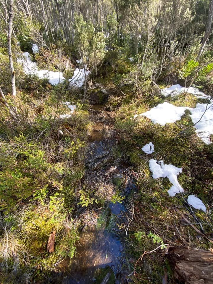
Snow melt and recent rains meant we were in for wet feet from this point on.
The entire hike to this point had been relatively easy - not steep or particularly physically exerting. We had however started rather later than any of us would have liked, lost an hour and a half due to access issues and having to walk roads we had anticipated driving, and it was now nearing 12pm. We took a moment and discussed our turn around time allowing for what looked - and sounded, with the wind howling - as foul conditions up top. The mountain will always be there next time. We agreed to push on to Goodwins Moor and reassess our options. For now, we needed to dig deep as the real climb was about to begin in earnest!

Out of the protection of the forest canopy and into the more exposed part of the day's climb.

Our first clear glimpse of the snowy summit ahead.

Cairns replaced ribbons as track markers as the tree line faded.
The climb ascended over 220m in elevation in under 500m from the creek, and we all finally felt like we were climbing a mountain! Not only were we now climbing steeply, but the track was less distinct due to scrub encroachment. It was here that we got our earliest glimpses of small snow deposits hidden in the scrub. As we climbed higher the frequency of the small patches of snow multiplied. Breaking out of the last section of the forest's shelter, we felt the cold in the air hit us on the edge of the exposed Goodwins Moor. It was time to suit up with our wet weather jackets and pants, as it was apparent that we had a fair amount of snow ahead.

The summit still a long way a way.

The summit disappearing in mist as we head south towards it.

Deeper snow means more energy being expended in sinking constantly.

Bee-lining it for the top of the hill that we needed to crest before heading to the summit.
With uninterrupted views of the clearly snow-laden summit a few kilometres away, the task ahead was obvious - knuckle down and get there! Cairns became our track markers as the track was buried under a foot or more of wet, mushy snow. Under the top crust the remaining snow had melted to create a running trail-creek beneath. With each step the snow would disappear under our feet and expose the melt below. Where the snow wasn't concealing water, it was hiding scoparia or pineapple grass. Our routine across Goodwins Moor was step-sink-step-sink-repeat! I was certainly feeling the 4am start at this stage. Of note was the effort that has clearly gone into some of the cairns from this point forward. They were almost artful. Not in that annoying and nature destroying "cairn-art" kind of way, but rather quite pretty in their design.
Although the walking had increased in difficulty due to the snow, and having to constantly assess a way forward, we were all pleasantly surprised that the weather was playing nice thus far. The summit still looked unkind due to its blanket of heavy grey mist and chilling snow, but the moor crossing - whilst cold - was lacking in the hail we had expected. A small win.

The trig in view we decided to head straight for the summit rather that lose time and distance heading to the ridge to follow the cairns.

One final push through deeper snow. The snow may have been slightly less deep on the ridge due to the presence of more rock but at least we were in the lea of the weather this way.

Snow up to our knees in places made for 'interesting' walking.
With one last high point to cross before turning south for the final push, we noted the cairns headed further north, covering some distance before turning south along the ridgeline to the summit. From our vantage point, we discussed heading directly for the summit to - hopefully - make a quicker final ascent and not waste time covering the extra distance along the ridge. We summised that the ridge may allow for easier walking as it would probably hold more rock and less scrub - though nothing was visible though due to the snow so this was an educated guess - but that it might also be more exposed to the elements, especially the wind. Our direct ascent route would no doubt involve a little more low scrub and snow to negotiate but would keep us in the lee of the wind and cut the distance we needed to travel. Bee-line it it was!
With the trig point now visible high above us we set off once again in a step-sink-step-sink routine. We were slightly behind our turn around time but had already deduced that the only risk in marginally extending our turn around time, was completing some of the road walk in the dark. That's why we always carry head torches - and we were now soooo close!

Chris enjoying a well-earned view.

Looking down the precipitous southern edge on the summit.

The summit cairn opposite the trig marker.

The trig is clearly higher but best lay a hand on both to make sure!
Finally we touched the summit and - wow - what a summit! Views of the nearby Mt. Shakespeare - one for another trip - were to our immediate north-east, with Mt. Lord and Mt. Field West around further south. We could just make out Mt. Mueller and Mt. Wedge under the low cloud while following the imposing Denison and Price of Wales Ranges up our western side. The clouds had cleared, the wind had dropped a little and we had views in every direction, albeit under a veil of cloud. Ben was in his element on the summit peering over its precipitous edge. Chris and I only let go for a quick photo opportunity. After soaking up the views I dropped off the summit to enjoy lunch whilst the boys took more photos. It was quite lovely sitting in the snow and eating lunch; I would have liked to stay there for the whole afternoon but the shadow of short daylight hours was intruding in our dalliance. Time to set off again.

Looking back at the trig.

Time to start the long journey back to the car.

A final glance back at the summit.

Cairn of the day for sure!

A snow capped Mt. Field West in the distance.
The return journey back to the edge of Goodwins Moor was faster than the journey up, as we expected with gravity helping the way. The post-holing down required far less exertion than the post-holing up. Reaching the edge of the moor there was time for us to soak up the views towards Mt. Lord and Mt. Field West - both covered with winter's white cloak - before dropping back into the forest cover, and the steep descent towards Coles Creek.
In rapid time we were back at the start of the trail head, with the final 3.5km of forestry road left. We decided to check out the alternate route back to the car, if for no other reason than to avoid the steep descent of the clay skid track we had negotiated at the beginning of the day. We made it back to the Mazda just as last remnants of daylight gave out, and drove out thanking both the mountain and the weather gods for shining on our day's quest. Time to plan our next adventure.
The stats.
Distance: Approximately 20km. From the trail head to the summit is 13km but there is an extra 7km of road walking due to bridge/road access issues.
Time taken: Approximately 8.5 hours (including the road walking). That's winter times with much of the route in snow and ice. Expect to be a bit quicker in dry/summer conditions, but still allow the best part of a day. The Abels book states 6 hours return from the trail head. We had approximately 1 hour extra in each direction of road walking.
Difficulty: Medium difficulty in summer due to a large section of the track being overgrown. In winter we would classify this walk as medium to hard. Snow covering an already scrubby trail increased the navigation skills required for our trip, and from Goodwins Moor there was a fair amount of post holing in deeper snow that slowed progress and increased fatigue.
Type of track: Tracked to summit but the track is skinny or overgrown in many sections. Some old ribbons and cairns mark the route.
Access from: Tiger Road off Florentine Valley Road.

Route taken to Wylds Crag.