Camp Hill
Date: 17 April 2022 - Summit: 1172m
Photo credits: Ben Wells, Tracey Orr, Simon Kendrick, Jess McDonald

Camp Hills summit cairn.
We begin our adventure to Camp Hill from the summit of Rocky Hill. The wind was whipping around us as we stood looking to our west, discussing where we might breach Camp Hill’s notorious scrubby guard. We thought, in the words of Mark Twain, that we had eaten the biggest frog a few days earlier on our visit to Pyramid Mountain and in terms of distance to travel, perhaps that was true. Although there was only 2km between us and Camp Hill’s summit, it would be a well earned summit and we would be in constant contact with our good friend scoparia almost the entire way…

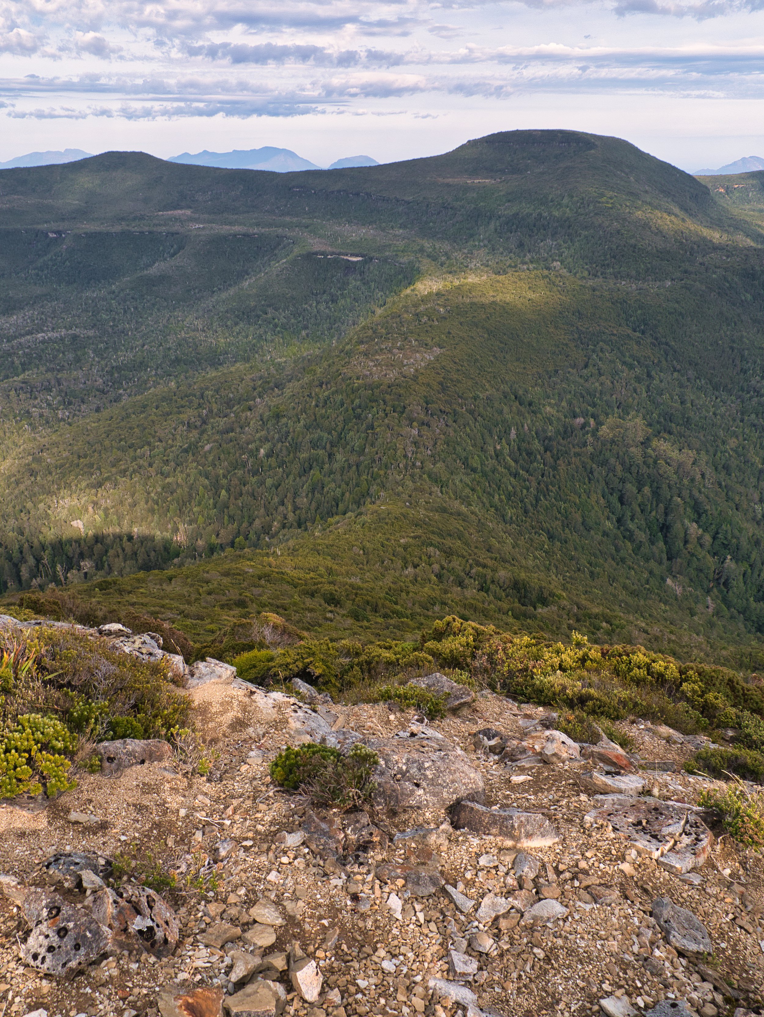
Looking north over the high point cairn on Camp Hill’s very broad, remarkably flat summit. Eldon Bluff and Castle Mountain can be seen in the distance.
The trip to Rocky Hill’s summit from our heavenly campsite had been a relatively quick, easy and straightforward affair. As we eyed off Camp Hill to our west, we knew that the adventure to its highest point was going to be anything but those things!
The wind was fierce but the sun was shinning, and rain wasn’t forecast till later that afternoon. After some time enjoying Rocky Hill’s stunning views we headed north west, gravel crunching under our feet as we descended towards the saddle that joins Rocky Hill with a small unnamed high point. Our route was almost identical to the border between the Cradle Mountain - Lake St Clair and Franklin-Gordon Wild Rivers National Parks marked on Tasmanian Topographic Map.

Looking north-west from Rocky Hill to the unnamed hill (right) and Camp Hill (left).

Looking north towards the Eldon Range from the unnamed hill between Rocky Hill and Camp Hill.
The walking at this stage was easy - ankle high scrub meant we covered the distance quickly. Contouring a little rocky outcrop along the way (on the return we went straight up and over it) we could see as far as the high point on the unnamed hill. Short-lived sections of gravel interrupted the low level vegetation and it was absolutely delightful to find fossils amongst the rock below our feet. Here we were standing on mountains and this area would have been covered by the oceans a thousand years ago. Scalloped imprints forever entombed in rock.

Fossils abound on the barren gravel sections.
Our pace slowed so we could enjoy this window into history. Searching the rocky deposits and turning over stone after stone. Like the fungi of the previous day’s trip, the Little Eldons were constantly putting on a show at our feet as well as a feast for our eyes with expansive views.
Looking west across the narrow saddle to Camp Hill.
The unnamed hill was broad, flat and covered in stunted vegetation. We spent a little time wandering its top before scouting its western edge for a suitable drop off point. The Type-2 fun was about to begin. Our path ahead involved a steep descent into a narrow saddle, then a climb to the next high point, where we would briefly level out before climbing steeply again to Camp Hill’s summit. What we could also see below was scrub, scrub and - you guessed it - more scrub. Time to eat that second frog!

Leaving the unnamed hill and entering the scrub. Camp Hills summit far in the distance (center of pic) Photo Credit: Simon Kendrick
A small section of rock led us straight into waist-high vegetation. That soon gave way to a prolonged section of head-high scoparia. We were using brute force to try and push our way through the almost impenetrable flora and were only making progress because our downwards momentum was assisting us. There would be no way we could push uphill through what was using all our energy to basically fall through on the way down - an alternate route would need to be taken on our return journey.

Occasional “pad like” sections would appear within the thicker scrub.
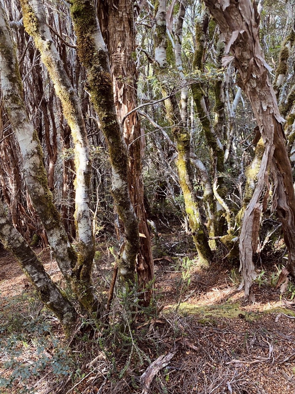
Finally, the thick scoparia gave way to open forest, a mix of tea tree, myrtle, sassafras and the occasional pandani. The forest canopy gave us precious respite from the rising heat and we ducked and weaved through it, always conscious of staying close to the centre of the ridge we were descending. Dropping off either side of it would only necessitate regaining precious elevation.

Moving through the open understorey was much more pleasant. Photo: Simon Kendrick

Ancient flora fighting for its place in the forest canopy. The pandani in particular were some of the tallest specimens we’ve seen.

Tiny Mycena interrupta growing out of decaying timber on the forest floor.
Our shade and easy walking would come to an end, as we positioned ourselves onto the spur east of Camp Hill. The plan was to follow this spur until its conclusion, dart briefly north-west and then follow the mountain’s north-eastern spur to the summit.

Moving through the open understorey was much more pleasant.

Making the most of the shade before the climb up the other side of the saddle.
Knowing we still had the most difficult part of the day to come, we rested in the shade of the forest and enjoyed a snack - none of us were overly eager to revisit what we feared would be more thick scrub.

Leaving the more open forest behind. Photo: Simon Kendrick
A pinchy climb up and out the forest and a few minutes weaving tall mounds of cutting grass, deposited us into a semi open area and surprisingly easy walking! Low baurea and lots of animal pads were a very, very welcome and completely unexpected change.

Looking east back at the unnamed hill we just traversed from.

Picking our way through moderate scrub thanks to several good animal pads through the bauera.
Taking turns to lead with glimpses of the “false” summit of Camp Hill spurring us along, we dropped down to the small gully below the next scrubby climb. Here we delighted in a large Fagus displaying the beginnings of its renowned orange glow.

A fine example of Nothofagus cunnii beginning to show its autumn colouration.

Closeup of the rich autumnal colouration of Nothofagus cunnii aka. Deciduous Beech.
The lone deciduous beech marked the point to start weaving our way upwards through the forest it stood guard in front of. Picking what seemed like the least dense section, we headed inwards and upwards. Our pace slowed, deliberately picking our path as carefully as possible through the patches of more open myrtle and tea tree. Save a few tight spots, it was relatively easy compared to the past couple of hours of walking.
Picking a clear way up the steep climb to the final ridgeline.
But, no sooner would we comment on “how good is this?”, Camp Hill would throw us a curve ball. Out of the forest and straight into head high scrub that required determined effort to push through.

Almost there… almost! Finding a way through on the final ridge towards the summit.

Getting close and personal with everyone’s prickly favourite Richea scoparia.
Camp Hill is one of those mountains that enjoys teasing (or should I say torturing?) its visitors. As we crested one high point, another would appear. The mountain appeared to be taunting us. How bad do you really want it?
Badly! There was no way we were turning back now - no matter what the mountain threw our way. We had worked too hard to get this far. Dense scrub - no problem. Steep climbs - no problem. “Wait!” thought Camp Hill, “Let’s throw in some scoparia so tall, that one must crawl under it instead of walking! A few minutes later another scoparia surprise was in store.
In all my years of walking I have seen - and had to push through - some very tall and very thick scoparia, but this took the cake. It rose a full metre or more higher than Bender or Simon. Perhaps because of its vertical height, the plant’s bases were spindly. Narrow corridors between each giant plant allowed us to walk “under” it with ease.

Finally clear of the scrubby stuff as the last few hundred metres to the summit are reeled in. Note the scrubby rise behind us that we would have to climb up on the return.
Eventually the patch of giant scoparia relented, to be replaced yet again with less intense scrub, which in turn gave way to a rocky pad leading up to what finally appeared to be the high point.
A short scramble up the last hundred or so metres and we had made it! The the broad and surprisingly flat summit area welcomed us with open arms. Cool refreshing water from its tarn filled our overheated and exhausted bodies. The real replenishment came from the endless views in the glorious sunshine. Wow, just wow!

Looking north-east, the final ridgeline we climbed. High Dome and the many peaks of the Du Cane Range lie beyond.

Jess and Simon enjoy a well-earned lunch looking south over the ever-present Frenchmans Group.
To the north the usually shy and distant Eldons Range was now visible in its entirety, front and centre. To our west Mounts Lyell and Owen dominated the view, with the Mounts Zeehan, Dundas and the Tyndalls Range further north. To the south Frenchmans Cap dominated - as its distinctive shape usually does - around the nearby summits of Philps and Sharlands Peaks. And to our east, we could see our full route back to Rocky Hill, with Pyramid Mountain further back and the lower Du Cane Range on the horizon.

Looking east back over the unnamed peak (left) and Rocky Hill (right). The twin-horned Mount Manfred can be seen behind ‘Junction Hill’ with Mounts Cuvier, Byron, Olympus, Hugel and Rufus further south.

Mounts Owen, Lyell and Sedgwick dominate the view west, with Lake Burbury in the fore.

Looking north across the valley of the South Eldon River, the Eldons Range has never felt so close! Left to right - Eldon Peak, Eldon Crag, Eldon Bluff, Dome Hill and Castle Mountain. Beyond the eastern ridgeline of Castle Mountain the faint silhouettes of Barn Bluff and Cradle Mountain can be made out.
It well and truly felt like we were alone in the universe, save the mountains that circled us in every direction. No better place to lunch like kings.
Lunchtime over, it was time to retrace our steps back to Rocky Hill. The return walk would be equally as challenging, with as much “up” as “down” as the trip out. Determined though to avoid the worst of the scoparia and thick scrub - as much to beat the forecast afternoon rain as to just avoid the discomfort - we discussed a few route changes as we descended back to the marshy area below the eastern ridgeline.
The determination paid off, particularly as we picked our way up the steep, scoparia covered final climb towards Rocky Hill. Like four hobbits, we dodged and weaved our way up, selecting forest and pineapple grass pockets always seeking the next pocket of pineapple grass. Slightly south to our outbound route, I found a gravelly drain that soon turned into enough of a pad to make the final climb much less frustrating.
Our tired feet were soon standing on Rocky Hill’s summit once more with just a hop, skip and a jump back to camp. And in good time too, as the building drizzle finally turned to rain not long after we reached our home away from home in the Pencil Pines.
We had been lucky enough to visit Rocky Hill, Pyramid Mountain and Camp Hill. Our bodies would be tired on the walk out tomorrow but for now we were warm and content. What a wonderful adventure with special friends.

Camp Hills open summit.
The Stats.
Distance: Approximately 8km return from our campsite.
Time taken: 7 Hours, 45 minutes return to camp including time spent at the summit of Rocky Hill and Camp Hill. From our campsite to the summit of Camp Hill (Via Rocky Hill) was 4.5 Hours.
Difficulty: Difficult. Completely off track with scrub varying from dense to super dense. Good navigational skills required.
Type of track: Completely off-track.
Access from: Rocky Hill.

The Map.
Route taken to Camp Hill from our camp just south of Rocky Hill.