Mount Ida
Date: 21st March 2020 – Summit: 1241m
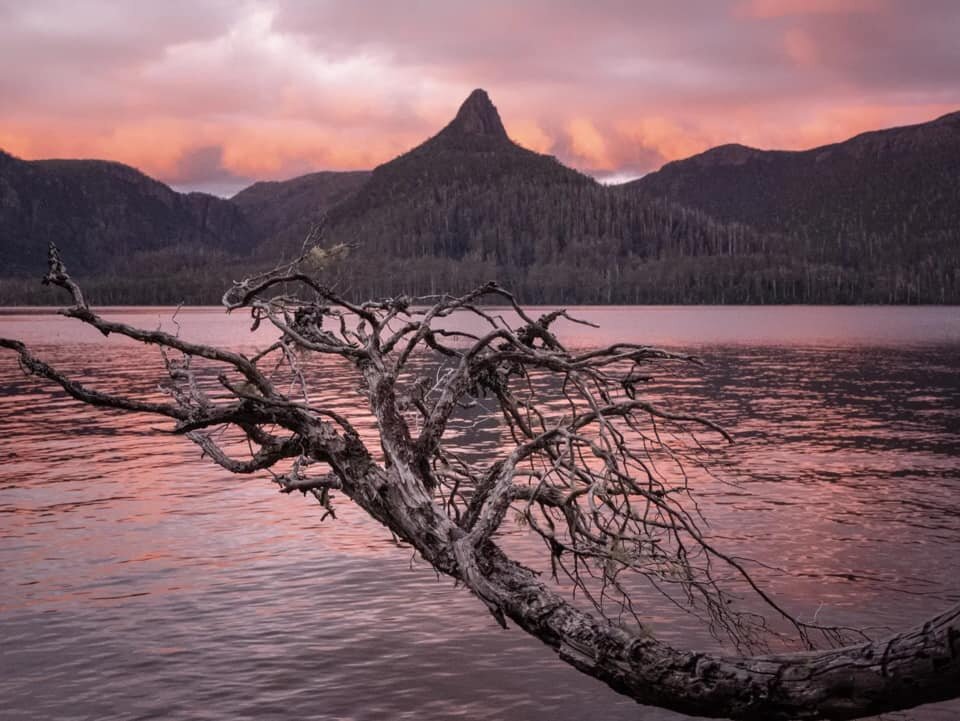
Mount Ida at sunset taken from the shores of Lake St Clair.
Mt. Ida's sharp dolerite point stands guard over the ancient rainforest below that line the shores of Ida Bay and Lake St. Clair. Whether one catches the ferry or walks the final segment of The Overland Track, all who pass along are guaranteed to be inspired by the conical shaped mountain on the other side of the lake that seems to rise straight from the shore. There is no better place to sit overlooking the unapologetic beauty that time, nature and glacial forces have combined to create.

Mount Ida from Lake St Clair. Photo Credit: Lynnda Coffey
Why not watch & read?
Please enjoy a visual trip to Mount Ida in addition to the blog below. Whilst the blog gives you greater detail on the trip (including route information) the video allows those that may never reach its summit a virtual experience.
I had planned a trip hiking Mt. Ida with some of my friends and intended on camping on the shore overnight. As of early 2020 - the ferry no longer drops hikers off to Ida Bay so a friends father had generously allowed us to use his boat.

The beauty of Ida Bay. Photo Credit: Lynnda Coffey.
I had Ben Young Cathy, Lynnda, Chris, Mim and twelve year old Armand joining me for this trip. The loose plan was to ferry one mandated "tent putter-upperer" over to the island in a few trips. That meant that by the time we had completed the last trip almost all our tents would be up.
This would save time and also ensure our shelters were up before we set off, in case the weather changed. The boat ride across the lake took around 20 minutes, but approaching shore it is important to look out for submerged trees and rocks in the shallow water. We beached the boat and spent about 15 minutes walking along the bay to look for the best camping opportunities.
For those interested, there are a few small and reasonably suitable campsites along the shore line. Whilst not perfect they definitely suffice for a night or two. Chris and I set about making camp. By 11:45am we had our entire group on the beach, tents up and were ready to set off. Not bad!

Heading off through the forest. Photo Credit: Ben Young
Chris would be in charge of navigation today, as he had a GPS track loaded from a good source who had climbed Mt. Ida a few weeks prior. The Abels is correct in its assessment that it is a completely untracked walk from the shore until very high up when a few ribbons and cairns appear. For this reason, it is important to take a compass bearing of Mt. Ida from the shore as once in the forest, it becomes completely hidden from view.
Whilst setting up our tent I had noticed a pink ribbon near our campsite and it was pretty close to the start of Chris's GPS coordinates, so we would make that the start of our journey. After crossing a large fallen log near a creek at the northern end of the beach, we arrived at the first pink ribbon. Hiking through the rainforest it would be at least 50 metres before we would locate another pink ribbon and after a sum total of three pink ribbons they became nonexistent!
The forest floor was mossy and covered in ferns, with no visible pad or track at all. We were glad to have our bearing and Chris's GPS, but the main goal of the day was to reach the spur that juts out from the south towards the lake, stick to the middle of it until we reached the imposing cliffs at the base of the summit and then skirt to the left (north) to enter the summit. Chris's GPS track was pretty "scattered" but it would be a good guide, as would the spur. The initial part of the walk was relatively flat but right from the get-go there were plenty of partially rotten and fallen trees to negotiate around or over, which would be the theme for much of the walk.
We continued through the open rainforest, weaving constantly to avoid fallen logs. This section of the hike was stunning. Every shade of mossy green was on show, as was every colour and shape of fungi hidden under the foliage, hanging off trees or in amongst the ferns. From bright yellows to muted apricots and purples. There was barely any elevation increase for the first half-kilometre, and the open forest made hiking a real pleasure. In the distance, I managed to spot what appeared to be a cairn on a fallen log. It was with great excitement we clambered over the log to find... not another single cairn! Soon after, the upwards climb would commence.
The elevation began to increase at the half-kilometre mark, and would be constant now to the summit. The climbing was moderate for the most part at this stage, occasionally with short, pinchy and usually very slippery climbs. We would occasionally stumble across what looked like a faint pad, but it was pretty much a choose-your-own-route to avoid the worst of the fallen trees and denser areas of scrub. All the while we kept an eye on Chris's GPS route, ensuring we stuck to the centre of the spur, not dropping down either side of it.
As the steepness increased so too did the level of care we needed to take. The ground underfoot was slippery due to being damp from overnight rain, and either covered in moss or having a healthy layer of leaf litter over it. Add to that the muddy ground underneath, slimy trees to climb over and millions of tree roots as a tripping hazard, and we were all watching our foot placements! Occasional large sandstone formations meant we were climbing small sections, rather than hiking them but still nothing overly challenging.
With the elevation ever increasing, the scrub also briefly increased in density. There was many a slimy log to climb over or skirt around, but once again we located sections of very faint pad. About 500m out from the scree at the base of the rock cliffs, we again sighted ruben tape. Yet again the tape was sparse, with quite a distance in between each piece, but it reinforced we were right to stick basically to the centre of the spur. Interestingly Chris's GPS showed that the previous party had stepped upon the scree well left (west) of our current, ribbon'd location.
Assisted by the very occasional sighting of ruben tape, we pushed upwards and out of the dense rainforest into a small clearing. Surrounding the clearing was cutting grass and a few delightful pandani. It was also the first time the skyline was visible, and through the forest ahead we could glimpse Mt. Ida again. Happy dance!
The ribbon markers disappeared from existence (again!), but we now had Mt. Ida in our line of sight. The surrounding forest changed from lush green rain forest to a mixture of tea tree, low alpine vegetation and baurea. All easy enough to find a path through. Here, the track leveled out ever so briefly, before the terrain changed to a drier forest floor with the rocks making a welcome appearance underfoot. That meant we were nearing scree. Another happy dance.
Our first glimpse of Mount Ida rising behind us. Photo Credit: Lynnda Coffey
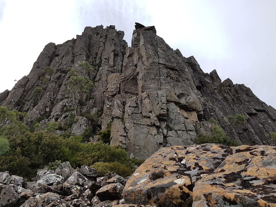
As we continued the steep climb the pad became more apparent. Although not very distinct, it was easy enough to follow, as cairns now led all the way to the scree field laying under Mt. Ida's imposing western cliff face. Looking up one would be forgiven for thinking it might be time to turn around. But we had faith the route to the north would lead us towards the summit without needing to scale the cliff vertically!

Half way up the climb and looking back to Mount Olympus across the lake. Photo Credit: Lynnda Coffey
We relaxed back on the scree for a spot of late morning tea, and to enjoy the views opening up below us. The sun was shining, the mist had cleared from around the nearby mountain ranges, and we were high enough up out of the tree cover now to look upon Lake St. Clair with the huge mass of Mt. Olympus commanding our attention from across the lake. Refreshed after a short stop, we located the next cairn on the scree field that would lead us north towards the chute to enter the summit from.
Leaving the scree, the track sidled around to the north. It would wind away from the scree, and once again enter scrub with some sections being dense enough to hide the pad for a few steps or so. It was well marked with cairns, but care needs to be taken as there were a few sections where it appears walkers have trodden a new pad in whilst looking for the route, only to back track.
This section of the walk was steep and at times we were more climbing than hiking, however the surrounding shrubs and rocks made for great hand holds to haul ourselves up. It was here at this point that Chris and I, who had been out front most of the day, decided to defer to the braver hikers amongst us... neither Chris nor I have any love of exposure and heights (I know, crazy for a couple of mountain climbers - right?). Lynnda was promptly summoned to the front, because soon we feared we would reach the dreaded "Fridge Rock"!
It is almost impossible to photograph the section of the climb that was almost the undoing for Chris and I. Often referred to as "Fridge Rock", it is a section of the trail that you need to climb in order to continue to the access chute for the final summit ascent. An almost vertical rocky section that is about the size of a fridge - hence the name - with tricky hand and foot holds.
For those that are shorter or uncomfortable around heights, frankly this section isn't great. Lynnda was sent up as the sacrificial lamb. She was to find a route up it, and not die. If she could do that, maybe Chris and I could! After Lynnda we would send the next sacrificial lamb, Armand - Chris's very brave 12 year-old son! After much testing and stretching and saying we weren't going to love it, Lynnda managed to find reasonable hand holds on the rock - which included a leap of faith to catch a tree root to hoist herself up and over onto the adjacent rock that the path continued up.
Once Lynnda was up she was able to hang onto the tree limb, whilst reaching Armand as he neared the top of fridge rock. One by one we made it to the top using each other to hoist or pull! The worst thing for Chris and I was knowing we had to get back down that way! We would strongly recommend against doing Mt. Ida as a solo trip purely from the point of view that it does have a couple of sections where if something went wrong, it could go very wrong!

Chris starting up fridge rock. Photo Credit: Ben Young
A sigh of relief and we were back on the pad winding up to the summit area. Although narrow, steep and a little exposed, it was at least a pad! The pad was short-lived and we stepped out onto scree. A few minutes of scrambling over the boulders, and were were on top of Mt. Ida. No party just yet though, as to reach the high point, we would need to traverse its rocky top to the northern high point.
Ben Y scrambled across a large choc stone (no fear of heights for him!) while those more safety conscious among us dropped down slightly to cross. It was here I saw a beast, a huge beast. A hairy eight-legged freak of a beast called a spider! Whilst I was having a major freak out and yelling obscenities like "kill it", Cathy - who is an entomologist - was rushing over to catch a glimpse!
A short scramble to the high point at the northern end of the rocky summit and Mt. Ida was in the bag! And you couldn't find a better restaurant to sit back and enjoy lunch!
With a crystal clear sky, the views from the summit were spectacular. Lake St. Clair glistened below us and we could see Mtn.s Othrys, Olympus, Rufus, Byron and Gould as well as Lake Laura and the Du Cane Range. Wow, wow and more wow! Even the skinks were up on the summit enjoying the view. Life is pretty good up there!


Summit Views. Photo Credits Lynnda Coffey.

The stats.
Distance: 6.5km return from the beach directly south-west of the summit, just south of Ida Bay.
Time taken: 5 hours including numerous stops for photos, videos and snacks.
Difficulty: The Abels rates this one as ‘hard’ and from a point of view of access we would absolutely agree. Given it lies on the north eastern side of Lake St. Clair and is no longer serviced by the ferry that previously ferried hikers to Ida bay, the options for physically getting to Ida Bay are now limited to one of three options:
Walk in from Traveller's Rest Lake (as described in The Abels as an alternate route) which you would require at least two days minimum to be set aside for the entire trip.
Kayak, from the Visitors Centre at Cynthia Bay up to Echo Point, then directly across the adjacent shoreline, which would require upwards of 3-4 hours each way assuming good weather and competent paddling.
Use a private boat.
In so far as the actual climb to the summit from nearby shore, we would classify the walk as fairly straightforward in difficulty (albeit quite steep with a few tricky sections towards the summit) but moderate from a navigation point of view, as no real track exists until reaching the spur nearer the summit itself.
Type of track: Untracked initially, then a vague pad from the southern spur towards the scree below the summit with a handful of pink ribbon to direct the route. Cairned from the scree below the cliff face to the summit.
Access from: Ida Bay or (as we did) the next beach further south, which is a little closer.

Route taken to Mt. Ida.