Mount Jukes
Date: 22nd February 2022 - Summit: 1168m
Photo credits: Ben Wells, Tracey Orr
Views open up almost immediately as you begin the climb.
Mount Jukes had well and truly alluded us for at least two years. Why? Not because of its difficulty - it is a short and a fairly easy Abel to climb. Nor because of the long drive from Launceston - though incidentally it still took us longer to drive to the trailhead than to actually climb the mountain itself! No, simply because weather on the west coast of Tasmania is so darn unpredictable. Or perhaps more accurately, it’s predictably bad whenever you want to go there! On three previous occasions the weather had altered our plans. With sunshine and clear skies not only forecast but actually likely to eventuate, we finally got to enjoy this lovely little mountain. It was well worth the wait!

The small car parking area off Jukes Road.
Bender had set himself a goal of having summited 120 Abels by the end of February, and that meant climbing at least four mountains in our five-day mini break. We had spent three of the days climbing Horizontal Hill, Mount Gould and The Guardians, but plans to continue on and climb Mount Cuvier and Manfred had to be abandoned halfway through. An upset tummy for Bender had bought us out of Lake St. Clair early for a night with the comforts of home (read: a toilet!). We were one mountain off his goal but had only one more day off work before the end of the month, so we set our sights and still-tired legs on Mount Jukes.
Luckily after a couple of days of rain, the rare run of mild, stable weather had returned and the forecast was looking as promising as it gets for Tasmania’s west coast. It would take around 4.5 hours of driving to reach the small car parking spot off Mt Jukes Road, where we would begin our walk. It was to be a fairly late start for us, as we had dropped a friend off to the Frenchmans Cap carpark along the way. I can’t remember the last time we ever started a walk at 10:30am in the morning. Not something we’re in the habit of doing, especially these days! But we had the benefit of long daylight hours, a relatively short walk and weren’t fussed how late we got back home to the other end of the state.
The car park was approximately 18km from Queenstown - just after cresting a minor rise in the road the parking spot is on your left hand side. Ben had seemingly bought just about every camera he owned to make the most of the day, and so whilst he got his electronic gadgetry sorted I started walking back up the rise and crossed the road to the Mount Jukes side. At the top of the rise, I located an obvious spot that is used to get up off the road and into the vegetation. A short rock climb but nothing difficult.

Leaving the road and hitting the trail.

Note the cairns which if located early on lead pretty much all the way to the summit!
Up and above the road cutting now we began searching around for a few minutes looking for signs of a pad or cairn to mark the point to head west up the adjacent slope. The route to Mount Jukes has historically been known as “untracked”, and certainly friends who have previously climbed it reiterated this, saying they would occasionally find a cairn or pad in places but mostly figured out their own route up to Proprietary Peak.
Whilst Ben was fiddling with his gear, I was wandering here and there, looking for evidence of where previous walkers had set off, and managed to stumble across a cairn! When I see one cairn I am like a blood hound, looking for the next! Suffice to say we were pleasantly surprised to find a series of well placed cairns that lead to a rough but definitely cut route up through the vegetation. Some enthusiastic souls - perhaps a local walking club in the area? - have put quite a bit of effort into creating a subtle but easy to follow route through the worst of the scrub, and cairns leading all the way to the summit. The key is to make sure you find said track at the very start!

Following the cairns and the cut button grass up towards the first rocky outcrop.

Views opening up early.
The first cairn led to a second, and that to a faint but discernible pad leading due west up through the button grass. At some stage someone has used tools to cut down the thicker vegetation to stumps. Whilst the button grass has reclaimed a reasonable amount of space, the track leading westwards was very obvious. It climbed steeply upwards through the button grass, heading in an almost completely diagonal line towards a band of small rocky bluffs. The trampled button grass and cut stumps were complimented by occasional cairns and even the odd bit of pink tape, until we reached the first rocky outcrop.
Following the pad and tape around to the right of the first rocky outcrop.

Nearing the first minor scree field.
Reaching the walls of rock we could see where a faint pad lead to the left, but there was also a faint pad to the right too. The pad to the right was somewhat hidden by taller shrubs but on investigation a few metres further along it opened up, with numerous pink ribbons indicating we were in the right place. Under our feet, the button grass was now replaced with vegetation and rock.
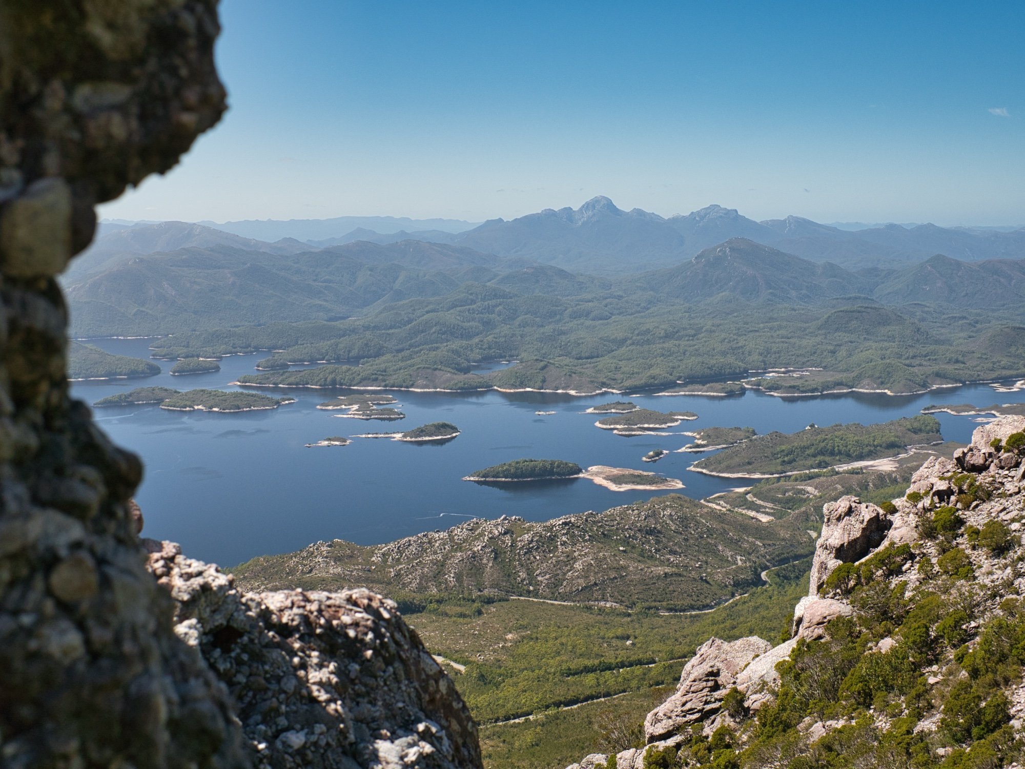
As the amount of rock increased, so did our level of care. It was quite loose and prone to moving around as we walked, so we made sure to keep a safe distance between us. Although the climb was steep we were thoroughly enjoying the views already opening up towards Lake Burbury. The many small islands sprinkled throughout the lake looked like jewels in a sea of deep blue. Oh why had it taken so long to finally do this walk?!

Cairns making navigation easy.
Once up on the first bluff, we could see all the way out to Proprietary Peak - the most substantial climb for our day. Navigation was simple thanks to both the low vegetation and because of the amount of work that had been put into the expertly cairned route. Not so excessive as to ruin the natural feel of the area, but enough to make navigation fairly painless. We could imagine they’d help massively if the weather changed suddenly - as the area is prone to - and walkers have found themselves in white-out or reduced visibility conditions.
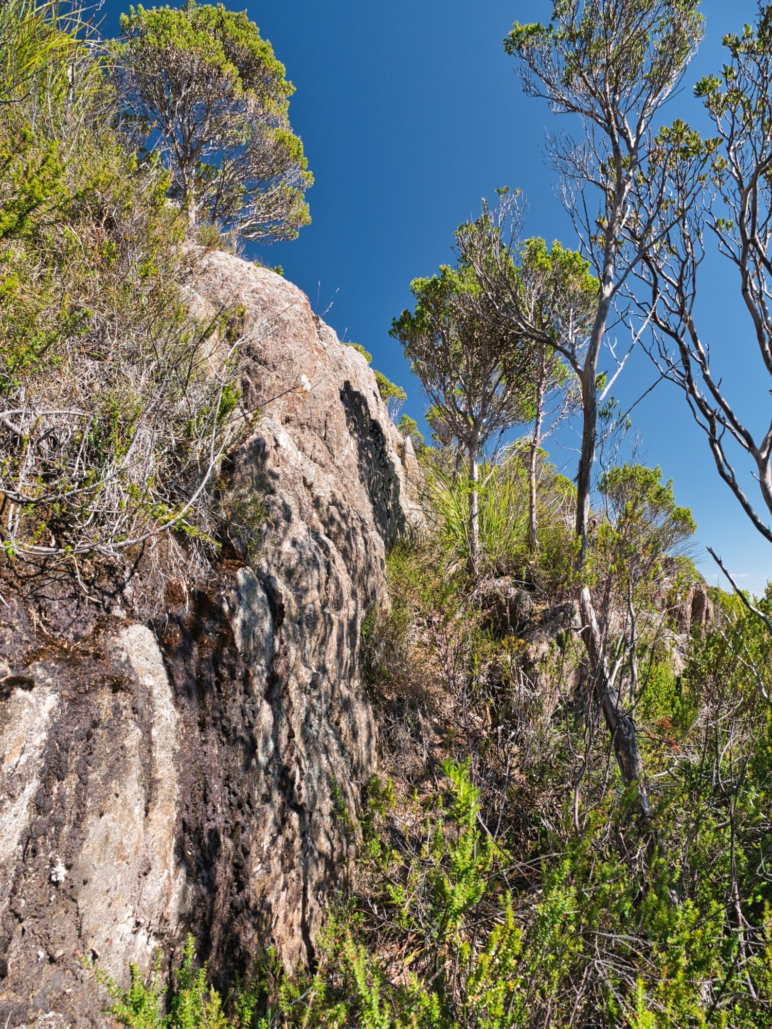
As we walked along the ridge admiring the views, we noticed that the rock below our feet was constantly changing. Light grey in some spots, pinkish in others and dark, almost black elsewhere. It always amazes me how there can be such distinct changes over such short distances. Vegetation or rock, it is just mind boggling the forces that created this beautiful state we live in.

Lovely rock formations are a highlight of this area.

Easy open walking was a pleasant change to our previous few days scrub bashing on Horizontal Hill.

The road below and the floating islands in Lake Burbury below.
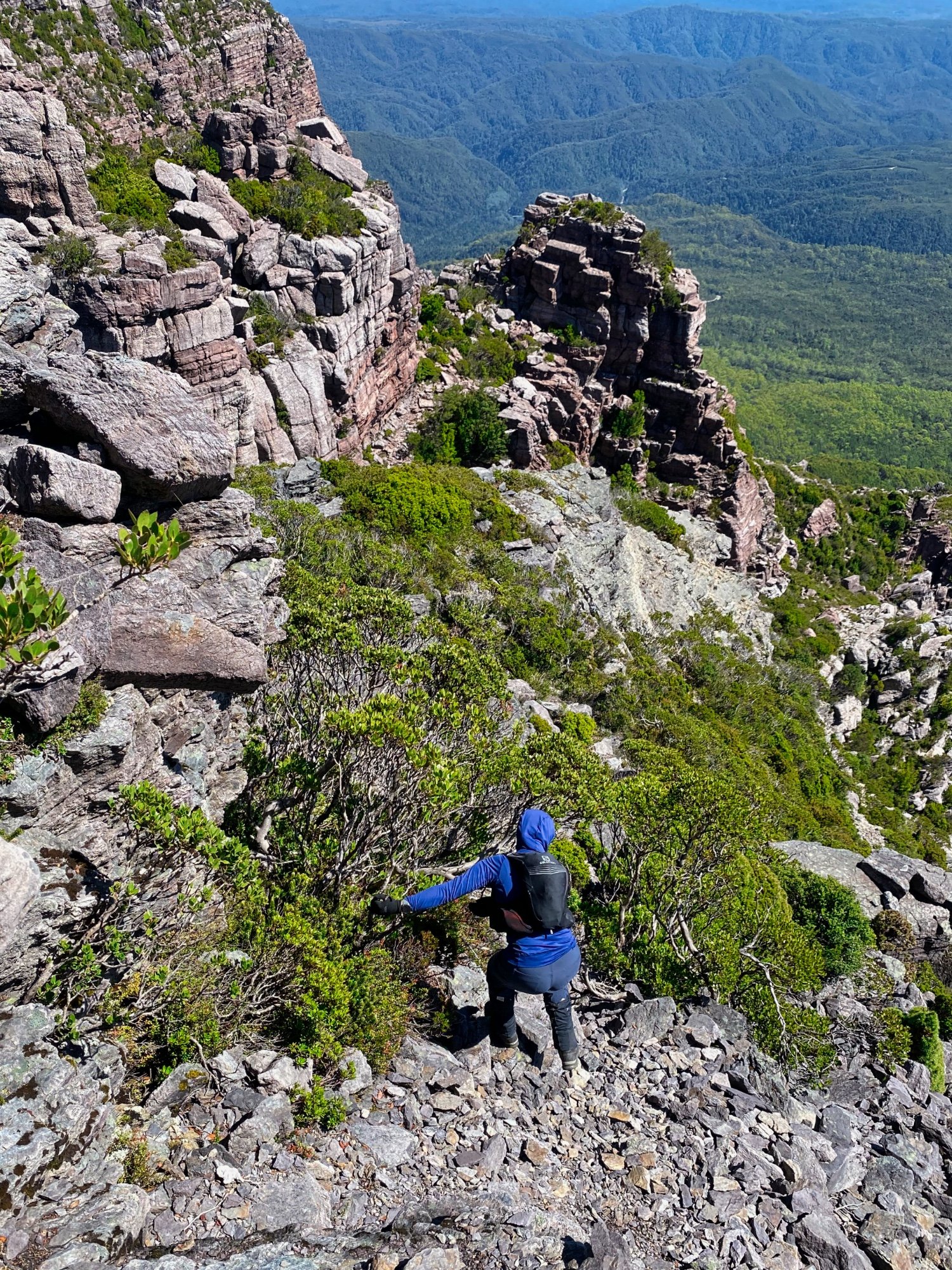
As we neared the saddle below Proprietary Peak, it looked like we would lose a ton of elevation and have to climb back up again. Instead the route crossed a narrow ridge, losing only a small amount of height. From there we followed the cairns which contoured the eastern side of the large rock formation directly below Proprietary Peak. The well-worn pad lead us comfortably through the head high scoparia and other dense scrub that lined the side of the mountain. In the near-distance we could see the trig point of Mount Jukes just off to our south, its precipitous purple-tinged slopes looking especially grand.

Continuing to gain elevation on the way to Proprietary Peak.

The summit trig visible from the saddle below Proprietary Peak.
Chatting away whilst stopping unhurried for photos and just generally just enjoying such a beautiful mountain on an equally beautiful day, we continued along, following the cairned route all the way to the summit of Proprietary Peak. Its large beehive cairn is a minor deviation from the route, coming into sight after another short but very steep climb. It gave us yet another opportunity to enjoy the gorgeous 360-degree views. We could also now see Mount Jukes summit area clearly, and the fact that after all the steep climbing, the remainder of our journey would be lovely open ridge walking at a very agreeable angle. My favourite!

A lovely cairn with a lovelier backdrop!
Descending to the narrow saddle connecting Proprietary Peak.

Looking up at Proprietary Peak.
The ridge walking was as exquisite as we expected and it took only a few more minutes to reach the summit of Mount Jukes from Proprietary Peak. A newish-looking helicopter landing pad - or tent platform? - and an ancient-looking trig structure greeted us at our arrival. Although very exposed to prevailing winds, the roomy and flat summit area would make a great overnight camp if one was prepared to pack haul water to the top or take their chances with finding it in the surrounding soaks (which were mostly dry).

The final push up to Proprietary Peak and the easy ridge walking to the summit of Mount Jukes.
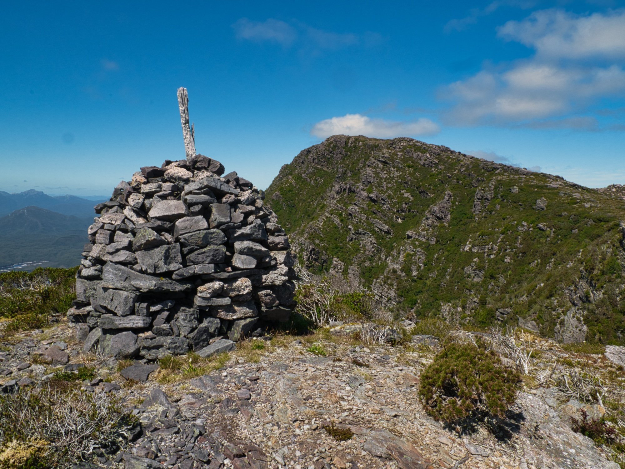
The beehive cairn on Proprietary Peak.

Easy ridge walking all the way to the summit now.
Mount Jukes had been well and truly worth the wait. A very underrated mountain with great views in every direction. What a perfect way to spend an afternoon - it has jumped onto our favourites list for sure. Given the short amount of time we had taken to climb it - and knowing we’d be even faster returning to the car - we indulged in a lengthy lunch at the top. People often ask why we climb mountains and this is the answer - a sunny day, great company, a stretch of the legs, mental and physical challenges and open views of Tasmania’s natural beauty.
Eventually dragging ourselves away from our scenic lunch spot, we began the descent back to the car, retracing our ascent route more or less exactly. As is the norm, the descent was even quicker than the walk up and we were back at the car in less than an hour. Our quick descent meant we had enough time to grab a coffee at the Railway Cafe in Queenstown before starting the long drive home. What a great day to be alive!

The trig well and truly in hand!

Wildflowers ending their life cycle.

Views all round. What a gorgeous sunny day!
The Stats.
Distance: Approximately 5.5km
Time taken: 5 hours which included multiple filming, photo and snack stops as well as a decent lunch break at the top.
Difficulty: Following the route we found we would classify this Abel as easyish to moderate - short and easy to navigate, but quite a steep and involved climb. Just make sure you pick the weather as the route is quite exposed and could become very unpleasant/dangerous in the wet and windy conditions the region is known for.
Type of track: Untracked but pads, cairns and tape to the summit.
Access from: Mount Jukes Road.

The Map.
Route taken to Mount Jukes via Proprietary Peak from the Mt Jukes Road, south of Queenstown.