Mount Proteus
Date: 1st October 2022 - Summit: 1152m
Photo credits: Ben Wells, Tracey Orr, Lucas Chamberlain

Mount Proteus summit.
What a way to celebrate the last year in my forties! A rarely visited peak, new friends, old friends, sunny skies and conversations about riding gigantic prehistoric wombats, Never Ending Story-style. Talk about spoilt! Even 10km of lumpy, bumpy, quad-killing buttongrass couldn’t dampen the celebrations on our Mount Proteus trip.

Mount Oakleigh from New Pelion Hut.
Bender and I have had many a conversation about journeying to Mount Proteus over the past few years. Somehow though, another mountain always stole our focus and time. Or the weather vetoed the trip - yeah, that happened more than once! Or a million other things that came up, constantly pushing Mount Proteus to the bottom of our infinitely long, always growing list of places to adventure to.
Mount Proteus had long been the last Abel in the Cradle/Ossa Group for us to summit, so a visit was well overdue. I treated myself to the Friday off work for my birthday, planning a leisurely morning stroll up the Arm River Track. I would nab a few bunks at New Pelion Hut (or pitch the tent, if the hut was full) and Bender and Lucas (yes the famous Lucas Chamberlain) would come in after they finished work late Friday.
As well as being my birthday, Friday 30th September was also the last day of the non-booking season on the Overland Track, so we weren’t sure how busy the hut or track would be. As it turned out it was quite busy, and interestingly with a lot of people doing the track in reverse ie. south to north.

Birthday lunch at New Pelion Hut. Homemade rice paper rolls and peanut dipping sauce. Spoilt much!
The Arm River Track was so dry compared to the last time we had walked it - in flooded conditions for a character building Mount Thetis trip! Even with multiple stops to watch some wombats go about their business, eat cake and take photos, I arrived at New Pelion Hut in a little over three hours. Yippee, I had lots of time to kick back in the sun, enjoy my lunch and relax.
Views of Mount Oakleigh across Pelion Plains, a lone currawong and perfect solitude were the icing on the cake for my lunch. Do birthdays get any better? I think not! My solitude was soon interrupted by the arrival of another solo female walker - Naomi - with whom Lucas, Ben and I would become fast friends with over the weekend. A delightful young lass who happened to be friends with some other very special friends of ours. Tassie, you are too small - in a good way!
Ben and Lucas arrived to the hut around 9:30pm that night - literally flying up the Arm River Track in 2h33m! Ben jokingly chastising Lucas for a five-minute stop so he could eat his Subway half way along the track and thus preventing them a sub 2:30hr hour effort. Jokes aside, the boys were tired and it was lights out the moment they had their beds sorted. We all had an early start and a long day walk to Mount Proteus the next morning.
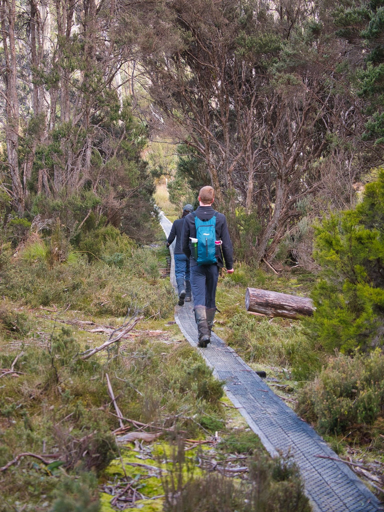
Setting off along the Overland Track.
I love the name that Bill Wilkinson of The Abels chose for Mount Proteus, in keeping with Greek legendary tradition for the mountains in the region. Proteus was the old Sea God, whose duty it was to guard Poseidon’s herd of seals, whom could change into harmless but nevertheless savage looking beasts.
It is a name well suited, as Mount Proteus itself is harmless enough, not particularly challenging or difficult to get to, nor as grand looking as the dominating Mount Pelion West. Yet from its somewhat isolated summit you can ponder the literal Gods of mountains that surround you in every direction. A mighty fine summit indeed.
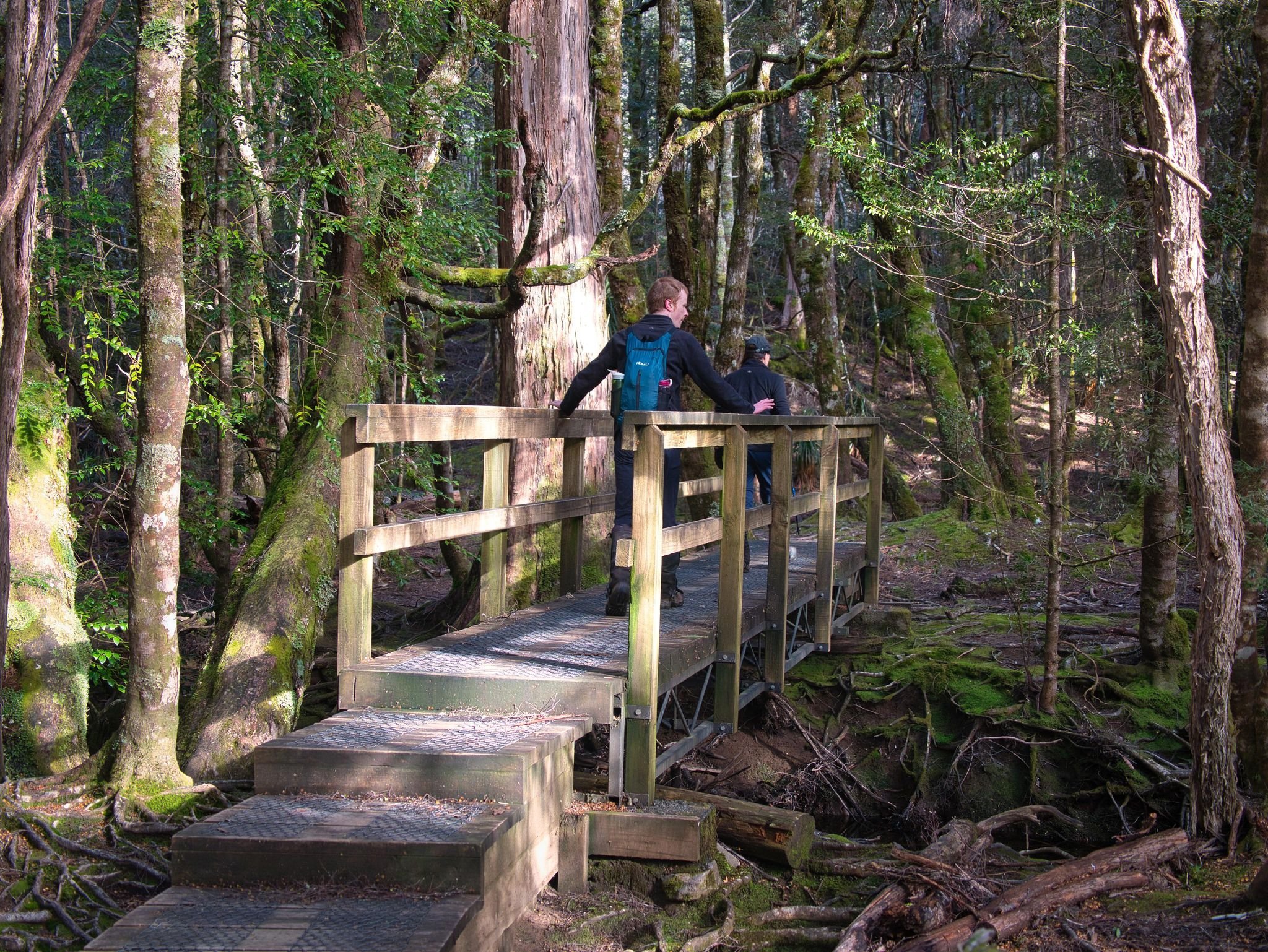
Walking along the Overland Track.
We would be completing a long day walk to the summit of Mount Proteus and return from New Pelion Hut. The benefit of slightly longer daylight hours, coupled with the fact that at least 20km of our roughly 30km walk would be along the Overland Track itself, meant that off-track camping closer to Mount Proteus wasn’t really necessary.
Awaking early (I find it impossible to sleep in in huts anyway) we farewelled Naomi, who would be trail running out to Mount Ossa, and started heading north aka “backwards” along the Overland Track towards Windermere Hut. We wandered along at a comfortable pace, reaching our step off point near the edge of Pine Forest Moor approx. 9.7km after leaving New Pelion Hut.

In the middle of the button grass moorlands discussing the way forwards.
There is no pad or marker indicating the preferred location to step off the Overland Track, but we settled on a spot not long after the Overland Track levelled out. Our return journey saw us coming back well north of where we stepped off, and utilising a fantastic pad which we all wished we had found on the way up.
** My advice is to continue to stick to the Overland Track until you are almost exactly on the 950m contour. This contour is located just as you crest a small rise and before the Overland Track drops down towards Pine Forest Moor and another creek.
Steeping off here (instead of slightly further south as we did) will allow you to find the well trodden pad that runs alongside the creek - initially about 50m or so from the creek but eventually brings you quite close to it. This way you will have a very short section of button grass before locating the pad that will wind you almost all the way to the weather station - none of which we knew on our way in! But back to where we were…

Views of Mount Pelion West as we cross the buttongrass.
Stepping due west off the Overland Track, we began to make our way through the buttongrass, weaving along and finding what patches of lower coral fern or animal pads we could to make the grind a little easier. It certainly wasn’t the worst buttongrass I have ever walked in, but knowing we had five kilometers of it - each way! - meant that saving as much energy as possible at this stage was sensible. The day was also shaping up to be warm, so we would have to either conserve our water or detour to find water along the way. Step up, press, balance - and in my case fall off the buttongrass mounds - became the theme of the day. I watched Lucas stride off in front his long legs making easy work of the soft and uneven vegetation and was very envious indeed!
We began heading almost due west across the first section of buttongrass, and discussed our route ahead. We had the benefit of clear views, and decided we would stick on the same course until turning south west at the ridge that would lead us to Mount Proteus’s summit, allowing us to approach the summit from the northern side of the ridge (see diagram below).

Picking the path of least resistance.
Lucas and I took turns leading as Bender hung behind taking photos. The enormous Mount Pelion West was constantly looking over our shoulders as we pressed on. Ahead, we could see a weather station of sorts, and we discussed heading up to it. I thought if there was infrastructure there might be pads - and easier walking - but the boys were keen to just press on and we decided to visit it on our return journey if time allowed. Turns out there is indeed much easier walking and pads near the station - a fact I pointed out on our return journey ;-)
Although we were only gaining elevation very slowly, the walking was somewhat taxing as I was managing to fall or trip into every hidden hole in the soft buttongrass. One point had Lucas chuckling as I completely disappeared down a hole to the top of my thighs. I just looked like a torso propped up in the bush!

Easier walking than constant button grass.
We reached Chalmers Creek and made the most of its crystal clear and cold mountain water, drinking our fill, topping up bottles and enjoying a snack while we surveyed the terrain ahead. We could see the hill we would climb to bring us towards Mount Proteus’s summit ridge. Although it looked scrubby in sections, and full of buttongrass in others, there were also sections of what appeared like greyish looking rock or potentially low scrub in the distance. We decided to head to those, as it appeared from our vantage point that the walking would be easier. Thankfully we were right.
The “greyish areas” turned out to be dried out coral fern, a fine surface to walk on which gave our legs a much needed break from the constant ankle rolling, thigh tiring, curse inducing buttongrass! These sections were never long enough though, before the buttongrass would reclaim the terrain and make us work that bit harder to progress forwards. Luckily, we stumbled across a fantastic pad eventually which led us up to the small plateau just below the broad summit area and enabled us to avoid almost all the scrub! We were sticking to the northern side of the ridge to avoid the worst of the scratchy stuff.

Gaining elevation gradually as we traverse the button grass and low shrubbery.
From this first high point we could see the ridgeline levelled briefly, before we would have a shortish climb to the true summit. The level area was easy enough walking, low scrub and multiple pads allowed us to cross it rather quickly. Lucas led through a very minor band of scoparia and located yet another great pad, which is either a highway for wombats or it has seen more than a few boots in its time. I am often amazed at how random people end up in the same areas on mountains. Do we all read terrain the same? Or is there some sort of innate gravitational pull that we aren’t consciously aware of?
I was pretty glad that we were nearing the summit. The day was now hot and it felt like we had been slogging it out in buttongrass and low scrub without shade for too long. The Abels states Mount Proteus is a medium grade walk and to allow approximately three hours from the Overland Track. I hadn’t looked at my watch but felt that we had been going for much, much longer than that. We hadn’t been racing along and we had been indulging in enjoying the views and chatting with each other. It is very easy for time to slip through your fingers (or, in this case, feet) when you aren’t actively keeping an eye on the time.

Leaving the creek behind after refilling our water.
As it turned out we had only been walking for about 2.5hrs hours since leaving the Overland Track, and had thus made pretty good time - even if it didn’t feel like it. And boy was it worth all the buttongrass. Mount Proteus’s substantial beehive cairn finally came into sight, but it was rendered insignificant by the 360-degree views surrounding us.
Mount Pelion West that had been our ever present companion was now joined by views out Cradle Mountain and Barn Bluff to the north. We could see Perrins Bluff and Mount Thetis front and centre to our south/south east. Macs Mountain and Mount Nereus to name but a few of the magnificent mountains surrounding us further south. Further to our west we had a commanding view of the fearsome yet usually-distant Eldon Range too.
Wow. Just woweee! We sat, we ate, we reveled in the day, with clear skies above us and the warmth of the sun on our sweaty faces. Not a care in the world. After filling our tummies we got Lucas to point out the name of every single mountain we could see (it’s a party trick we insist he does on every summit we do together, as he is amazing at knowing the profile of every peak).

Mount Proteus’s flat summit expanse.
After an unhurried lunch, it was unfortunately time to leave the summit behind. As is the norm for our walks we now had the benefit of elevation and better line of sight and so decided to change course for our return journey to the Overland Track.
We would take the same pad from the summit to the plateau below the small summit. Then relocate the pad that had led us up to the small plateau area. We would then change course to a more south-easterly bearing to bring us down to the creek in a more direct fashion. From the creek we would head towards the weather station to have a look at it out of curiosity. Then we would make our way back along the long buttongrass moorlands to the Overland Track. None of us were particularly enthusiastic about three more hours of buttongrass!

Back on the Overland Track returning to New Pelion Hut.
Sticking to our new plan we descended off Mount Proteus in record time and were soon enjoying a cool drink at the creek - the boys getting a good laugh as I offered to fill Lucas’s water bottle, tripped and poured water all over the front of myself, and then fell in yet another hole for good measure. A bystander might have thought that there was gin in my water bottle, such was my inability to stay upright this trip ;-)
From the creek to the weather station was mere minutes and the closer to the station we got the easier the walking. Whilst Bender and Lucas discussed what the infrastructure might be for and took a few photos, I hunted around for a pad. Happy dancing when I found one the three of us set off.
I was quite expecting the pad to soon peter out, but it did the opposite. It led us easily through the buttongrass moorland sticking closeish to the creek (we had been much further from the creek on our inwards journey). What a lovely find for our weary legs!
About 400m before the Overland Track we decided to step off the pad as it was heading down towards the creek and trees. We were worried it might get scrubby and we had only a few hundred metres of button grass walking left, as opposed to the many kilometers of buttongrass we had endured on our trip in. Thanks to the very decent pad we had made great time back to the Overland Track, even with a long break at the creek and time spent investigating the weather station.

My all time fav birthday photo! Being silly on a summit! Love it!
The formed gravel of the Overland track crunching under our feet was a most welcome sound. There was still a 10km walk back to New Pelion Hut, but the day was young and the rest of our journey was on formal track, much of it shaded from the bright afternoon sun. Arriving into New Pelion a bit before 5pm, it was fabulous to catch up with an excited Naomi who had spent the day exploring Mount Ossa and Mount Pelion East.
The next day the four of us walked out back to our cars at the Arm River Track trailhead together. Me enthralled in my new found knowledge (thanks Lucas) that there were once wombats as big as cars! I pictured my very own wombat that big and me riding my pet wombie, Never Ending Story-style, around the mountains of The Overland. Oh how much I would love that! I told Bender I would like one of those wombies for my birthday next year. After all, one can dream!
The Stats.
Distance: Approximately 32km return from New Pelion Hut.
Time taken: 10 hours total elapsed time which included multiple breaks, lunch at the summit, filming, photos and falling into buttongrass!
Difficulty: On a clear day, navigation is straightforward and other than buttongrass and minor patches of scrub, Mount Proteus is not particularly difficult. Keep in mind though that it is a 30km round trip to New Pelion Hut. The 10km of exposed off-track walking needs to be carefully considered in less-than-ideal conditions.
Type of track: 20km tracked along the Overland Track, 10km untracked buttongrass moorlands.
Access from: The Overland Track.

Route to Mount Proteus.
The Map.
Route taken to Mount Proteus from New Pelion Hut.