Slatters Peak
Date: 2nd April 2022 - Summit: 1300m
Photo credits: Ben Wells, Tracey Orr
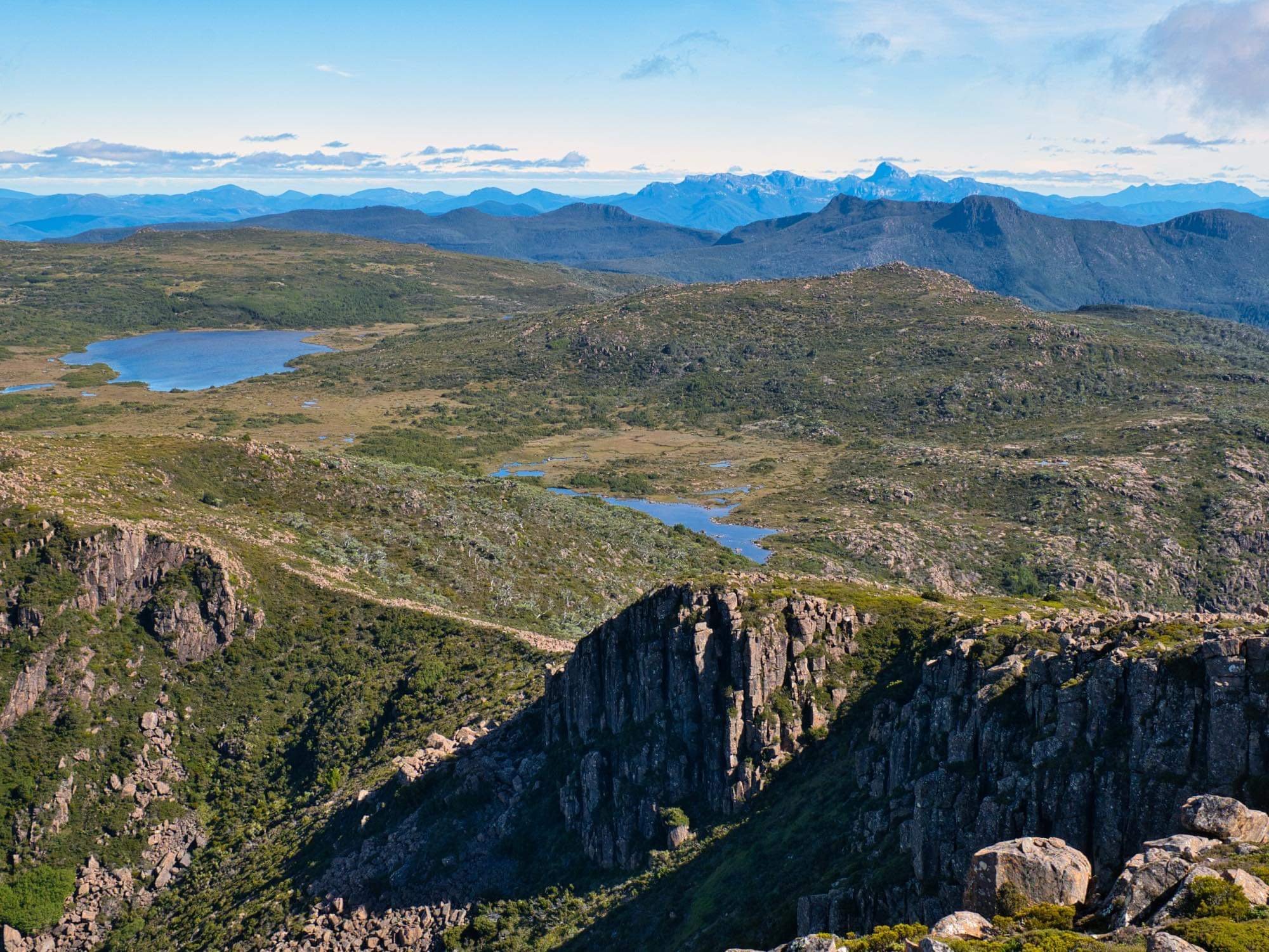
Views to Lake Anne from the summit of Slatters Peak.
The sense of deja vu was strong as the Mazda pulled into the small parking area at Guelph Basin (Lake King William). We had been in this exact spot only a week earlier for our first - and promptly aborted - attempt on Slatters Peak.
That attempt had failed before it’d even begun. As we settled down for the night at Guelph Basin after almost three hours of driving, I suddenly realised I had forgotten my gaiters! Even a mad dash to the (relatively) close by Lake St. Clair Visitors Centre early the next morning couldn’t save our trip - their gift shop doesn’t sell gaiters.
Had it not been an off track walk I would have set off sans gaiters, but the combination of scrub, snakes and summer-like warmth meant we erred on the side of caution and postponed our trip for a week. Knowing what I know now, I am very glad I did not attempt this walk without gaiters.

Slatters Peak from Guelph Basin as the sun sets.
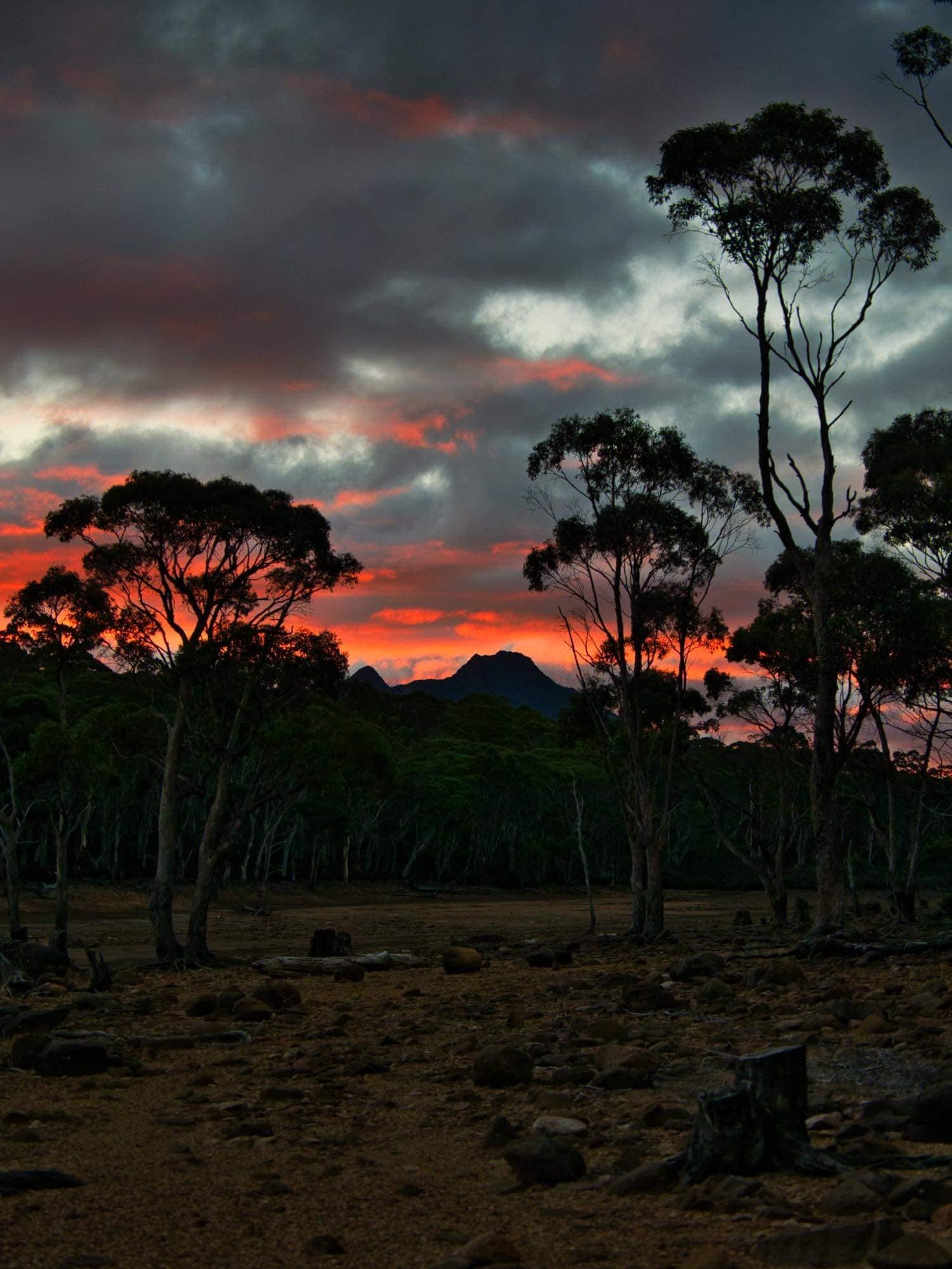
Sunset at Guelph Basin.
Our plans were to (again) drive as far down Harbacks Road as possible, before sleeping in the Mazda and making an early start the next day. We arrived at the car parking area earlier than the previous week’s trip (Bender gave himself an early minute from work) and were able to enjoy a spectacular sunset, with hues of purple and pink lighting up Slatters Peak in the distance as we feasted on homemade sushi for dinner.
Even with the ‘creature comforts’ the Mazda’s set up afforded, neither of us were feeling our usual energetic selves when the alarm went off early the next morning. We were both COVID-19 clear but still a little under the weather, and so our plans were fluid. If we could make it up Slatters Peak and then onto Lake Anne in reasonable time we would also attempt King William II on Day One. If not, we would summit King William II the next day before walking out.
Anyone for a skate?
Anyone for a skate?
Starting the lake walk section of the trip.

Slatters Peak hiding in the mist as we travel along the lake’s shore.
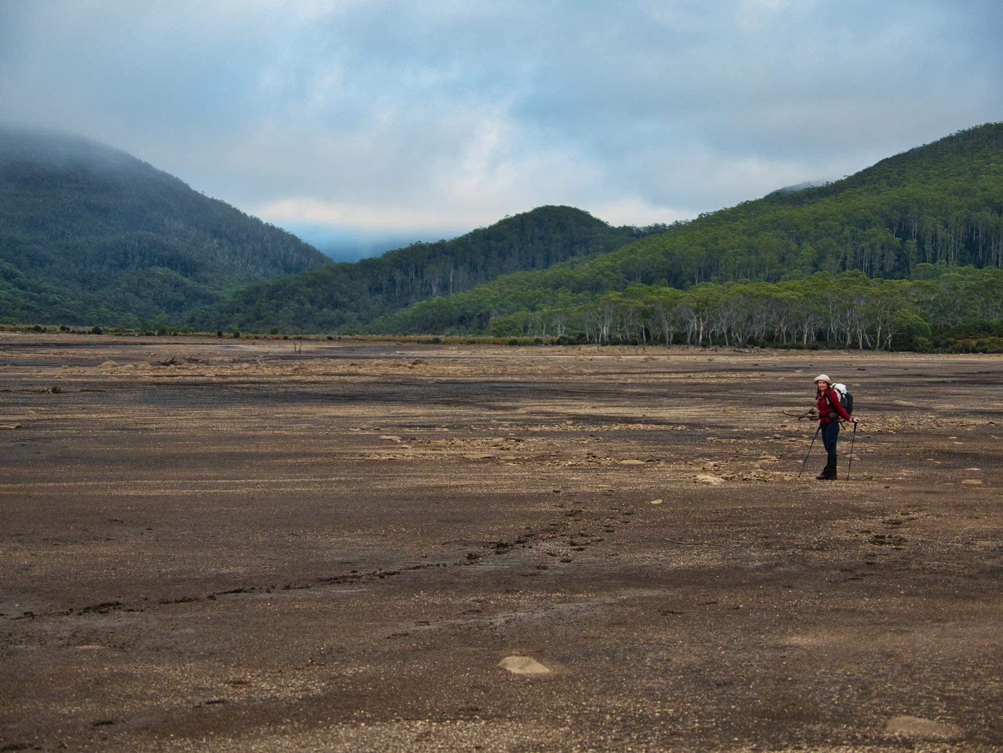
Packs on, we set off on the roughly 5km of lake’s edge walking ahead of us. With water levels so low - from the summer time draw down through the Clark Hydroelectric dam and lack of rain - we were able to complete the entire section without hitting bush by simply walking “in” the lake.
Whilst the semi-dried lake bowl allowed us to conveniently avoid any scrub for now (plenty of time for that later) it felt like we were walking in snow. Clumpy black mud clung to our boots and gaiters. It was squelchy enough in places, that using my poles I could almost mud-skate instead of walk, but deep enough in others that one’s boots would disappear entirely!
Mosaic patterns in the dried mud led to a false sense of security. The patterns lured you to believe the earth was parched, but as you trod the crusty top soon gave way to slush underneath. There were multiple small drains to cross along the way, where we would clean our boots, only to slide through the mud again moments later.
Clearly fishermen and four wheel drive enthusiasts enjoy this lake, but sadly some with little respect for preserving its beauty. In one small section alone, we counted over 25 discarded beer bottles. Humanity is so disappointing at times.

One more point to skirt (left of screen) before we step off the lake and into button grass.
Slatters Peak would pop in and out of sight through the morning mist as we trudged along the lake. Already our legs were tired from the mud. This didn’t bode well for the up and coming scrub bash! I was actually looking forward to the button grass, if only because we would be off the mud flats. Along the way, short, more walkable sections of rock gave us some respite from the incessant mud.
We were taking our time along the lake, snapping photos and stopping to enjoy the views - and perhaps got a little too distracted! It took us around 2 hours to wander the lake and cross the button grass - the same section would take us a mere 1:15 on the return. As far as button grass is concerned the sections were, for the most part, really quite good with smaller mounds and good animal pad availability. As we travelled across the button grass we constantly looked up towards Slatters Peak, gauging when we should leave the grass and tackle the climb up through the scrub.
Our future for the next few hours!
Rather than following the eastern ridge up to the summit, we decided to approach from the button grass almost directly below the high point. The eastern ridge looked super scrubby and ended in cliffs. We had heard stories of people having to pack haul and deal with somewhat-sketchy cliffs when heading in via that ridge.
In theory, leaving the button grass only when almost in line with the summit would allow for a shorter section of scrub to deal with, and it would also allow us to seek out the small scree fields displayed on satellite imagery. This would lessen the overall scrub bash and make progress easier as we approached the top. Once we reached the rock immediately below the summit we would decide our course to the summit proper.
The solid pad we were on through the button grass petered out at the base of the days climbing. Both of us were eyeing the scrub fest in front of and above us -with a decided lack of enthusiasm - but in the words of Ralph Lauren - “A lot of hard work is hidden behind nice things.” If we wanted the nice views and the nice campsite well we best be prepared to put in the work!

Hot, sweaty and scrub bashing but still smiling.
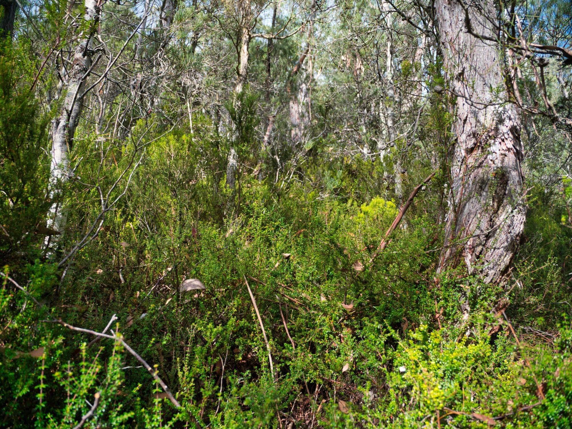
We left the edge of the button grass and began pushing through what was already quite dense vegetation. Whilst the elevation gain was gradual at this stage, the baurea was thick and tangling around our boots and legs. From the get go it was making us fight for forward progress - when not tripping us up completely.
We have certainly pushed through much worse vegetation - and for much longer, both facts we kept reminding each other of - but already it felt like a slog of epic proportions. We had gone from walking on mud that felt like snow, to pushing through bush on a 45-degree slope that pushed back with every step! Oh, the fun!
Some small measure of consolation was that the sun was not yet high and the skies were clouded over. Our exertions were in the shade at least. We took turns pushing through the mountain’s defences; as suspected, the summit here would be properly earned. At times we used Ben’s brute force and strength to punch holes through the scrub, at other’s I ducked and weaved us through hobbit-sized gaps in the forest. Both methods were often only effective for a few metres at a time before we would swap over. Runs of 10-20m worth of clear progress were a rarity.
We were both physically struggling and upon reflection admitted that perhaps setting off when we were both less than 100% well wasn’t the smartest idea! With the forest cover blocking any views above or below us, it was quite claustrophobic. It was also very slow going. Push, force, weave, swear, stop, catch your breath. This stop-start pattern became our lives for almost three hours!

Guelph Basin below - along with the worst of the scrub, now thankfully behind us for now.
Occasionally the baurea and other thigh-deep delights would give way to pandani and open forest, with big enough gaps we could easily weave in and around. But in these sections, hidden rocks, holes and rotting timber tested our knees, our heavy multi day packs not making life any easier. Our main objective was picking the path of least resistance as we stayed on top of what appeared to be a very small and shallow spur, constantly checking we weren’t veering into the scrubby gully to the west where the vegetation was so thick we might never return!
We were, however, pleasantly surprised that while the scrub hid rocks and holes, it also hid multiple small water sources. We had loaded our packs up with extra water for the climb up Slatters, after severely underestimating our water needs for the recent trip to Pokana Peak and weren’t keen to ever repeat that experience again. Now here we were lugging all that additional weight up a seriously steep and challenging slope, and finding lots of easily accessible soaks. So typical!
Thanks to the wonders of modern technology - aka. mapping GPS - we were eventually able to break the constant scrub fight with sizeable sections of boulders as we crept ever close to the plateau just below the summit. Using pre-saved aerial photography we picked out pockets of rock amongst the scrub. It wasn’t the easiest talus we’d ever traversed, but still made a most welcome change from what we’d been pushing up through the past couple of hours. I remarked to Ben that I was glad that we were traversing the boulders in the dry, as black lichen and moss covered the boulders. (Little did we know our return journey the next day would be in drizzle and over these hard, slippery mounds that call themselves boulders!)
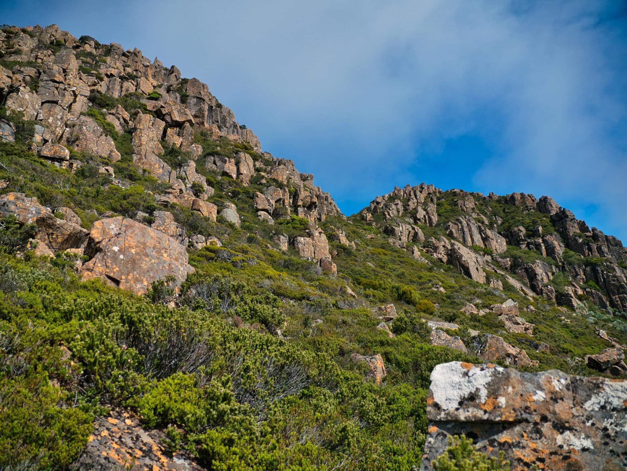
The scrubby eastern notch generally used to summit Slatters Peak.
It was with a sense of relief for both of us that we eventually cleared the scrub line. Ahead lay the large rock field immediately below Slatters Peak’s summit. The sun was now hot with little cloud to temper it. We had missed lunch so took the time here to stop, sit and replenish ourselves with water and food, as we discussed our final approach.
With no lack of short cliffs protecting the peak’s northern flank, the generally accepted route from here is to use a small notch on the western end to gain easy(ish) access to the ridgeline, drop packs and head south east for a short climb to the summit high point. We eyed off this notch without much enthusiasm, for the fact that the route between led again into scrub - really steep scrub - all the way towards the notch. Yuk.

The less scrubby eastern notch we would use to summit Slatters Peak.
Simultaneously, we both said “let’s use that low notch further to the east and climb to the summit from there”. Yes, it would mean dragging our big packs all the way up to and over the summit - something you naturally try to avoid - but there would be little to no scrub to contend with and the largish boulders looked quite managable. Plus, the more eastern notch appeared to have a perfect looking strip of mixed pineapple grass and very low pockets of vegetation leading upwards almost to the top. Our Yellow Brick Road!
Lifting our heavy packs back on we started climbing over and through the various sized boulders towards our eastern target. Once again, I remarked to Bender how I was glad to be crossing them in the dry. The rock field led to our lovely little bit of grass, that in turn led us along the ridgeline, towards a few giant boulders directly before the summit. A little grunting as we hauled ourselves and packs up and onto the high point and we were on the summit! Yay! It had taken us 5.5 hours from the car to cover the measly 7.5km, with the last kilometre taking over half that time!

Summit views, looking north over Lake Sally Jane, Bayeux Bluff and Mt King William I.

Summit views down to Lake Anne and the main King William Range. The ever-distinctive shape of Frenchmans Cap lies in the distance.
With clear skies and little cloud cover the views were totally worth all the effort. We could see Lake Anne shimmering below, which would be camp for the night. We had already decided that we would be making camp and resting up for the remainder of the day. It had taken longer than expected to summit Slatters Peak and neither of us had the inclination or energy to push on towards King William II in the afternoon, figuring the odds of returning back before dark weren’t great. Had it been the middle of summer with the longer daylight hours, we may have considered it.

Close up views of Lake Anne. Beyond Snow Plains lie Loddon and Adam Ranges and the headwaters of the Denison River.
Having resigned ourselves to pulling up stumps for the day at Lake Anne, we enjoyed extra time up on the summit and used it wisely to spy our route onwards to the west. We would cross from the summit into the western notch and gain access to the second high point from there. Then, we would follow the rock leads all the way south-west, staying high as long as possible. Only when the rock ran out would we veer almost directly west and drop to Lake Anne. This would allow us to avoid more unnecessary and unwanted scrub bashing.
The climb up and onto the second high point was relatively easy with only one small section of difficulty and a small amount of exposure. From there, we picked our way down the rock until we reached the edge of the small band of scrub that flanks Lake Anne. It was easy enough to pick a path downwards using the more open sections towards the south, and soon we were standing on the manicured grasses that surround Lake Anne’s shores.

Looking back up to the twin high points of Slatters Peak. The southern flank drops quickly to Lake Rufus (not pictured) and the southern end of Guelph Basin. Mt Hobhouse, Mt Shakespeare and Wylds Craig lie in the distance.
What a glorious spot! We’d heard numerous reports that Lake Anne was a mighty fine place to camp and won’t argue over that assessment. The lake filled with crisp, cool water to drink, we had all the room in the world to set up our tent, and magical mountains surrounding us in every direction. The sun was shining and life was good. The last six and three-quarter hours had been worth it to arrive in such paradise.
With Mt King William II bumped until the morning, we would rest up, lounge like lazy lizards and enjoy the remaining warmth of the afternoon. We wandered the lake’s edges for a bit ohhing and ahhing at its beauty, as we carefully selected our home for the next 16 hrs. We found the perfect site, sheltered by mid-height scrub from the prevailing south-westerly weather, and back far enough from the lake itself to avoid the damp soils and requisite mosquitos.

Descending to Lake Anne (not pictured). The small tarn shown feeds Saxon Creek, in the very steep, scrub-filled gully The Abels Vol 2. warns to avoid.
As we lay in the tent dozing in the afternoon sun, we discussed the next day’s adventure.
What’s that saying about not putting off untill tomorrow, what you can do today? Had we known what we would awake to the next day, we might have pushed on to the summit of King William II instead of lazying around…

Nearing Lake Anne (not pictured) with the broad ridgeline of the King William Range behind. The named King William II high point can be seen, with the actual highest point/Abel hidden behind.

One side weather affected - the other not!

Our lovely sheltered campsite. An unnamed 1180m peak to the south lights up orange in the sunset.

Cooking up dinner.

Nestled in amongst ancient Pencil pines and Deciduous beech, surrounded by dolerite ablaze in a slow sunset’s glow. Tasmania’s alpine wilderness never ceases to impress.
The Stats.
Distance: Approximately 7.5km from the car to the summit or 8.5km to Lake Anne.
Time taken: 5.5 hours from the car to the summit. All up 6 hours, 45 minutes from the car to Lake Anne.
Difficulty: Difficult. Only those confident in off track navigation and capable in steep, thick scrub should attempt this walk. Lake Anne and its surrounds lie above 1150m elevation with limited protection from bad weather; again, camping on the King William Range is for experienced bushwalkers only.
Type of track: Untracked. Muddy exposed shoreline around Guelph Basin. Steep and scrubby up Slatters Peak, rock and alpine heath to Lake Anne.
Access from: Harbacks Road..

The Map.
Route taken to the summit of Slatters Peak and onwards to Lake Anne.